Property Record
34435 El Sendero Dr, Valley Center, CA 92082
NEARBY LISTINGS FOR SALE OR LEASE
-
-
View all Valley Center listings for sale on LoopNet.com
Property Detail
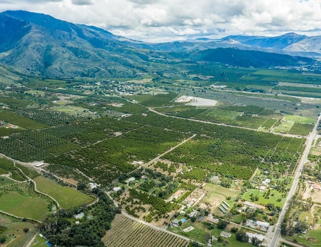
34435 El Sendero Dr
131-050-02
Rancho Pauma
Orchard
MOST SELY PAR AS PER ROS 3297 TR PB0001PG067
X
San Diego
06073C0510G
California
2024
22.85 AC
2025
Outlying SD County N
019103
San Diego
1,360 SF
San Diego-Carlsbad, CA
DEMOGRAPHICS near 34435 El Sendero Dr
1 Mile
3 Mile
5 Mile
2024 Total Population
364
1,453
4,532
2029 Population
333
1,377
4,319
Pop Growth 2024-2029
(8.52%)
(5.23%)
(4.70%)
Average Age
41
43
43
2024 Total Households
119
494
1,482
HH Growth 2024-2029
(8.40%)
(5.26%)
(4.93%)
Median Household Inc
$77,404
$99,999
$106,535
Avg Household Size
3.10
2.90
2.90
2024 Avg HH Vehicles
2.00
3.00
3.00
Median Home Value
$951,922
$812,231
$769,620
Median Year Built
1991
1987
1985
Nearby Places
Map Layers
Map Styles
 Street
 Aerial
- Restaurants
- Banks
- Shops
- Fitness
- Groceries
Nearby Properties
Address
Land Use
TOTAL SIZE
Lot Size
Zoning
Address
Land Use
TOTAL SIZE
Lot Size
Zoning
5,040 SF
991.49 AC
A
Address
Land Use
TOTAL SIZE
Lot Size
Zoning
3,290 SF
291.90 AC
A70
Address
Land Use
TOTAL SIZE
Lot Size
Zoning
31.29 AC
A70
Address
Land Use
TOTAL SIZE
Lot Size
Zoning
37.15 AC
RR
Address
Land Use
TOTAL SIZE
Lot Size
Zoning
598.98 AC
A
Address
Land Use
TOTAL SIZE
Lot Size
Zoning
145.57 AC
A
Address
Land Use
TOTAL SIZE
Lot Size
Zoning
2,720 SF
400 AC
A70
Address
Land Use
TOTAL SIZE
Lot Size
Zoning
59.91 AC
A70
Address
Land Use
TOTAL SIZE
Lot Size
Zoning
1,248 SF
181.22 AC
A70
Address
Land Use
TOTAL SIZE
Lot Size
Zoning
51,229 SF
150.77 AC
A70
Address
Land Use
TOTAL SIZE
Lot Size
Zoning
3,984 SF
49.77 AC
A70
Address
Land Use
TOTAL SIZE
Lot Size
Zoning
7,982 SF
80 AC
A70
Address
Land Use
TOTAL SIZE
Lot Size
Zoning
4,942 SF
2.69 AC
A70
Address
Land Use
TOTAL SIZE
Lot Size
Zoning
4,622 SF
13.19 AC
A70
Address
Land Use
TOTAL SIZE
Lot Size
Zoning
100.47 AC
RR
Address
Land Use
TOTAL SIZE
Lot Size
Zoning
1,226 SF
105.43 AC
RS
Address
Land Use
TOTAL SIZE
Lot Size
Zoning
4,487 SF
165.06 AC
A70
Address
Land Use
TOTAL SIZE
Lot Size
Zoning
88.52 AC
RR
Address
Land Use
TOTAL SIZE
Lot Size
Zoning
3,161 SF
154.14 AC
A70
Address
Land Use
TOTAL SIZE
Lot Size
Zoning
54.53 AC
A
Address
Land Use
TOTAL SIZE
Lot Size
Zoning
3,432 SF
93.84 AC
A70
Address
Land Use
TOTAL SIZE
Lot Size
Zoning
40.02 AC
A70
Address
Land Use
TOTAL SIZE
Lot Size
Zoning
10,752 SF
4.54 AC
S86
Address
Land Use
TOTAL SIZE
Lot Size
Zoning
3,704 SF
3.33 AC
RR
Address
Land Use
TOTAL SIZE
Lot Size
Zoning
10,665 SF
529.43 AC
A70
Address
Land Use
TOTAL SIZE
Lot Size
Zoning
5,665 SF
19.60 AC
A70
Address
Land Use
TOTAL SIZE
Lot Size
Zoning
78.55 AC
A70
Address
Land Use
TOTAL SIZE
Lot Size
Zoning
126.65 AC
RR
Address
Land Use
TOTAL SIZE
Lot Size
Zoning
1,604 SF
59.39 AC
A70
Address
Land Use
TOTAL SIZE
Lot Size
Zoning
38.33 AC
A70
The World's #1 Commercial Real Estate Marketplace
Connect with us
© 2025 CoStar Group
The information above has been obtained from sources believed reliable. While we do not doubt its accuracy we have not verified it and make no guarantee, warranty or representation about it. It is your responsibility to independently confirm its accuracy and completeness. Any projections, opinions, assumptions, or estimates used are for example only and do not represent the current or future performance of the property. The value of this transaction to you depends on tax and other factors which should be evaluated by your tax, financial, and legal advisors. You and your advisors should conduct a careful, independent investigation of the property to determine to your satisfaction the suitability of the property for your needs.