Property Record
345 Beasley Rd, Jackson, MS 39206


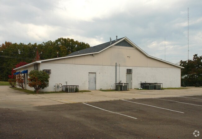
Property Detail
345 Beasley Rd
0723-0005-003
BEG 345 FT W INT S/L BEASLEY RD & W/L MAYES ST W 155 FT S 281.14 FT E 155 FT N 281.14 FT TO POB IN SW 1/4 SE 1/4 SEC 2 & NW 1/4 NE 1/4 SEC 11 T6 R1E
Commercialnec
Hinds
B and X Area of moderate flood hazard, usually the area between the limits of the 100-year and 500-year floods.
Mississippi
2024
1 AC
2025
North Jackson
010201
Jackson
3,816 SF
Jackson, MS
NEARBY LISTINGS FOR SALE OR LEASE
DEMOGRAPHICS near 345 Beasley Rd
1 mile
3 mile
5 mile
2024 Total Population
6,017
45,876
95,235
2029 Population
5,674
44,108
93,797
Pop Growth 2024-2029
(5.70%)
(3.85%)
(1.51%)
Average Age
38
40
40
2024 Total Households
2,600
19,460
41,473
HH Growth 2024-2029
(5.81%)
(4.06%)
(1.57%)
Median Household Inc
$39,932
$57,421
$53,383
Avg Household Size
2.30
2.20
2.20
2024 Avg HH Vehicles
2.00
2.00
2.00
Median Home Value
$139,816
$180,932
$192,702
Median Year Built
1975
1972
1975
Nearby Places
Map Layers
Map Styles
 Street
 Aerial
Transit
 Traffic
 Biking
Places
Listings with unknown addresses are not visible on the map
- Restaurants
- Banks
- Shops
- Fitness
- Groceries
Nearby Properties
Address
Land Use
TOTAL SIZE
Lot Size
Zoning
Address
Land Use
TOTAL SIZE
Lot Size
Zoning
416,776 SF
18.77 AC
Address
Land Use
TOTAL SIZE
Lot Size
Zoning
33,960 SF
19,602 AC
Address
Land Use
TOTAL SIZE
Lot Size
Zoning
59,840 SF
2.72 AC
Address
Land Use
TOTAL SIZE
Lot Size
Zoning
10,904 SF
8.50 AC
Address
Land Use
TOTAL SIZE
Lot Size
Zoning
55,160 SF
3 AC
Address
Land Use
TOTAL SIZE
Lot Size
Zoning
105,600 SF
13 AC
Address
Land Use
TOTAL SIZE
Lot Size
Zoning
186,992 SF
27.27 AC
Address
Land Use
TOTAL SIZE
Lot Size
Zoning
54,291 SF
6.99 AC
Address
Land Use
TOTAL SIZE
Lot Size
Zoning
49,949 SF
10 AC
Address
Land Use
TOTAL SIZE
Lot Size
Zoning
57,234 SF
Address
Land Use
TOTAL SIZE
Lot Size
Zoning
102,249 SF
14.38 AC
Address
Land Use
TOTAL SIZE
Lot Size
Zoning
10,620 SF
2.81 AC
Address
Land Use
TOTAL SIZE
Lot Size
Zoning
230,401 SF
643,381.54 AC
Address
Land Use
TOTAL SIZE
Lot Size
Zoning
156,184 SF
16.82 AC
Address
Land Use
TOTAL SIZE
Lot Size
Zoning
108,198 SF
15.40 AC
Address
Land Use
TOTAL SIZE
Lot Size
Zoning
310,650 SF
17 AC
Address
Land Use
TOTAL SIZE
Lot Size
Zoning
23,589 SF
110,808.08 AC
Address
Land Use
TOTAL SIZE
Lot Size
Zoning
48,847 SF
20.70 AC
Address
Land Use
TOTAL SIZE
Lot Size
Zoning
9,003 SF
1 AC
Address
Land Use
TOTAL SIZE
Lot Size
Zoning
81,911 SF
15.53 AC
Address
Land Use
TOTAL SIZE
Lot Size
Zoning
148,195 SF
11.66 AC
Address
Land Use
TOTAL SIZE
Lot Size
Zoning
139,497 SF
12 AC
Address
Land Use
TOTAL SIZE
Lot Size
Zoning
83,318 SF
4.35 AC
Address
Land Use
TOTAL SIZE
Lot Size
Zoning
223,203 SF
625,957.30 AC
Address
Land Use
TOTAL SIZE
Lot Size
Zoning
30,703 SF
1 AC
Address
Land Use
TOTAL SIZE
Lot Size
Zoning
349,916 SF
29.10 AC
Address
Land Use
TOTAL SIZE
Lot Size
Zoning
101,006 SF
5.04 AC
Address
Land Use
TOTAL SIZE
Lot Size
Zoning
162,792 SF
12.12 AC
Address
Land Use
TOTAL SIZE
Lot Size
Zoning
183,953 SF
11.56 AC
Address
Land Use
TOTAL SIZE
Lot Size
Zoning
15.09 AC
The World's #1 Commercial Real Estate Marketplace
Connect with us
© 2026 CoStar Group
The information above has been obtained from sources believed reliable. While we do not doubt its accuracy we have not verified it and make no guarantee, warranty or representation about it. It is your responsibility to independently confirm its accuracy and completeness. Any projections, opinions, assumptions, or estimates used are for example only and do not represent the current or future performance of the property. The value of this transaction to you depends on tax and other factors which should be evaluated by your tax, financial, and legal advisors. You and your advisors should conduct a careful, independent investigation of the property to determine to your satisfaction the suitability of the property for your needs.