Property Record
345 Cemetery Rd, Kalispell, MT 59901


NEARBY LISTINGS FOR SALE OR LEASE
Property Detail
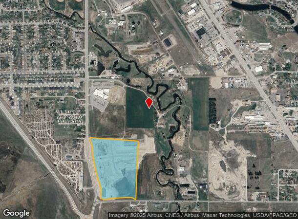
345 Cemetery Rd
Kalispell, MT
Certificate/Surv 18252
07-3966-29-2-01-10-0000
S29, T28 N, R21 W, ACRES 12.81, TR 13D IN NW4NW4
Agriculturalland
Flathead
X
Montana
30029C1820J
a
2025
12.81 AC
2025
Glacier Country
001201
Other Market Areas
DEMOGRAPHICS near 345 Cemetery Rd
1 Mile
3 Mile
5 Mile
2024 Total Population
3,150
22,749
46,046
2029 Population
3,704
26,734
54,276
Pop Growth 2024-2029
+ 17.59%
+ 17.52%
+ 17.87%
Average Age
36
39
40
2024 Total Households
1,193
9,651
18,711
HH Growth 2024-2029
+ 17.35%
+ 17.44%
+ 17.80%
Median Household Inc
$74,560
$59,404
$64,480
Avg Household Size
2.60
2.30
2.40
2024 Avg HH Vehicles
2.00
2.00
2.00
Median Home Value
$289,233
$337,657
$355,513
Median Year Built
1995
1980
1989
Nearby Places
Map Layers
Map Styles
 Street
 Aerial
- Restaurants
- Banks
- Shops
- Fitness
- Groceries
PUBLIC TRANSPORTATION
AIRPORT
Glacier Park International
DRIVE
WALK
Distance
Glacier Park International
21 min
11.4 mi
Freight Ports
Port of Everett
DRIVE
WALK
Distance
Port of Everett
632 min
547.2 mi
SALE & LEASE HISTORY
LISTING DATE
SALE/LEASE

Jan 30, 2024
For Sale
Feb 05, 2024
For Sale
Nearby Properties
Address
Land Use
TOTAL SIZE
Lot Size
Zoning
Address
Land Use
TOTAL SIZE
Lot Size
Zoning
321,200 SF
7.77 AC
Address
Land Use
TOTAL SIZE
Lot Size
Zoning
105,300 SF
2.56 AC
Address
Land Use
TOTAL SIZE
Lot Size
Zoning
117,819 SF
3.70 AC
Address
Land Use
TOTAL SIZE
Lot Size
Zoning
33,084 SF
5.42 AC
Address
Land Use
TOTAL SIZE
Lot Size
Zoning
97,968 SF
6.31 AC
Address
Land Use
TOTAL SIZE
Lot Size
Zoning
231,514 SF
22.45 AC
6
Address
Land Use
TOTAL SIZE
Lot Size
Zoning
90,186 SF
10.60 AC
Address
Land Use
TOTAL SIZE
Lot Size
Zoning
62,420 SF
1.73 AC
Address
Land Use
TOTAL SIZE
Lot Size
Zoning
35,198 SF
5.86 AC
Address
Land Use
TOTAL SIZE
Lot Size
Zoning
83,823 SF
4.78 AC
Address
Land Use
TOTAL SIZE
Lot Size
Zoning
31,230 SF
0.64 AC
Address
Land Use
TOTAL SIZE
Lot Size
Zoning
32,769 SF
Address
Land Use
TOTAL SIZE
Lot Size
Zoning
15,856 SF
3.64 AC
6
Address
Land Use
TOTAL SIZE
Lot Size
Zoning
69,429 SF
5.97 AC
Address
Land Use
TOTAL SIZE
Lot Size
Zoning
34,284 SF
7.37 AC
6
Address
Land Use
TOTAL SIZE
Lot Size
Zoning
34,780 SF
13.03 AC
Address
Land Use
TOTAL SIZE
Lot Size
Zoning
45,934 SF
2.80 AC
Address
Land Use
TOTAL SIZE
Lot Size
Zoning
47,844 SF
5.26 AC
Address
Land Use
TOTAL SIZE
Lot Size
Zoning
19,232 SF
3.79 AC
Address
Land Use
TOTAL SIZE
Lot Size
Zoning
28,492 SF
6.36 AC
1
Address
Land Use
TOTAL SIZE
Lot Size
Zoning
32,480 SF
1.73 AC
Address
Land Use
TOTAL SIZE
Lot Size
Zoning
43,560 SF
2.04 AC
3
Address
Land Use
TOTAL SIZE
Lot Size
Zoning
129,708 SF
14.69 AC
Address
Land Use
TOTAL SIZE
Lot Size
Zoning
17,922 SF
2.42 AC
Address
Land Use
TOTAL SIZE
Lot Size
Zoning
24,051 SF
1.80 AC
Address
Land Use
TOTAL SIZE
Lot Size
Zoning
44,972 SF
1.94 AC
Address
Land Use
TOTAL SIZE
Lot Size
Zoning
52,653 SF
1.72 AC
Address
Land Use
TOTAL SIZE
Lot Size
Zoning
4,000 SF
9.29 AC
6
Address
Land Use
TOTAL SIZE
Lot Size
Zoning
44,640 SF
2.11 AC
Address
Land Use
TOTAL SIZE
Lot Size
Zoning
50,622 SF
5.49 AC
1
The World's #1 Commercial Real Estate Marketplace
Connect with us
© 2026 CoStar Group
The information above has been obtained from sources believed reliable. While we do not doubt its accuracy we have not verified it and make no guarantee, warranty or representation about it. It is your responsibility to independently confirm its accuracy and completeness. Any projections, opinions, assumptions, or estimates used are for example only and do not represent the current or future performance of the property. The value of this transaction to you depends on tax and other factors which should be evaluated by your tax, financial, and legal advisors. You and your advisors should conduct a careful, independent investigation of the property to determine to your satisfaction the suitability of the property for your needs.