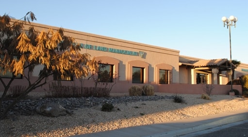
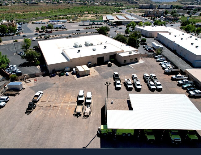
Property Record
345 E Riverside Dr, Saint George, UT 84790

Property Detail
345 E Riverside Dr
0448434
S: 31 T: 42S R: 15W BEG ON NLY LN RIVER SD DR BEING N 89*2823 E 444.26 FT ALG SEC/L & N 531.54 FT FM S1/4 COR SEC 31 T42S R15W TH SWLY FM RAD/L BEARS N 49*5030 W AN ARC 291.67FT THRU CTRL ANG 29*5031 ;TH S 70* W 187.70 FT; TH N 20* W 207.69 FT; TH N
Commercialnec
Washington
C3
Utah
B and X Area of moderate flood hazard, usually the area between the limits of the 100-year and 500-year floods.
4.50 AC
2024
Cedar City & St George
2025
Other Market Areas
271800
St. George, UT
31,242 SF
NEARBY LISTINGS FOR SALE OR LEASE
-
-
View all Saint George listings for lease on LoopNet.com
DEMOGRAPHICS near 345 E Riverside Dr
1 mile
3 mile
5 mile
2025 Total Population
8,807
60,635
117,860
2030 Population
9,536
66,520
129,316
Pop Growth 2025-2030
+ 8.28%
+ 9.71%
+ 9.72%
Average Age
39
40
40
2025 Total Households
3,124
21,107
40,767
HH Growth 2025-2030
+ 8.55%
+ 9.98%
+ 10.00%
Median Household Inc
$64,548
$74,721
$78,810
Avg Household Size
2.60
2.70
2.80
2025 Avg HH Vehicles
2.00
2.00
2.00
Median Home Value
$447,752
$492,854
$537,581
Median Year Built
1989
1998
2002
Nearby Places
Map Layers
Map Styles
 Street
 Aerial
Transit
 Traffic
 Biking
Places
Listings with unknown addresses are not visible on the map
- Restaurants
- Banks
- Shops
- Fitness
- Groceries
PUBLIC TRANSPORTATION
AIRPORT
St George Regional
Drive
Walk
Distance
St George Regional
9 min
3.8 mi
SALE & LEASE HISTORY
LISTING DATE
SALE/LEASE

Mar 10, 2025
For Sale
Feb 07, 2024
For Sale
Dec 03, 2023
For Lease
Apr 21, 2025
For Lease
Nearby Properties
Address
Land Use
TOTAL SIZE
Lot Size
Zoning
Address
Land Use
TOTAL SIZE
Lot Size
Zoning
1,120,988 SF
52.22 AC
PDCOM
Address
Land Use
TOTAL SIZE
Lot Size
Zoning
319,351 SF
31.39 AC
Address
Land Use
TOTAL SIZE
Lot Size
Zoning
319,351 SF
31.39 AC
PD
Address
Land Use
TOTAL SIZE
Lot Size
Zoning
163,605 SF
13.51 AC
C3
Address
Land Use
TOTAL SIZE
Lot Size
Zoning
252,737 SF
3.95 AC
C-4
Address
Land Use
TOTAL SIZE
Lot Size
Zoning
175,817 SF
30.20 AC
Address
Land Use
TOTAL SIZE
Lot Size
Zoning
118,603 SF
16.56 AC
Address
Land Use
TOTAL SIZE
Lot Size
Zoning
1,063.96 AC
R110
Address
Land Use
TOTAL SIZE
Lot Size
Zoning
141,151 SF
15 AC
PDCOM
Address
Land Use
TOTAL SIZE
Lot Size
Zoning
206,801 SF
12.60 AC
PD
Address
Land Use
TOTAL SIZE
Lot Size
Zoning
9,037 SF
188.69 AC
C2
Address
Land Use
TOTAL SIZE
Lot Size
Zoning
141,567 SF
1.31 AC
C-4
Address
Land Use
TOTAL SIZE
Lot Size
Zoning
196,334 SF
22.87 AC
PDCOM
Address
Land Use
TOTAL SIZE
Lot Size
Zoning
280,428 SF
1.96 AC
C-4
Address
Land Use
TOTAL SIZE
Lot Size
Zoning
91,517 SF
8.96 AC
C2
Address
Land Use
TOTAL SIZE
Lot Size
Zoning
84,384 SF
6.34 AC
C2
Address
Land Use
TOTAL SIZE
Lot Size
Zoning
88,445 SF
3.28 AC
C2
Address
Land Use
TOTAL SIZE
Lot Size
Zoning
120,219 SF
11.88 AC
Address
Land Use
TOTAL SIZE
Lot Size
Zoning
97,202 SF
2.92 AC
C3
Address
Land Use
TOTAL SIZE
Lot Size
Zoning
67,974 SF
7.04 AC
Address
Land Use
TOTAL SIZE
Lot Size
Zoning
76,907 SF
4 AC
PDCOM
Address
Land Use
TOTAL SIZE
Lot Size
Zoning
94,810 SF
3.15 AC
C-3
Address
Land Use
TOTAL SIZE
Lot Size
Zoning
59,500 SF
4.93 AC
R110
Address
Land Use
TOTAL SIZE
Lot Size
Zoning
57,312 SF
3.14 AC
PDCOM
Address
Land Use
TOTAL SIZE
Lot Size
Zoning
137,662 SF
7.81 AC
PD
Address
Land Use
TOTAL SIZE
Lot Size
Zoning
67,139 SF
1.25 AC
Address
Land Use
TOTAL SIZE
Lot Size
Zoning
158,638 SF
4.67 AC
C-3
Address
Land Use
TOTAL SIZE
Lot Size
Zoning
69,421 SF
5.73 AC
PDCOM
Address
Land Use
TOTAL SIZE
Lot Size
Zoning
82,440 SF
2.88 AC
Address
Land Use
TOTAL SIZE
Lot Size
Zoning
56,572 SF
12 AC
The World's #1 Commercial Real Estate Marketplace
Connect with us
© 2026 CoStar Group
The information above has been obtained from sources believed reliable. While we do not doubt its accuracy we have not verified it and make no guarantee, warranty or representation about it. It is your responsibility to independently confirm its accuracy and completeness. Any projections, opinions, assumptions, or estimates used are for example only and do not represent the current or future performance of the property. The value of this transaction to you depends on tax and other factors which should be evaluated by your tax, financial, and legal advisors. You and your advisors should conduct a careful, independent investigation of the property to determine to your satisfaction the suitability of the property for your needs.