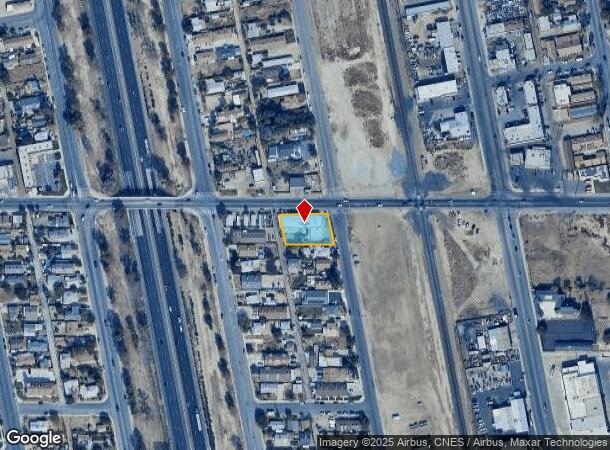
Property Record
345 Glenwood St, Delano, CA 93215
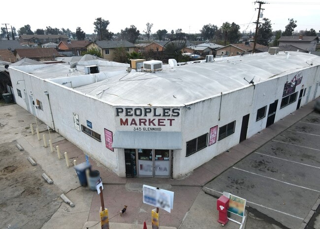
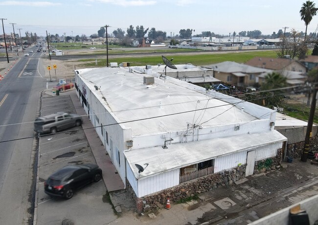
This Property Is For Sale
NEARBY LISTINGS FOR SALE OR LEASE
Property Detail
345 Glenwood St
Bakersfield, CA
New Southern Add
422-071-01-00-7
CITY NSTHN , BLOCK , LOT 1&2
Retailwithmorethanonenonretailuse
Kern
X
California
06107C2300E
1,2
2024
0.34 AC
2025
North Outlying Kern County
004802
Bakersfield
5,168 SF
DEMOGRAPHICS near 345 Glenwood St
1 Mile
3 Mile
5 Mile
2024 Total Population
15,658
45,046
47,564
2029 Population
16,302
46,754
49,296
Pop Growth 2024-2029
+ 4.11%
+ 3.79%
+ 3.64%
Average Age
34
34
35
2024 Total Households
4,227
11,490
11,675
HH Growth 2024-2029
+ 4.42%
+ 3.93%
+ 3.91%
Median Household Inc
$37,786
$48,153
$48,015
Avg Household Size
3.60
3.80
3.80
2024 Avg HH Vehicles
2.00
2.00
2.00
Median Home Value
$245,367
$261,501
$261,619
Median Year Built
1981
1987
1987
Nearby Places
Map Layers
Map Styles
 Street
 Aerial
- Restaurants
- Banks
- Shops
- Fitness
- Groceries
PUBLIC TRANSPORTATION
AIRPORT
Meadows Field
DRIVE
WALK
Distance
Meadows Field
37 min
27.8 mi
Freight Ports
The Port of Hueneme
DRIVE
WALK
Distance
The Port of Hueneme
184 min
152.5 mi
Nearby Properties
Address
Land Use
TOTAL SIZE
Lot Size
Zoning
Address
Land Use
TOTAL SIZE
Lot Size
Zoning
33.33 AC
Address
Land Use
TOTAL SIZE
Lot Size
Zoning
22.76 AC
Address
Land Use
TOTAL SIZE
Lot Size
Zoning
51.50 AC
SP
Address
Land Use
TOTAL SIZE
Lot Size
Zoning
1,197,504 SF
80.46 AC
M1
Address
Land Use
TOTAL SIZE
Lot Size
Zoning
115,071 SF
46.83 AC
R-1
Address
Land Use
TOTAL SIZE
Lot Size
Zoning
13,558 SF
5.53 AC
GC
Address
Land Use
TOTAL SIZE
Lot Size
Zoning
233,028 SF
11.76 AC
G-C
Address
Land Use
TOTAL SIZE
Lot Size
Zoning
190,069 SF
18 AC
CRC
Address
Land Use
TOTAL SIZE
Lot Size
Zoning
89,941 SF
11.22 AC
CRC
Address
Land Use
TOTAL SIZE
Lot Size
Zoning
80,178 SF
4.65 AC
R-3
Address
Land Use
TOTAL SIZE
Lot Size
Zoning
67,951 SF
3.42 AC
I
Address
Land Use
TOTAL SIZE
Lot Size
Zoning
87,580 SF
12 AC
A-1
Address
Land Use
TOTAL SIZE
Lot Size
Zoning
68,994 SF
4.83 AC
R-2
Address
Land Use
TOTAL SIZE
Lot Size
Zoning
3,179 SF
5.45 AC
R-3
Address
Land Use
TOTAL SIZE
Lot Size
Zoning
68,077 SF
10 AC
GC
Address
Land Use
TOTAL SIZE
Lot Size
Zoning
67,645 SF
4.71 AC
Address
Land Use
TOTAL SIZE
Lot Size
Zoning
61,600 SF
4.49 AC
R-3
Address
Land Use
TOTAL SIZE
Lot Size
Zoning
1.77 AC
Address
Land Use
TOTAL SIZE
Lot Size
Zoning
1,800 SF
4.49 AC
C1
Address
Land Use
TOTAL SIZE
Lot Size
Zoning
1.35 AC
Address
Land Use
TOTAL SIZE
Lot Size
Zoning
18,538 SF
7.25 AC
R-1
Address
Land Use
TOTAL SIZE
Lot Size
Zoning
34,608 SF
1.59 AC
C1
Address
Land Use
TOTAL SIZE
Lot Size
Zoning
17,206 SF
2.27 AC
GC
Address
Land Use
TOTAL SIZE
Lot Size
Zoning
28,560 SF
9.51 AC
R-3
Address
Land Use
TOTAL SIZE
Lot Size
Zoning
34,064 SF
3.37 AC
GC
Address
Land Use
TOTAL SIZE
Lot Size
Zoning
84,767 SF
4.88 AC
Address
Land Use
TOTAL SIZE
Lot Size
Zoning
13,052 SF
1.77 AC
GC
Address
Land Use
TOTAL SIZE
Lot Size
Zoning
21,246 SF
0.54 AC
GC
The World's #1 Commercial Real Estate Marketplace
Connect with us
© 2025 CoStar Group
The information above has been obtained from sources believed reliable. While we do not doubt its accuracy we have not verified it and make no guarantee, warranty or representation about it. It is your responsibility to independently confirm its accuracy and completeness. Any projections, opinions, assumptions, or estimates used are for example only and do not represent the current or future performance of the property. The value of this transaction to you depends on tax and other factors which should be evaluated by your tax, financial, and legal advisors. You and your advisors should conduct a careful, independent investigation of the property to determine to your satisfaction the suitability of the property for your needs.