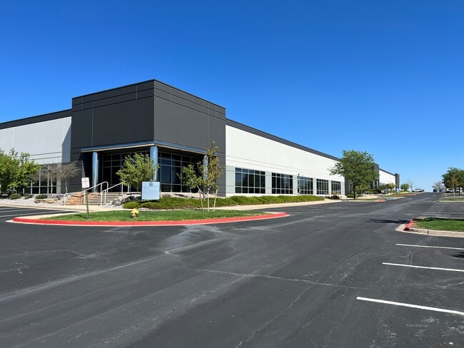
Property Record
345 Inverness Dr S, Englewood, CO 80112


NEARBY LISTINGS FOR SALE OR LEASE
Property Detail
345 Inverness Dr S
Denver
Inverness
Denver-Aurora-Lakewood, CO
LOT 1B-2A INVERNESS #7 10TH AMEND. 16.482 AM/L
2231-021-01-006
Douglas
Commercialnec
Colorado
2024
1b2a
2024
16.48 AC
014014
Inverness
172,792 SF
DEMOGRAPHICS near 345 Inverness Dr S
1 Mile
3 Mile
5 Mile
2024 Total Population
4,162
61,964
204,304
2029 Population
4,888
68,052
220,370
Pop Growth 2024-2029
+ 17.44%
+ 9.83%
+ 7.86%
Average Age
33
38
39
2024 Total Households
2,303
26,808
79,483
HH Growth 2024-2029
+ 17.59%
+ 10.12%
+ 7.97%
Median Household Inc
$68,377
$105,501
$118,722
Avg Household Size
1.80
2.30
2.50
2024 Avg HH Vehicles
1.00
2.00
2.00
Median Home Value
$348,120
$641,677
$657,119
Median Year Built
2011
2003
1997
Nearby Places
Map Layers
Map Styles
 Street
 Aerial
- Restaurants
- Banks
- Shops
- Fitness
- Groceries
PUBLIC TRANSPORTATION
AIRPORT
Denver International
DRIVE
WALK
Distance
Denver International
38 min
33.4 mi
Freight Ports
Tulsa Port Of Catoosa
DRIVE
WALK
Distance
Tulsa Port Of Catoosa
730 min
713.3 mi
SALE & LEASE HISTORY
LISTING DATE
SALE/LEASE

Sep 26, 2016
For Lease
Nov 17, 2016
For Lease
Jan 12, 2021
For Lease
Dec 15, 2020
For Lease
Aug 14, 2023
For Lease
Aug 13, 2023
For Lease
Aug 03, 2023
For Lease
Apr 07, 2023
For Lease
Nearby Properties
Address
Land Use
TOTAL SIZE
Lot Size
Zoning
Address
Land Use
TOTAL SIZE
Lot Size
Zoning
709,725 SF
29.14 AC
Address
Land Use
TOTAL SIZE
Lot Size
Zoning
709,725 SF
15.21 AC
Address
Land Use
TOTAL SIZE
Lot Size
Zoning
805,440 SF
28.65 AC
Address
Land Use
TOTAL SIZE
Lot Size
Zoning
260,667 SF
19.72 AC
Address
Land Use
TOTAL SIZE
Lot Size
Zoning
1,629,937 SF
32.01 AC
Address
Land Use
TOTAL SIZE
Lot Size
Zoning
637,459 SF
4.94 AC
AMU
Address
Land Use
TOTAL SIZE
Lot Size
Zoning
661,139 SF
Address
Land Use
TOTAL SIZE
Lot Size
Zoning
222,000 SF
16.26 AC
AMU
Address
Land Use
TOTAL SIZE
Lot Size
Zoning
29,070 SF
308.89 AC
Address
Land Use
TOTAL SIZE
Lot Size
Zoning
162,758 SF
11.21 AC
Address
Land Use
TOTAL SIZE
Lot Size
Zoning
305,198 SF
34.41 AC
PUD
Address
Land Use
TOTAL SIZE
Lot Size
Zoning
279,884 SF
14.72 AC
Address
Land Use
TOTAL SIZE
Lot Size
Zoning
473,600 SF
5.57 AC
Address
Land Use
TOTAL SIZE
Lot Size
Zoning
246,768 SF
12.37 AC
PUD
Address
Land Use
TOTAL SIZE
Lot Size
Zoning
139,291 SF
8.63 AC
AMU
Address
Land Use
TOTAL SIZE
Lot Size
Zoning
621,565 SF
32.64 AC
PDU
Address
Land Use
TOTAL SIZE
Lot Size
Zoning
650,416 SF
33.37 AC
LI
Address
Land Use
TOTAL SIZE
Lot Size
Zoning
632,485 SF
38.43 AC
PDU
Address
Land Use
TOTAL SIZE
Lot Size
Zoning
163,443 SF
14.39 AC
Address
Land Use
TOTAL SIZE
Lot Size
Zoning
304,620 SF
23.95 AC
AMU
Address
Land Use
TOTAL SIZE
Lot Size
Zoning
216,853 SF
5.42 AC
PUD
Address
Land Use
TOTAL SIZE
Lot Size
Zoning
231,715 SF
5.58 AC
Address
Land Use
TOTAL SIZE
Lot Size
Zoning
107,760 SF
5.41 AC
AMU
Address
Land Use
TOTAL SIZE
Lot Size
Zoning
418,258 SF
14.46 AC
PDU
Address
Land Use
TOTAL SIZE
Lot Size
Zoning
326,230 SF
9.69 AC
Address
Land Use
TOTAL SIZE
Lot Size
Zoning
128,812 SF
2.55 AC
Address
Land Use
TOTAL SIZE
Lot Size
Zoning
207,872 SF
44.94 AC
PDU
Address
Land Use
TOTAL SIZE
Lot Size
Zoning
494,862 SF
30.59 AC
PDU
Address
Land Use
TOTAL SIZE
Lot Size
Zoning
651,701 SF
10.77 AC
PDU
Address
Land Use
TOTAL SIZE
Lot Size
Zoning
196,390 SF
13.10 AC
The World's #1 Commercial Real Estate Marketplace
Connect with us
© 2025 CoStar Group
The information above has been obtained from sources believed reliable. While we do not doubt its accuracy we have not verified it and make no guarantee, warranty or representation about it. It is your responsibility to independently confirm its accuracy and completeness. Any projections, opinions, assumptions, or estimates used are for example only and do not represent the current or future performance of the property. The value of this transaction to you depends on tax and other factors which should be evaluated by your tax, financial, and legal advisors. You and your advisors should conduct a careful, independent investigation of the property to determine to your satisfaction the suitability of the property for your needs.