Property Record
345 Lakeside Rd, Newburgh, NY 12550
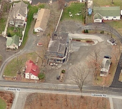

Property Detail
345 Lakeside Rd
Kiryas Joel-Poughkeepsie-Newburgh, NY
LT 1 205 LAKESIDE ASSOC SUBMAP 283-96
334600-033-000-0001-026.100-0000
Orange
Restaurantbuilding
New York
AE The base floodplain where base flood elevations are provided. AE Zones are now used on new format FIRMs instead of A1-A30 Zones.
26.10
2024
0.91 AC
2024
Newburgh
010502
Northern New Jersey
2,687 SF
NEARBY LISTINGS FOR SALE OR LEASE
DEMOGRAPHICS near 345 Lakeside Rd
1 mile
3 mile
5 mile
2025 Total Population
1,996
18,233
57,344
2030 Population
2,039
18,617
58,187
Pop Growth 2025-2030
+ 2.15%
+ 2.11%
+ 1.47%
Average Age
43
42
40
2025 Total Households
724
6,562
20,596
HH Growth 2025-2030
+ 2.21%
+ 2.18%
+ 1.51%
Median Household Inc
$123,976
$102,381
$93,501
Avg Household Size
2.60
2.70
2.70
2025 Avg HH Vehicles
2.00
2.00
2.00
Median Home Value
$415,894
$353,167
$355,207
Median Year Built
1984
1976
1969
Nearby Places
Map Layers
Map Styles
 Street
 Aerial
Layers
 Traffic
 Biking
Places
Listings with unknown addresses are not visible on the map
- Restaurants
- Banks
- Shops
- Fitness
- Groceries
PUBLIC TRANSPORTATION
COMMUTER RAIL
Beacon Station (Hudson Line - Metro-North Commuter Railroad Company (Metro-North))
Drive
Walk
Distance
Beacon Station (Hudson Line - Metro-North Commuter Railroad Company (Metro-North))
17 min
9.3 mi
AIRPORT
New York Stewart International
Drive
Walk
Distance
New York Stewart International
15 min
6.7 mi
Nearby Properties
Address
Land Use
TOTAL SIZE
Lot Size
Zoning
Address
Land Use
TOTAL SIZE
Lot Size
Zoning
1,015,632 SF
187.20 AC
I1
Address
Land Use
TOTAL SIZE
Lot Size
Zoning
927,041 SF
104.37 AC
Address
Land Use
TOTAL SIZE
Lot Size
Zoning
130,037 SF
128.80 AC
Address
Land Use
TOTAL SIZE
Lot Size
Zoning
130,037 SF
136 AC
Address
Land Use
TOTAL SIZE
Lot Size
Zoning
71.72 AC
Address
Land Use
TOTAL SIZE
Lot Size
Zoning
44.50 AC
Address
Land Use
TOTAL SIZE
Lot Size
Zoning
505,577 SF
50.50 AC
Address
Land Use
TOTAL SIZE
Lot Size
Zoning
71,379 SF
20.80 AC
Address
Land Use
TOTAL SIZE
Lot Size
Zoning
20.90 AC
Address
Land Use
TOTAL SIZE
Lot Size
Zoning
10.30 AC
Address
Land Use
TOTAL SIZE
Lot Size
Zoning
215,219 SF
14.57 AC
Address
Land Use
TOTAL SIZE
Lot Size
Zoning
Address
Land Use
TOTAL SIZE
Lot Size
Zoning
Address
Land Use
TOTAL SIZE
Lot Size
Zoning
Address
Land Use
TOTAL SIZE
Lot Size
Zoning
75,620 SF
12.80 AC
Address
Land Use
TOTAL SIZE
Lot Size
Zoning
61,822 SF
7.30 AC
Address
Land Use
TOTAL SIZE
Lot Size
Zoning
Address
Land Use
TOTAL SIZE
Lot Size
Zoning
3.20 AC
Address
Land Use
TOTAL SIZE
Lot Size
Zoning
12.30 AC
Address
Land Use
TOTAL SIZE
Lot Size
Zoning
Address
Land Use
TOTAL SIZE
Lot Size
Zoning
149,051 SF
14.10 AC
I1
Address
Land Use
TOTAL SIZE
Lot Size
Zoning
149,085 SF
48.90 AC
Address
Land Use
TOTAL SIZE
Lot Size
Zoning
31,073 SF
5.10 AC
Address
Land Use
TOTAL SIZE
Lot Size
Zoning
40,200 SF
14.40 AC
Address
Land Use
TOTAL SIZE
Lot Size
Zoning
14.90 AC
Address
Land Use
TOTAL SIZE
Lot Size
Zoning
411.40 AC
Address
Land Use
TOTAL SIZE
Lot Size
Zoning
Address
Land Use
TOTAL SIZE
Lot Size
Zoning
320 SF
88.50 AC
Address
Land Use
TOTAL SIZE
Lot Size
Zoning
69,636 SF
7.20 AC
Address
Land Use
TOTAL SIZE
Lot Size
Zoning
353,311 SF
13.50 AC
The World's #1 Commercial Real Estate Marketplace
Connect with us
© 2026 CoStar Group
The information above has been obtained from sources believed reliable. While we do not doubt its accuracy we have not verified it and make no guarantee, warranty or representation about it. It is your responsibility to independently confirm its accuracy and completeness. Any projections, opinions, assumptions, or estimates used are for example only and do not represent the current or future performance of the property. The value of this transaction to you depends on tax and other factors which should be evaluated by your tax, financial, and legal advisors. You and your advisors should conduct a careful, independent investigation of the property to determine to your satisfaction the suitability of the property for your needs.