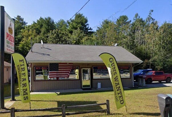
Property Record
345 Nooseneck Hill Rd, Exeter, RI 02822

Property Detail
345 Nooseneck Hill Rd
EXET-000020-000003-000002
Washington
Commercialbuilding
Rhode Island
LB/R
2
B and X Area of moderate flood hazard, usually the area between the limits of the 100-year and 500-year floods.
0.83 AC
2025
Washington County
2025
Providence
050500
Providence-Warwick, RI-MA
1,480 SF
NEARBY LISTINGS FOR SALE OR LEASE
-
-
View all Exeter listings for lease on LoopNet.com
DEMOGRAPHICS near 345 Nooseneck Hill Rd
1 mile
3 mile
5 mile
2025 Total Population
409
3,293
8,592
2030 Population
398
3,228
8,430
Pop Growth 2025-2030
(2.69%)
(1.97%)
(1.89%)
Average Age
43
43
43
2025 Total Households
159
1,240
3,202
HH Growth 2025-2030
(3.14%)
(2.42%)
(2.25%)
Median Household Inc
$97,916
$129,270
$127,185
Avg Household Size
2.60
2.60
2.60
2025 Avg HH Vehicles
2.00
2.00
2.00
Median Home Value
$397,777
$476,178
$487,093
Median Year Built
1958
1981
1983
Nearby Places
Map Layers
Map Styles
 Street
 Aerial
Layers
 Traffic
 Biking
Places
Listings with unknown addresses are not visible on the map
- Restaurants
- Banks
- Shops
- Fitness
- Groceries
PUBLIC TRANSPORTATION
COMMUTER RAIL
Drive
Walk
Distance
16 min
9.9 mi
AIRPORT
Rhode Island Tf Green International
Drive
Walk
Distance
Rhode Island Tf Green International
32 min
20.5 mi
Freight Ports
Port of Davisville, RI
Drive
Walk
Distance
Port of Davisville, RI
30 min
16.2 mi
SALE & LEASE HISTORY
LISTING DATE
SALE/LEASE

Apr 03, 2020
For Lease
Nearby Properties
Address
Land Use
TOTAL SIZE
Lot Size
Zoning
Address
Land Use
TOTAL SIZE
Lot Size
Zoning
39.91 AC
RFR2
Address
Land Use
TOTAL SIZE
Lot Size
Zoning
50,160 SF
23.40 AC
RE-2
Address
Land Use
TOTAL SIZE
Lot Size
Zoning
33,350 SF
38.50 AC
LI
Address
Land Use
TOTAL SIZE
Lot Size
Zoning
38,724 SF
11.20 AC
RU-4
Address
Land Use
TOTAL SIZE
Lot Size
Zoning
2,121.08 AC
OSPL
Address
Land Use
TOTAL SIZE
Lot Size
Zoning
423.80 AC
Address
Land Use
TOTAL SIZE
Lot Size
Zoning
102,456 SF
16.07 AC
HB
Address
Land Use
TOTAL SIZE
Lot Size
Zoning
1,679.80 AC
OSPL
Address
Land Use
TOTAL SIZE
Lot Size
Zoning
7,500 SF
8.20 AC
HB
Address
Land Use
TOTAL SIZE
Lot Size
Zoning
93.45 AC
Address
Land Use
TOTAL SIZE
Lot Size
Zoning
5,568 SF
168.83 AC
RFR2
Address
Land Use
TOTAL SIZE
Lot Size
Zoning
8,880 SF
70.82 AC
RFR2
Address
Land Use
TOTAL SIZE
Lot Size
Zoning
15,638 SF
2.04 AC
HB
Address
Land Use
TOTAL SIZE
Lot Size
Zoning
167.50 AC
RFR2
Address
Land Use
TOTAL SIZE
Lot Size
Zoning
10,434 SF
15.50 AC
RFR2
Address
Land Use
TOTAL SIZE
Lot Size
Zoning
10,040 SF
5.96 AC
LI
Address
Land Use
TOTAL SIZE
Lot Size
Zoning
26,026 SF
5.85 AC
B
Address
Land Use
TOTAL SIZE
Lot Size
Zoning
2,054 SF
36.64 AC
RU-4
Address
Land Use
TOTAL SIZE
Lot Size
Zoning
35.60 AC
B
Address
Land Use
TOTAL SIZE
Lot Size
Zoning
23,184 SF
4.01 AC
HB
Address
Land Use
TOTAL SIZE
Lot Size
Zoning
1,482 SF
2.10 AC
HB
Address
Land Use
TOTAL SIZE
Lot Size
Zoning
145.37 AC
Address
Land Use
TOTAL SIZE
Lot Size
Zoning
80.20 AC
Address
Land Use
TOTAL SIZE
Lot Size
Zoning
13,984 SF
2.10 AC
RU-3
Address
Land Use
TOTAL SIZE
Lot Size
Zoning
1,632 SF
7.30 AC
HB
Address
Land Use
TOTAL SIZE
Lot Size
Zoning
4,337 SF
3.80 AC
HB
Address
Land Use
TOTAL SIZE
Lot Size
Zoning
6,231 SF
5.28 AC
NB
Address
Land Use
TOTAL SIZE
Lot Size
Zoning
13,960 SF
12.65 AC
LI
Address
Land Use
TOTAL SIZE
Lot Size
Zoning
1,272 SF
HB
Address
Land Use
TOTAL SIZE
Lot Size
Zoning
6,800 SF
2.25 AC
LB/R
The World's #1 Commercial Real Estate Marketplace
Connect with us
© 2026 CoStar Group
The information above has been obtained from sources believed reliable. While we do not doubt its accuracy we have not verified it and make no guarantee, warranty or representation about it. It is your responsibility to independently confirm its accuracy and completeness. Any projections, opinions, assumptions, or estimates used are for example only and do not represent the current or future performance of the property. The value of this transaction to you depends on tax and other factors which should be evaluated by your tax, financial, and legal advisors. You and your advisors should conduct a careful, independent investigation of the property to determine to your satisfaction the suitability of the property for your needs.