Property Record
3450 Charles City Rd, Henrico, VA 23231

NEARBY LISTINGS FOR SALE OR LEASE
Property Detail
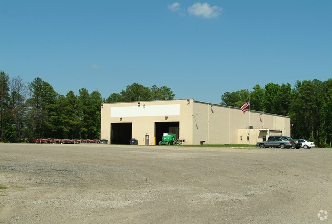
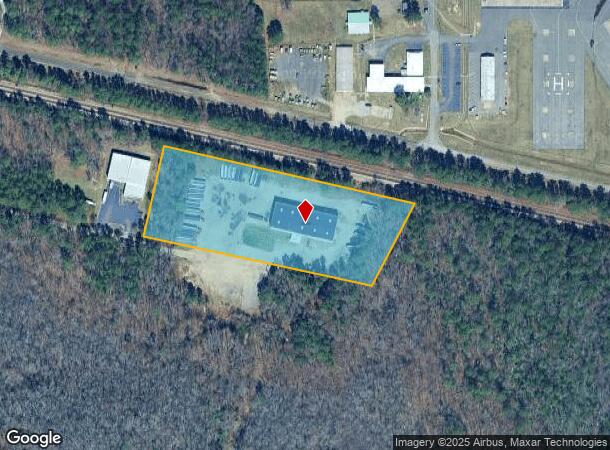
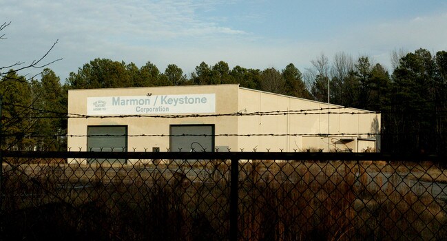
3450 Charles City Rd
826-704-5071
01950A0000 0003; W OF BEULAH RD AC 5 42 A1 7
Publicstorage
Henrico
X
Virginia
51087C0230D
5 AC
2025
Airport
2025
Richmond VA
201502
Richmond, VA
16,840 SF
DEMOGRAPHICS near 3450 Charles City Rd
1 Mile
3 Mile
5 Mile
2024 Total Population
108
14,235
60,677
2029 Population
108
14,186
60,632
Pop Growth 2024-2029
0.00%
(0.34%)
(0.07%)
Average Age
45
40
40
2024 Total Households
41
5,674
24,232
HH Growth 2024-2029
0.00%
(0.42%)
(0.09%)
Median Household Inc
$93,749
$70,466
$59,111
Avg Household Size
2.50
2.40
2.40
2024 Avg HH Vehicles
3.00
2.00
2.00
Median Home Value
$265,384
$213,024
$205,042
Median Year Built
1980
1979
1981
Nearby Places
Map Layers
Map Styles
 Street
 Aerial
- Restaurants
- Banks
- Shops
- Fitness
- Groceries
PUBLIC TRANSPORTATION
COMMUTER RAIL
DRIVE
WALK
Distance
18 min
9.9 mi
AIRPORT
Richmond International
DRIVE
WALK
Distance
Richmond International
13 min
5.3 mi
Freight Ports
Virginia Port Authority - Richmond
DRIVE
WALK
Distance
Virginia Port Authority - Richmond
22 min
12.0 mi
Nearby Properties
Address
Land Use
TOTAL SIZE
Lot Size
Zoning
Address
Land Use
TOTAL SIZE
Lot Size
Zoning
548,680 SF
2,298.89 AC
MIXE
Address
Land Use
TOTAL SIZE
Lot Size
Zoning
920,673 SF
99.01 AC
MIXE
Address
Land Use
TOTAL SIZE
Lot Size
Zoning
49,152 SF
31.21 AC
M-1
Address
Land Use
TOTAL SIZE
Lot Size
Zoning
407,205 SF
286.12 AC
MIXE
Address
Land Use
TOTAL SIZE
Lot Size
Zoning
446,500 SF
49.33 AC
M1-C
Address
Land Use
TOTAL SIZE
Lot Size
Zoning
444,069 SF
23.82 AC
M-1
Address
Land Use
TOTAL SIZE
Lot Size
Zoning
322,000 SF
15.94 AC
M-1
Address
Land Use
TOTAL SIZE
Lot Size
Zoning
278,967 SF
26.07 AC
M1-C
Address
Land Use
TOTAL SIZE
Lot Size
Zoning
181,200 SF
14.74 AC
R-5
Address
Land Use
TOTAL SIZE
Lot Size
Zoning
146,560 SF
11.09 AC
R-5
Address
Land Use
TOTAL SIZE
Lot Size
Zoning
179,359 SF
11.85 AC
M-1
Address
Land Use
TOTAL SIZE
Lot Size
Zoning
246,760 SF
59.70 AC
M-2C
Address
Land Use
TOTAL SIZE
Lot Size
Zoning
241,800 SF
M-2C
Address
Land Use
TOTAL SIZE
Lot Size
Zoning
142,379 SF
17.69 AC
M-1
Address
Land Use
TOTAL SIZE
Lot Size
Zoning
53,530 SF
4.50 AC
M-1C
Address
Land Use
TOTAL SIZE
Lot Size
Zoning
1,782 SF
400 AC
A-1
Address
Land Use
TOTAL SIZE
Lot Size
Zoning
202,560 SF
13.27 AC
M-1C
Address
Land Use
TOTAL SIZE
Lot Size
Zoning
316,548 SF
20.94 AC
M-1
Address
Land Use
TOTAL SIZE
Lot Size
Zoning
130,638 SF
11.06 AC
R-5
Address
Land Use
TOTAL SIZE
Lot Size
Zoning
1,546 SF
43.18 AC
MIXE
Address
Land Use
TOTAL SIZE
Lot Size
Zoning
216,000 SF
17.08 AC
M-1C
Address
Land Use
TOTAL SIZE
Lot Size
Zoning
155,268 SF
11.50 AC
R-5
Address
Land Use
TOTAL SIZE
Lot Size
Zoning
168,520 SF
9.86 AC
M-1C
Address
Land Use
TOTAL SIZE
Lot Size
Zoning
109,728 SF
9.09 AC
R-5C
Address
Land Use
TOTAL SIZE
Lot Size
Zoning
159,200 SF
12.34 AC
M-1C
Address
Land Use
TOTAL SIZE
Lot Size
Zoning
80,815 SF
3.25 AC
M-1
Address
Land Use
TOTAL SIZE
Lot Size
Zoning
97,132 SF
7.88 AC
MIXE
Address
Land Use
TOTAL SIZE
Lot Size
Zoning
149,040 SF
11.39 AC
M-2
Address
Land Use
TOTAL SIZE
Lot Size
Zoning
153,219 SF
9.91 AC
M-1C
Address
Land Use
TOTAL SIZE
Lot Size
Zoning
174,720 SF
13.12 AC
M-2
The World's #1 Commercial Real Estate Marketplace
Connect with us
© 2025 CoStar Group
The information above has been obtained from sources believed reliable. While we do not doubt its accuracy we have not verified it and make no guarantee, warranty or representation about it. It is your responsibility to independently confirm its accuracy and completeness. Any projections, opinions, assumptions, or estimates used are for example only and do not represent the current or future performance of the property. The value of this transaction to you depends on tax and other factors which should be evaluated by your tax, financial, and legal advisors. You and your advisors should conduct a careful, independent investigation of the property to determine to your satisfaction the suitability of the property for your needs.