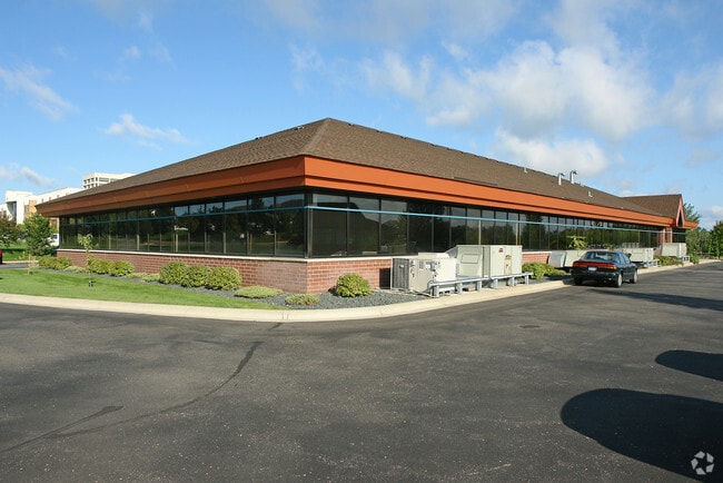
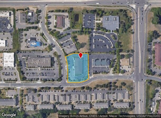
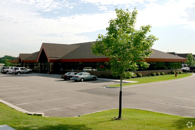
Property Record
3450 Oleary Ln, Saint Paul, MN 55123
NEARBY LISTINGS FOR SALE OR LEASE
Property Detail
3450 Oleary Ln
Minneapolis-St. Paul-Bloomington, MN-WI
Town Centre 100 18Th Add
10-77067-01-010
TOWN CENTRE 100 18TH ADD 1 1
Commercialnec
Dakota
X
Minnesota
27053C0500F
10
2024
1.51 AC
2024
Burnsville/Eagan/Apple Vy
060727
Minneapolis/St Paul
13,490 SF
DEMOGRAPHICS near 3450 Oleary Ln
1 Mile
3 Mile
5 Mile
2024 Total Population
10,018
51,103
113,633
2029 Population
10,289
52,155
115,831
Pop Growth 2024-2029
+ 2.71%
+ 2.06%
+ 1.93%
Average Age
38
40
41
2024 Total Households
4,495
20,429
46,624
HH Growth 2024-2029
+ 2.60%
+ 2.11%
+ 1.92%
Median Household Inc
$78,519
$100,863
$95,959
Avg Household Size
2.10
2.40
2.40
2024 Avg HH Vehicles
2.00
2.00
2.00
Median Home Value
$352,868
$374,297
$373,779
Median Year Built
1988
1987
1986
Nearby Places
Map Layers
Map Styles
 Street
 Aerial
- Restaurants
- Banks
- Shops
- Fitness
- Groceries
PUBLIC TRANSPORTATION
AIRPORT
Minneapolis-St Paul International/Wold-Chamberlain
DRIVE
WALK
Distance
Minneapolis-St Paul International/Wold-Chamberlain
15 min
7.5 mi
Freight Ports
Port Milwaukee
DRIVE
WALK
Distance
Port Milwaukee
374 min
337.4 mi
Nearby Properties
Address
Land Use
TOTAL SIZE
Lot Size
Zoning
Address
Land Use
TOTAL SIZE
Lot Size
Zoning
479,742 SF
11.35 AC
Address
Land Use
TOTAL SIZE
Lot Size
Zoning
466,503 SF
28.74 AC
Address
Land Use
TOTAL SIZE
Lot Size
Zoning
587,427 SF
87.26 AC
Address
Land Use
TOTAL SIZE
Lot Size
Zoning
657,358 SF
17.12 AC
Address
Land Use
TOTAL SIZE
Lot Size
Zoning
264,370 SF
36.39 AC
Address
Land Use
TOTAL SIZE
Lot Size
Zoning
383,495 SF
15.41 AC
Address
Land Use
TOTAL SIZE
Lot Size
Zoning
291,589 SF
6.77 AC
Address
Land Use
TOTAL SIZE
Lot Size
Zoning
246,636 SF
7.20 AC
Address
Land Use
TOTAL SIZE
Lot Size
Zoning
192,843 SF
13.32 AC
Address
Land Use
TOTAL SIZE
Lot Size
Zoning
223,583 SF
5.32 AC
Address
Land Use
TOTAL SIZE
Lot Size
Zoning
381,158 SF
11.86 AC
Address
Land Use
TOTAL SIZE
Lot Size
Zoning
317,235 SF
32.38 AC
Address
Land Use
TOTAL SIZE
Lot Size
Zoning
206,818 SF
2.84 AC
Address
Land Use
TOTAL SIZE
Lot Size
Zoning
300,000 SF
18.44 AC
Address
Land Use
TOTAL SIZE
Lot Size
Zoning
314,237 SF
10.63 AC
Address
Land Use
TOTAL SIZE
Lot Size
Zoning
240,316 SF
9.57 AC
Address
Land Use
TOTAL SIZE
Lot Size
Zoning
201,481 SF
6.69 AC
Address
Land Use
TOTAL SIZE
Lot Size
Zoning
Address
Land Use
TOTAL SIZE
Lot Size
Zoning
170,292 SF
2.08 AC
Address
Land Use
TOTAL SIZE
Lot Size
Zoning
134,298 SF
16.70 AC
Address
Land Use
TOTAL SIZE
Lot Size
Zoning
247,451 SF
9.57 AC
Address
Land Use
TOTAL SIZE
Lot Size
Zoning
110,979 SF
9.65 AC
Address
Land Use
TOTAL SIZE
Lot Size
Zoning
278,320 SF
31.12 AC
Address
Land Use
TOTAL SIZE
Lot Size
Zoning
159,341 SF
2.82 AC
Address
Land Use
TOTAL SIZE
Lot Size
Zoning
1,339,582 SF
78.22 AC
Address
Land Use
TOTAL SIZE
Lot Size
Zoning
541,075 SF
88.93 AC
Address
Land Use
TOTAL SIZE
Lot Size
Zoning
206,503 SF
5.61 AC
Address
Land Use
TOTAL SIZE
Lot Size
Zoning
162,372 SF
9.11 AC
Address
Land Use
TOTAL SIZE
Lot Size
Zoning
436,701 SF
19.58 AC
Address
Land Use
TOTAL SIZE
Lot Size
Zoning
281,133 SF
23.21 AC
The World's #1 Commercial Real Estate Marketplace
Connect with us
© 2025 CoStar Group
The information above has been obtained from sources believed reliable. While we do not doubt its accuracy we have not verified it and make no guarantee, warranty or representation about it. It is your responsibility to independently confirm its accuracy and completeness. Any projections, opinions, assumptions, or estimates used are for example only and do not represent the current or future performance of the property. The value of this transaction to you depends on tax and other factors which should be evaluated by your tax, financial, and legal advisors. You and your advisors should conduct a careful, independent investigation of the property to determine to your satisfaction the suitability of the property for your needs.