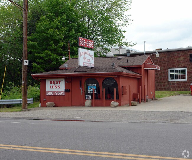
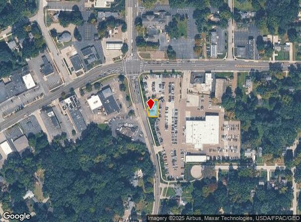
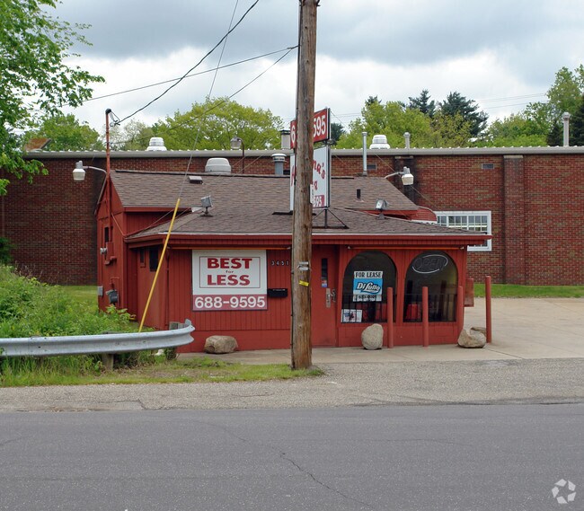
Property Record
3451 Darrow Rd, Stow, OH 44224
NEARBY LISTINGS FOR SALE OR LEASE
Property Detail
3451 Darrow Rd
Cleveland
Stow
Akron, OH
LOT 26 NW S OF RD .300A LESS PT FOR RD 3-WD
56-00616
Summit
Commercialnec
Ohio
2023
26
2025
0.12 AC
530502
Akron
504 SF
DEMOGRAPHICS near 3451 Darrow Rd
1 mile
3 mile
5 mile
2024 Total Population
9,666
67,665
145,637
2029 Population
9,618
67,000
144,421
Pop Growth 2024-2029
(0.50%)
(0.98%)
(0.83%)
Average Age
44
42
41
2024 Total Households
4,136
29,836
63,331
HH Growth 2024-2029
(0.48%)
(1.04%)
(0.87%)
Median Household Inc
$79,908
$70,771
$67,423
Avg Household Size
2.30
2.20
2.20
2024 Avg HH Vehicles
2.00
2.00
2.00
Median Home Value
$180,592
$184,011
$183,820
Median Year Built
1964
1970
1968
Nearby Places
Map Layers
Map Styles
 Street
 Aerial
Transit
 Traffic
 Biking
Places
Listings with unknown addresses are not visible on the map
- Restaurants
- Banks
- Shops
- Fitness
- Groceries
PUBLIC TRANSPORTATION
COMMUTER RAIL
Drive
Walk
Distance
15 min
7.7 mi
Drive
Walk
Distance
20 min
8.1 mi
AIRPORT
Akron-Canton Regional
Drive
Walk
Distance
Akron-Canton Regional
30 min
20.3 mi
Cleveland-Hopkins International
Drive
Walk
Distance
Cleveland-Hopkins International
53 min
37.1 mi
Nearby Properties
Address
Land Use
TOTAL SIZE
Lot Size
Zoning
Address
Land Use
TOTAL SIZE
Lot Size
Zoning
342,850 SF
86.98 AC
Address
Land Use
TOTAL SIZE
Lot Size
Zoning
77,663 SF
83.47 AC
Address
Land Use
TOTAL SIZE
Lot Size
Zoning
Address
Land Use
TOTAL SIZE
Lot Size
Zoning
57,908 SF
6.36 AC
Address
Land Use
TOTAL SIZE
Lot Size
Zoning
314,622 SF
15.59 AC
Address
Land Use
TOTAL SIZE
Lot Size
Zoning
64,501 SF
175.97 AC
Address
Land Use
TOTAL SIZE
Lot Size
Zoning
297,758 SF
23.28 AC
Address
Land Use
TOTAL SIZE
Lot Size
Zoning
52,646 SF
69.69 AC
Address
Land Use
TOTAL SIZE
Lot Size
Zoning
278,319 SF
34.50 AC
Address
Land Use
TOTAL SIZE
Lot Size
Zoning
214,120 SF
14.64 AC
Address
Land Use
TOTAL SIZE
Lot Size
Zoning
15.41 AC
Address
Land Use
TOTAL SIZE
Lot Size
Zoning
169,260 SF
9.95 AC
Address
Land Use
TOTAL SIZE
Lot Size
Zoning
118,740 SF
15.25 AC
Address
Land Use
TOTAL SIZE
Lot Size
Zoning
145,844 SF
9.80 AC
Address
Land Use
TOTAL SIZE
Lot Size
Zoning
Address
Land Use
TOTAL SIZE
Lot Size
Zoning
Address
Land Use
TOTAL SIZE
Lot Size
Zoning
119,896 SF
3.19 AC
Address
Land Use
TOTAL SIZE
Lot Size
Zoning
17,731 SF
216.50 AC
Address
Land Use
TOTAL SIZE
Lot Size
Zoning
157,827 SF
26.63 AC
Address
Land Use
TOTAL SIZE
Lot Size
Zoning
90,820 SF
23.72 AC
Address
Land Use
TOTAL SIZE
Lot Size
Zoning
78,446 SF
18.02 AC
Address
Land Use
TOTAL SIZE
Lot Size
Zoning
68,855 SF
32.57 AC
Address
Land Use
TOTAL SIZE
Lot Size
Zoning
136,220 SF
33 AC
Address
Land Use
TOTAL SIZE
Lot Size
Zoning
140,288 SF
19.51 AC
Address
Land Use
TOTAL SIZE
Lot Size
Zoning
90,512 SF
9.53 AC
Address
Land Use
TOTAL SIZE
Lot Size
Zoning
70,432 SF
2.28 AC
Address
Land Use
TOTAL SIZE
Lot Size
Zoning
619,128 SF
19.95 AC
Address
Land Use
TOTAL SIZE
Lot Size
Zoning
105,404 SF
31.05 AC
Address
Land Use
TOTAL SIZE
Lot Size
Zoning
149,465 SF
13.60 AC
Address
Land Use
TOTAL SIZE
Lot Size
Zoning
96,691 SF
1.58 AC
The World's #1 Commercial Real Estate Marketplace
Connect with us
© 2026 CoStar Group
The information above has been obtained from sources believed reliable. While we do not doubt its accuracy we have not verified it and make no guarantee, warranty or representation about it. It is your responsibility to independently confirm its accuracy and completeness. Any projections, opinions, assumptions, or estimates used are for example only and do not represent the current or future performance of the property. The value of this transaction to you depends on tax and other factors which should be evaluated by your tax, financial, and legal advisors. You and your advisors should conduct a careful, independent investigation of the property to determine to your satisfaction the suitability of the property for your needs.