Property Record
3601 University Dr, Alexandria, VA 22301

NEARBY LISTINGS FOR SALE OR LEASE
Property Detail
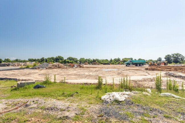
3601 University Dr
008.04-01-02
N Potomac Yards Ph 1
Vacantlandnec
PARCEL 827 N POTOMAC YARDS PH 1 RE/SUB OF PARCEL 724
X
Alexandria
5155190033F
Virginia
2024
4.55 AC
2025
Crystal City
201400
Washington, DC
75,083 SF
Washington-Arlington-Alexandria, DC-VA-MD-WV
DEMOGRAPHICS near 3601 University Dr
1 Mile
3 Mile
5 Mile
2024 Total Population
18,045
179,581
634,159
2029 Population
17,563
173,725
611,600
Pop Growth 2024-2029
(2.67%)
(3.26%)
(3.56%)
Average Age
37
38
38
2024 Total Households
8,368
85,341
299,558
HH Growth 2024-2029
(2.51%)
(3.16%)
(3.91%)
Median Household Inc
$123,046
$112,156
$101,312
Avg Household Size
2.10
2.00
2.00
2024 Avg HH Vehicles
1.00
1.00
1.00
Median Home Value
$770,551
$689,300
$608,783
Median Year Built
1983
1972
1975
Nearby Places
Map Layers
Map Styles
 Street
 Aerial
- Restaurants
- Banks
- Shops
- Fitness
- Groceries
PUBLIC TRANSPORTATION
TRANSIT/SUBWAY
Braddock Road (Blue Line - Washington Metropolitan Area Transit Authority Metrorail (Metrorail), Yellow Line - Washington Metropolitan Area Transit Authority Metrorail (Metrorail))
DRIVE
WALK
Distance
Braddock Road (Blue Line - Washington Metropolitan Area Transit Authority Metrorail (Metrorail), Yellow Line - Washington Metropolitan Area Transit Authority Metrorail (Metrorail))
2 min
13 min
0.7 mi
COMMUTER RAIL
1 (Fredericksburg Line - Virginia Railway Express, Manassas Line - Virginia Railway Express)
DRIVE
WALK
Distance
1 (Fredericksburg Line - Virginia Railway Express, Manassas Line - Virginia Railway Express)
4 min
1.4 mi
Alexandria (Fredericksburg Line - Virginia Railway Express, Manassas Line - Virginia Railway Express)
DRIVE
WALK
Distance
Alexandria (Fredericksburg Line - Virginia Railway Express, Manassas Line - Virginia Railway Express)
4 min
1.4 mi
AIRPORT
Ronald Reagan Washington Ntl
DRIVE
WALK
Distance
Ronald Reagan Washington Ntl
9 min
3.3 mi
Washington Dulles International
DRIVE
WALK
Distance
Washington Dulles International
49 min
27.6 mi
Freight Ports
Port of Baltimore
DRIVE
WALK
Distance
Port of Baltimore
68 min
45.0 mi
Nearby Properties
Address
Land Use
TOTAL SIZE
Lot Size
Zoning
Address
Land Use
TOTAL SIZE
Lot Size
Zoning
900,000 SF
11.10 AC
S-3A
Address
Land Use
TOTAL SIZE
Lot Size
Zoning
1,719,751 SF
39.48 AC
PDR-3;UNZO
Address
Land Use
TOTAL SIZE
Lot Size
Zoning
75.49 AC
RA
Address
Land Use
TOTAL SIZE
Lot Size
Zoning
508,547 SF
4.58 AC
C-O-2.5
Address
Land Use
TOTAL SIZE
Lot Size
Zoning
40,891 SF
2.39 AC
C-O-2.5/C-
Address
Land Use
TOTAL SIZE
Lot Size
Zoning
989,384 SF
5.17 AC
CDD#2
Address
Land Use
TOTAL SIZE
Lot Size
Zoning
1,278,930 SF
28.17 AC
350
Address
Land Use
TOTAL SIZE
Lot Size
Zoning
6,370 SF
3.06 AC
RA6-15
Address
Land Use
TOTAL SIZE
Lot Size
Zoning
35.71 AC
P-S/RA8-18
Address
Land Use
TOTAL SIZE
Lot Size
Zoning
360,007 SF
35.80 AC
UT
Address
Land Use
TOTAL SIZE
Lot Size
Zoning
336,904 SF
2.12 AC
CDD#15
Address
Land Use
TOTAL SIZE
Lot Size
Zoning
782,494 SF
27.65 AC
R 12
Address
Land Use
TOTAL SIZE
Lot Size
Zoning
1,032,882 SF
CDD#20
Address
Land Use
TOTAL SIZE
Lot Size
Zoning
5.85 AC
RA4.8
Address
Land Use
TOTAL SIZE
Lot Size
Zoning
53,549 SF
3.50 AC
C-O
Address
Land Use
TOTAL SIZE
Lot Size
Zoning
16,782 SF
1.67 AC
C-O-1.5
Address
Land Use
TOTAL SIZE
Lot Size
Zoning
568,512 SF
2 AC
C-O
Address
Land Use
TOTAL SIZE
Lot Size
Zoning
608,495 SF
1.50 AC
CDD#2
Address
Land Use
TOTAL SIZE
Lot Size
Zoning
2 SF
2.03 AC
C-O-1.5
Address
Land Use
TOTAL SIZE
Lot Size
Zoning
1,178,900 SF
4.67 AC
CDD#1
Address
Land Use
TOTAL SIZE
Lot Size
Zoning
343,400 SF
12 AC
POS
Address
Land Use
TOTAL SIZE
Lot Size
Zoning
6,764 SF
3.83 AC
RA4.8
Address
Land Use
TOTAL SIZE
Lot Size
Zoning
514,822 SF
44.64 AC
Address
Land Use
TOTAL SIZE
Lot Size
Zoning
559,357 SF
2.26 AC
CDD#2
Address
Land Use
TOTAL SIZE
Lot Size
Zoning
980,000 SF
4.52 AC
C-O
Address
Land Use
TOTAL SIZE
Lot Size
Zoning
981,001 SF
2.24 AC
C-O
Address
Land Use
TOTAL SIZE
Lot Size
Zoning
960,000 SF
12.59 AC
RA6-15/C-O
Address
Land Use
TOTAL SIZE
Lot Size
Zoning
104,107 SF
2.45 AC
C-O
The World's #1 Commercial Real Estate Marketplace
Connect with us
© 2025 CoStar Group
The information above has been obtained from sources believed reliable. While we do not doubt its accuracy we have not verified it and make no guarantee, warranty or representation about it. It is your responsibility to independently confirm its accuracy and completeness. Any projections, opinions, assumptions, or estimates used are for example only and do not represent the current or future performance of the property. The value of this transaction to you depends on tax and other factors which should be evaluated by your tax, financial, and legal advisors. You and your advisors should conduct a careful, independent investigation of the property to determine to your satisfaction the suitability of the property for your needs.