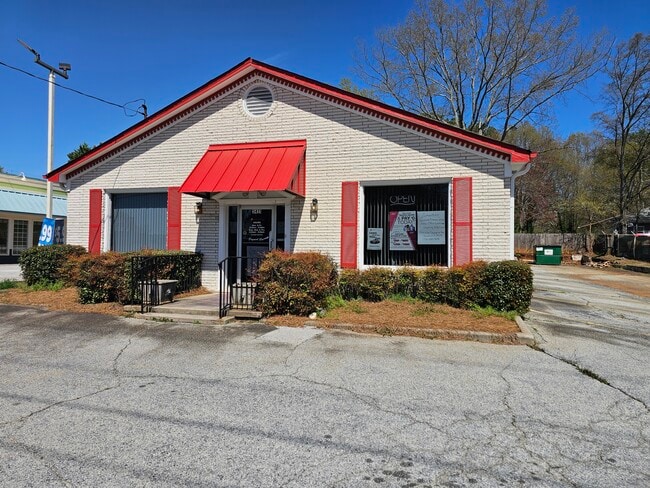
Property Record
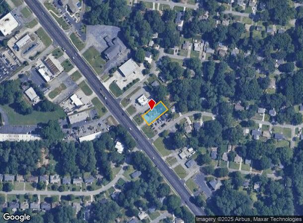
3451 S Cobb Dr Se, Smyrna, GA 30080
NEARBY LISTINGS FOR SALE OR LEASE
Property Detail
3451 S Cobb Dr Se
17-0453-0-041-0
Smyrna Hts Sub
Officebuilding
Cobb
X
Georgia
13067C0207J
1
2025
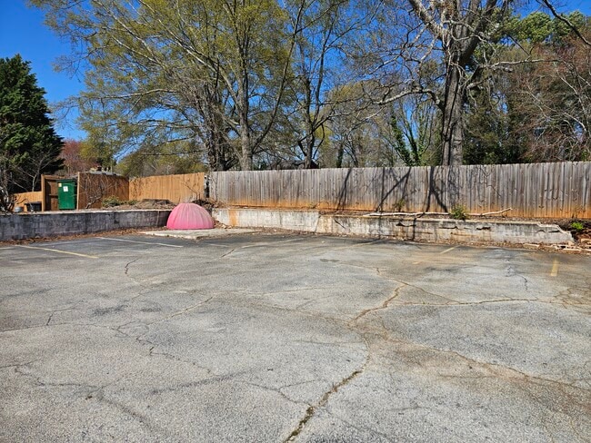
0.28 AC
2025
Cumberland/Galleria
031110
Atlanta
2,160 SF
Atlanta-Sandy Springs-Roswell, GA
DEMOGRAPHICS near 3451 S Cobb Dr Se
1 Mile
3 Mile
5 Mile
2024 Total Population
10,733
97,220
240,365
2029 Population
10,877
98,957
245,637
Pop Growth 2024-2029
+ 1.34%
+ 1.79%
+ 2.19%
Average Age
38
37
37
2024 Total Households
4,398
41,239
103,472
HH Growth 2024-2029
+ 1.34%
+ 1.74%
+ 2.15%
Median Household Inc
$95,911
$84,035
$78,031
Avg Household Size
2.40
2.30
2.30
2024 Avg HH Vehicles
2.00
2.00
2.00
Median Home Value
$378,203
$374,174
$338,506
Median Year Built
1982
1986
1988
Nearby Places
Map Layers
Map Styles
 Street
 Aerial
- Restaurants
- Banks
- Shops
- Fitness
- Groceries
PUBLIC TRANSPORTATION
AIRPORT
Hartsfield - Jackson Atlanta International
DRIVE
WALK
Distance
Hartsfield - Jackson Atlanta International
35 min
23.3 mi
SALE & LEASE HISTORY
LISTING DATE
SALE/LEASE

Apr 17, 2025
For Sale
Nearby Properties
Address
Land Use
TOTAL SIZE
Lot Size
Zoning
Address
Land Use
TOTAL SIZE
Lot Size
Zoning
3,929,999 SF
32.70 AC
OHR
Address
Land Use
TOTAL SIZE
Lot Size
Zoning
173,430 SF
13.83 AC
PVC
Address
Land Use
TOTAL SIZE
Lot Size
Zoning
553,125 SF
42.07 AC
PRD MF
Address
Land Use
TOTAL SIZE
Lot Size
Zoning
394,294 SF
21.56 AC
OHR
Address
Land Use
TOTAL SIZE
Lot Size
Zoning
468,079 SF
31.79 AC
RMR
Address
Land Use
TOTAL SIZE
Lot Size
Zoning
16,408 SF
8.97 AC
PVC
Address
Land Use
TOTAL SIZE
Lot Size
Zoning
389,428 SF
22.50 AC
RM12
Address
Land Use
TOTAL SIZE
Lot Size
Zoning
560,836 SF
60.28 AC
RM-8
Address
Land Use
TOTAL SIZE
Lot Size
Zoning
424,402 SF
34.46 AC
RM-12
Address
Land Use
TOTAL SIZE
Lot Size
Zoning
504,744 SF
44.36 AC
RM-12
Address
Land Use
TOTAL SIZE
Lot Size
Zoning
347,150 SF
19.99 AC
RM-16
Address
Land Use
TOTAL SIZE
Lot Size
Zoning
357,031 SF
10.69 AC
MU
Address
Land Use
TOTAL SIZE
Lot Size
Zoning
285,395 SF
26.58 AC
RM-12
Address
Land Use
TOTAL SIZE
Lot Size
Zoning
374,698 SF
30.72 AC
RM-12
Address
Land Use
TOTAL SIZE
Lot Size
Zoning
477,544 SF
4.61 AC
MU
Address
Land Use
TOTAL SIZE
Lot Size
Zoning
403,687 SF
42.37 AC
RM-12
Address
Land Use
TOTAL SIZE
Lot Size
Zoning
264,878 SF
28.71 AC
RM-16
Address
Land Use
TOTAL SIZE
Lot Size
Zoning
385,088 SF
33.31 AC
RM-12
Address
Land Use
TOTAL SIZE
Lot Size
Zoning
207,090 SF
24.40 AC
RM-12
Address
Land Use
TOTAL SIZE
Lot Size
Zoning
74,592 SF
9.83 AC
OS
Address
Land Use
TOTAL SIZE
Lot Size
Zoning
307,837 SF
3.43 AC
PVC
Address
Land Use
TOTAL SIZE
Lot Size
Zoning
313,882 SF
22.33 AC
RM-12
Address
Land Use
TOTAL SIZE
Lot Size
Zoning
227,558 SF
27.80 AC
RM-12
Address
Land Use
TOTAL SIZE
Lot Size
Zoning
428,305 SF
30.88 AC
RM-16
Address
Land Use
TOTAL SIZE
Lot Size
Zoning
488,748 SF
32.28 AC
RM-12
Address
Land Use
TOTAL SIZE
Lot Size
Zoning
230,032 SF
19.77 AC
RM-16
Address
Land Use
TOTAL SIZE
Lot Size
Zoning
215,194 SF
15 AC
RM-16
Address
Land Use
TOTAL SIZE
Lot Size
Zoning
267,021 SF
13.72 AC
RM-16
Address
Land Use
TOTAL SIZE
Lot Size
Zoning
319,840 SF
27.79 AC
RM-12
Address
Land Use
TOTAL SIZE
Lot Size
Zoning
698,904 SF
36.69 AC
HI
The World's #1 Commercial Real Estate Marketplace
Connect with us
© 2025 CoStar Group
The information above has been obtained from sources believed reliable. While we do not doubt its accuracy we have not verified it and make no guarantee, warranty or representation about it. It is your responsibility to independently confirm its accuracy and completeness. Any projections, opinions, assumptions, or estimates used are for example only and do not represent the current or future performance of the property. The value of this transaction to you depends on tax and other factors which should be evaluated by your tax, financial, and legal advisors. You and your advisors should conduct a careful, independent investigation of the property to determine to your satisfaction the suitability of the property for your needs.