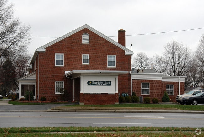
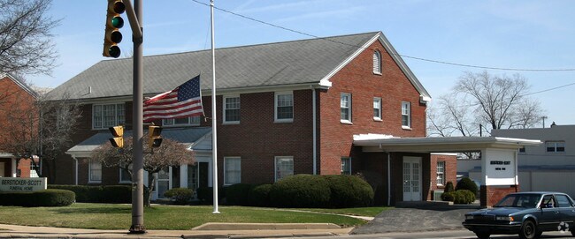
Property Record
3453 Heatherdowns Blvd, Toledo, OH 43614

Property Detail
3453 Heatherdowns Blvd
07-63274
HEATHER DOWNS SECOND LOTS 1092 - 1094 EXC BYRNERD WIDENING & ALL VA
Funeralhome
LUCAS
10-CR
Ohio
B and X Area of moderate flood hazard, usually the area between the limits of the 100-year and 500-year floods.
1092
2025
0.67 AC
2025
South/Southwest
006900
Toledo
13,188 SF
Toledo, OH
NEARBY LISTINGS FOR SALE OR LEASE
DEMOGRAPHICS near 3453 Heatherdowns Blvd
1 mile
3 mile
5 mile
2025 Total Population
10,118
69,286
173,245
2030 Population
9,910
68,362
172,732
Pop Growth 2025-2030
(2.06%)
(1.33%)
(0.30%)
Average Age
42
41
40
2025 Total Households
4,590
31,605
74,728
HH Growth 2025-2030
(1.98%)
(1.32%)
(0.29%)
Median Household Inc
$61,542
$58,054
$58,745
Avg Household Size
2.10
2.10
2.20
2025 Avg HH Vehicles
2.00
2.00
2.00
Median Home Value
$159,471
$162,571
$173,968
Median Year Built
1958
1967
1968
Nearby Places
Map Layers
Map Styles
 Street
 Aerial
Transit
 Traffic
 Biking
Places
Listings with unknown addresses are not visible on the map
- Restaurants
- Banks
- Shops
- Fitness
- Groceries
PUBLIC TRANSPORTATION
COMMUTER RAIL
Toledo (Capitol Limited - Amtrak, Lake Shore Limited - Amtrak)
Drive
Walk
Distance
Toledo (Capitol Limited - Amtrak, Lake Shore Limited - Amtrak)
9 min
5.8 mi
AIRPORT
Eugene F Kranz Toledo Express
Drive
Walk
Distance
Eugene F Kranz Toledo Express
27 min
14.1 mi
Freight Ports
Port of Toledo
Drive
Walk
Distance
Port of Toledo
23 min
11.9 mi
Nearby Properties
Address
Land Use
TOTAL SIZE
Lot Size
Zoning
Address
Land Use
TOTAL SIZE
Lot Size
Zoning
1,237,446 SF
193.94 AC
10-RS12
Address
Land Use
TOTAL SIZE
Lot Size
Zoning
245,237 SF
31.72 AC
10-MX
Address
Land Use
TOTAL SIZE
Lot Size
Zoning
393,343 SF
62.48 AC
10-IC
Address
Land Use
TOTAL SIZE
Lot Size
Zoning
123,064 SF
10 AC
10-RS6
Address
Land Use
TOTAL SIZE
Lot Size
Zoning
196,149 SF
18.69 AC
10-RD6
Address
Land Use
TOTAL SIZE
Lot Size
Zoning
170,960 SF
4 AC
10-RS6
Address
Land Use
TOTAL SIZE
Lot Size
Zoning
269,263 SF
55.93 AC
16-R2
Address
Land Use
TOTAL SIZE
Lot Size
Zoning
94,439 SF
9 AC
10-CO
Address
Land Use
TOTAL SIZE
Lot Size
Zoning
316,351 SF
30.65 AC
10-IC
Address
Land Use
TOTAL SIZE
Lot Size
Zoning
138,607 SF
21.30 AC
10-RS12
Address
Land Use
TOTAL SIZE
Lot Size
Zoning
94,891 SF
18.80 AC
10-RS6
Address
Land Use
TOTAL SIZE
Lot Size
Zoning
352,382 SF
62.93 AC
16-M1
Address
Land Use
TOTAL SIZE
Lot Size
Zoning
80,668 SF
9.67 AC
Address
Land Use
TOTAL SIZE
Lot Size
Zoning
81,672 SF
14.93 AC
10-RS9
Address
Land Use
TOTAL SIZE
Lot Size
Zoning
210,996 SF
22.18 AC
10-CRSO
Address
Land Use
TOTAL SIZE
Lot Size
Zoning
172,739 SF
10.93 AC
10-IL
Address
Land Use
TOTAL SIZE
Lot Size
Zoning
131,201 SF
10 AC
10-CUP
Address
Land Use
TOTAL SIZE
Lot Size
Zoning
69,007 SF
15.93 AC
Address
Land Use
TOTAL SIZE
Lot Size
Zoning
363,176 SF
11.72 AC
10-RM36
Address
Land Use
TOTAL SIZE
Lot Size
Zoning
126,732 SF
15 AC
10-CRSO
Address
Land Use
TOTAL SIZE
Lot Size
Zoning
48,321 SF
93.94 AC
10-RS12
Address
Land Use
TOTAL SIZE
Lot Size
Zoning
58.33 AC
10-IL
Address
Land Use
TOTAL SIZE
Lot Size
Zoning
160,811 SF
10.83 AC
10-MX
Address
Land Use
TOTAL SIZE
Lot Size
Zoning
78,685 SF
14.86 AC
10-RS12
Address
Land Use
TOTAL SIZE
Lot Size
Zoning
60,805 SF
9.38 AC
10-RS12
Address
Land Use
TOTAL SIZE
Lot Size
Zoning
115,607 SF
42.88 AC
16-R2
Address
Land Use
TOTAL SIZE
Lot Size
Zoning
93,531 SF
13.31 AC
16-C2
Address
Land Use
TOTAL SIZE
Lot Size
Zoning
47,944 SF
7.58 AC
10-RS6
Address
Land Use
TOTAL SIZE
Lot Size
Zoning
2 AC
10-RS6
Address
Land Use
TOTAL SIZE
Lot Size
Zoning
126,402 SF
6 AC
10-CRSO
The World's #1 Commercial Real Estate Marketplace
Connect with us
© 2026 CoStar Group
The information above has been obtained from sources believed reliable. While we do not doubt its accuracy we have not verified it and make no guarantee, warranty or representation about it. It is your responsibility to independently confirm its accuracy and completeness. Any projections, opinions, assumptions, or estimates used are for example only and do not represent the current or future performance of the property. The value of this transaction to you depends on tax and other factors which should be evaluated by your tax, financial, and legal advisors. You and your advisors should conduct a careful, independent investigation of the property to determine to your satisfaction the suitability of the property for your needs.