Property Record
3455 N Highway 1, Cocoa, FL 32926
NEARBY LISTINGS FOR SALE OR LEASE
Property Detail
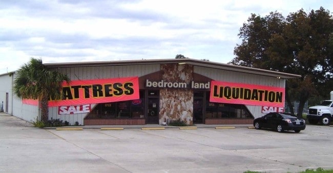
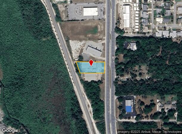
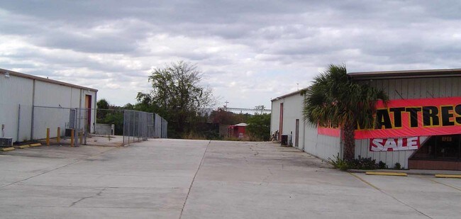
3455 N Highway 1
24-36-07-00-00768.0-0000.00
N 250 FT OF SE 1/4 OF SE 1/4 LYING BETWEEN FEC RR & US HWY 1 AS DESC IN ORB 930 PG 490 EXC S 125 FT
Storebuilding
Brevard
X
Florida
12009C0320H
0.82 AC
2024
Brevard County
2025
Orlando
062112
Palm Bay-Melbourne-Titusville, FL
10,920 SF
DEMOGRAPHICS near 3455 N Highway 1
1 Mile
3 Mile
5 Mile
2024 Total Population
2,129
26,496
74,208
2029 Population
2,347
28,896
81,080
Pop Growth 2024-2029
+ 10.24%
+ 9.06%
+ 9.26%
Average Age
47
43
44
2024 Total Households
919
10,994
30,751
HH Growth 2024-2029
+ 10.01%
+ 8.81%
+ 9.03%
Median Household Inc
$63,461
$47,288
$55,085
Avg Household Size
2.30
2.30
2.30
2024 Avg HH Vehicles
2.00
2.00
2.00
Median Home Value
$248,305
$237,378
$263,035
Median Year Built
1977
1981
1981
Nearby Places
Map Layers
Map Styles
 Street
 Aerial
- Restaurants
- Banks
- Shops
- Fitness
- Groceries
PUBLIC TRANSPORTATION
AIRPORT
Melbourne Orlando International
DRIVE
WALK
Distance
Melbourne Orlando International
43 min
30.8 mi
Freight Ports
Port Canaveral
DRIVE
WALK
Distance
Port Canaveral
14 min
9.4 mi
Nearby Properties
Address
Land Use
TOTAL SIZE
Lot Size
Zoning
Address
Land Use
TOTAL SIZE
Lot Size
Zoning
825,903 SF
94.80 AC
RU17
Address
Land Use
TOTAL SIZE
Lot Size
Zoning
335,014 SF
185.59 AC
M2
Address
Land Use
TOTAL SIZE
Lot Size
Zoning
307,934 SF
13.66 AC
RU215
Address
Land Use
TOTAL SIZE
Lot Size
Zoning
176,670 SF
13.49 AC
CG
Address
Land Use
TOTAL SIZE
Lot Size
Zoning
264,679 SF
59.90 AC
RU17
Address
Land Use
TOTAL SIZE
Lot Size
Zoning
211,753 SF
25.16 AC
CG
Address
Land Use
TOTAL SIZE
Lot Size
Zoning
174,500 SF
13.34 AC
RU-2-10
Address
Land Use
TOTAL SIZE
Lot Size
Zoning
96,878 SF
17.47 AC
CN
Address
Land Use
TOTAL SIZE
Lot Size
Zoning
75,552 SF
9.95 AC
PUD
Address
Land Use
TOTAL SIZE
Lot Size
Zoning
96,814 SF
8.89 AC
RU215
Address
Land Use
TOTAL SIZE
Lot Size
Zoning
144,430 SF
14.02 AC
M2
Address
Land Use
TOTAL SIZE
Lot Size
Zoning
95,535 SF
12.69 AC
AU
Address
Land Use
TOTAL SIZE
Lot Size
Zoning
52,398 SF
9.68 AC
M2
Address
Land Use
TOTAL SIZE
Lot Size
Zoning
86,391 SF
12.02 AC
GU
Address
Land Use
TOTAL SIZE
Lot Size
Zoning
109,153 SF
20 AC
RU17
Address
Land Use
TOTAL SIZE
Lot Size
Zoning
59,448 SF
6.46 AC
RU2-15
Address
Land Use
TOTAL SIZE
Lot Size
Zoning
107,340 SF
7.64 AC
CR
Address
Land Use
TOTAL SIZE
Lot Size
Zoning
222,813 SF
20.01 AC
CP
Address
Land Use
TOTAL SIZE
Lot Size
Zoning
97,966 SF
17.08 AC
RU17
Address
Land Use
TOTAL SIZE
Lot Size
Zoning
126,270 SF
20.99 AC
M2
Address
Land Use
TOTAL SIZE
Lot Size
Zoning
79,371 SF
12.44 AC
RU17
Address
Land Use
TOTAL SIZE
Lot Size
Zoning
92,025 SF
3.08 AC
RU225
Address
Land Use
TOTAL SIZE
Lot Size
Zoning
7,788 SF
200 AC
GML
Address
Land Use
TOTAL SIZE
Lot Size
Zoning
92,647 SF
7.02 AC
BU-2
Address
Land Use
TOTAL SIZE
Lot Size
Zoning
42,936 SF
27.69 AC
GU
Address
Land Use
TOTAL SIZE
Lot Size
Zoning
27,783 SF
8.91 AC
CN
Address
Land Use
TOTAL SIZE
Lot Size
Zoning
34,296 SF
1.41 AC
RU215
Address
Land Use
TOTAL SIZE
Lot Size
Zoning
15,320 SF
113.85 AC
AU
Address
Land Use
TOTAL SIZE
Lot Size
Zoning
47,030 SF
2.45 AC
RU215
Address
Land Use
TOTAL SIZE
Lot Size
Zoning
38,646 SF
9.23 AC
CN
The World's #1 Commercial Real Estate Marketplace
Connect with us
© 2025 CoStar Group
The information above has been obtained from sources believed reliable. While we do not doubt its accuracy we have not verified it and make no guarantee, warranty or representation about it. It is your responsibility to independently confirm its accuracy and completeness. Any projections, opinions, assumptions, or estimates used are for example only and do not represent the current or future performance of the property. The value of this transaction to you depends on tax and other factors which should be evaluated by your tax, financial, and legal advisors. You and your advisors should conduct a careful, independent investigation of the property to determine to your satisfaction the suitability of the property for your needs.