Property Record
3455 Sw Williston Rd, Gainesville, FL 32608
NEARBY LISTINGS FOR SALE OR LEASE
-
-
View all Gainesville listings for sale on LoopNet.com
Property Detail
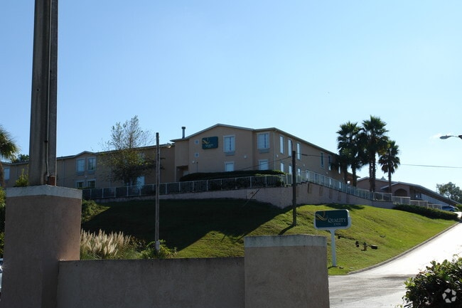
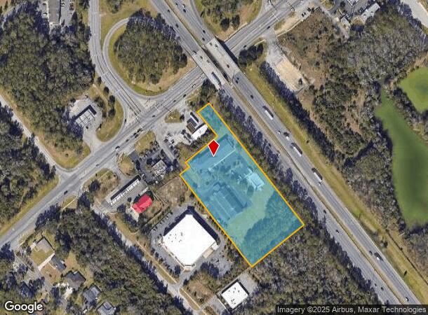
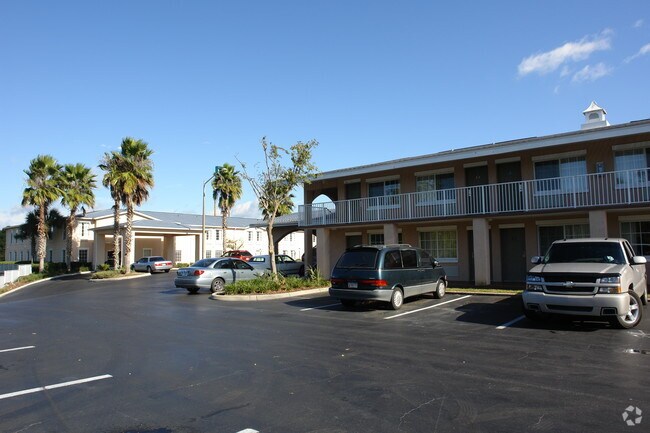
3455 Sw Williston Rd
Gainesville, FL
Ponderosa Addn Mcintosh Grant
07143-009-000
MCINTOSH GRANT MACKEY & HUDSON TRACT DB J-906 LOT 1 & 2 E 61.03 FT OF LOT 16 PONDEROSA ADDITION IN LOT 10 (LESS THE E 61.03 FT OF LOT 16 PONDEROSA ADDITION IN LOT 10) OR 4495/0337
Motel
Alachua
X
Florida
12001C0451E
2
2025
4.63 AC
2025
Gainesville
002220
Other Market Areas
39,432 SF
DEMOGRAPHICS near 3455 Sw Williston Rd
1 Mile
3 Mile
5 Mile
2024 Total Population
2,771
47,631
128,039
2029 Population
2,938
50,336
134,380
Pop Growth 2024-2029
+ 6.03%
+ 5.68%
+ 4.95%
Average Age
35
31
33
2024 Total Households
1,177
20,267
50,785
HH Growth 2024-2029
+ 5.95%
+ 5.62%
+ 5.18%
Median Household Inc
$57,380
$36,199
$43,617
Avg Household Size
2.30
2.10
2.20
2024 Avg HH Vehicles
2.00
1.00
2.00
Median Home Value
$287,999
$195,395
$287,089
Median Year Built
1990
1991
1987
Nearby Places
Map Layers
Map Styles
 Street
 Aerial
- Restaurants
- Banks
- Shops
- Fitness
- Groceries
PUBLIC TRANSPORTATION
AIRPORT
Gainesville Regional
DRIVE
WALK
Distance
Gainesville Regional
22 min
10.0 mi
Nearby Properties
Address
Land Use
TOTAL SIZE
Lot Size
Zoning
Address
Land Use
TOTAL SIZE
Lot Size
Zoning
3,617,778 SF
276.74 AC
ED
Address
Land Use
TOTAL SIZE
Lot Size
Zoning
790,340 SF
526 AC
ED
Address
Land Use
TOTAL SIZE
Lot Size
Zoning
382,760 SF
109.58 AC
MD
Address
Land Use
TOTAL SIZE
Lot Size
Zoning
1,142,852 SF
106.08 AC
PD
Address
Land Use
TOTAL SIZE
Lot Size
Zoning
508,106 SF
27.40 AC
PD
Address
Land Use
TOTAL SIZE
Lot Size
Zoning
233,910 SF
3.64 AC
PD
Address
Land Use
TOTAL SIZE
Lot Size
Zoning
571,635 SF
55.49 AC
RMF6
Address
Land Use
TOTAL SIZE
Lot Size
Zoning
392,241 SF
25 AC
U9
Address
Land Use
TOTAL SIZE
Lot Size
Zoning
490,069 SF
40.15 AC
RMF8
Address
Land Use
TOTAL SIZE
Lot Size
Zoning
497,470 SF
33.60 AC
PD
Address
Land Use
TOTAL SIZE
Lot Size
Zoning
219,150 SF
9.99 AC
PD
Address
Land Use
TOTAL SIZE
Lot Size
Zoning
495,440 SF
14.88 AC
U9
Address
Land Use
TOTAL SIZE
Lot Size
Zoning
337,105 SF
7.87 AC
MU1
Address
Land Use
TOTAL SIZE
Lot Size
Zoning
299,984 SF
10.33 AC
MU2
Address
Land Use
TOTAL SIZE
Lot Size
Zoning
371,818 SF
14.05 AC
RMF8
Address
Land Use
TOTAL SIZE
Lot Size
Zoning
307,739 SF
3.43 AC
U7
Address
Land Use
TOTAL SIZE
Lot Size
Zoning
170,185 SF
5.14 AC
R-1AA
Address
Land Use
TOTAL SIZE
Lot Size
Zoning
484,466 SF
7.44 AC
U9
Address
Land Use
TOTAL SIZE
Lot Size
Zoning
371,933 SF
15 AC
PD
Address
Land Use
TOTAL SIZE
Lot Size
Zoning
230,564 SF
6.34 AC
U9
Address
Land Use
TOTAL SIZE
Lot Size
Zoning
228,729 SF
8.10 AC
U9
Address
Land Use
TOTAL SIZE
Lot Size
Zoning
22,710 SF
30 AC
ED
Address
Land Use
TOTAL SIZE
Lot Size
Zoning
440,687 SF
33.32 AC
RMF8
Address
Land Use
TOTAL SIZE
Lot Size
Zoning
214,608 SF
21.23 AC
MU2
Address
Land Use
TOTAL SIZE
Lot Size
Zoning
205,916 SF
9.89 AC
U9
Address
Land Use
TOTAL SIZE
Lot Size
Zoning
183,300 SF
11.73 AC
ED
Address
Land Use
TOTAL SIZE
Lot Size
Zoning
354,707 SF
25.98 AC
RMF8
Address
Land Use
TOTAL SIZE
Lot Size
Zoning
232,629 SF
22.60 AC
U9
Address
Land Use
TOTAL SIZE
Lot Size
Zoning
134,068 SF
3.47 AC
R-2
Address
Land Use
TOTAL SIZE
Lot Size
Zoning
311,673 SF
34.15 AC
R-2
The World's #1 Commercial Real Estate Marketplace
Connect with us
© 2025 CoStar Group
The information above has been obtained from sources believed reliable. While we do not doubt its accuracy we have not verified it and make no guarantee, warranty or representation about it. It is your responsibility to independently confirm its accuracy and completeness. Any projections, opinions, assumptions, or estimates used are for example only and do not represent the current or future performance of the property. The value of this transaction to you depends on tax and other factors which should be evaluated by your tax, financial, and legal advisors. You and your advisors should conduct a careful, independent investigation of the property to determine to your satisfaction the suitability of the property for your needs.