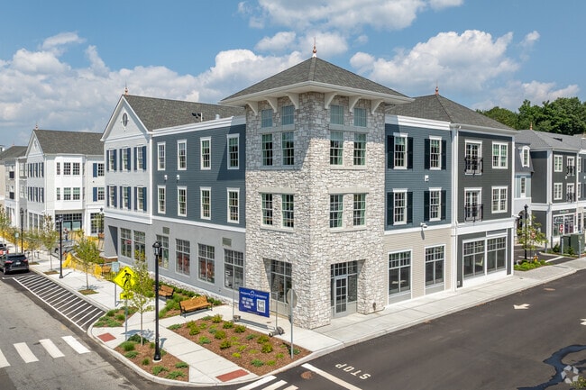
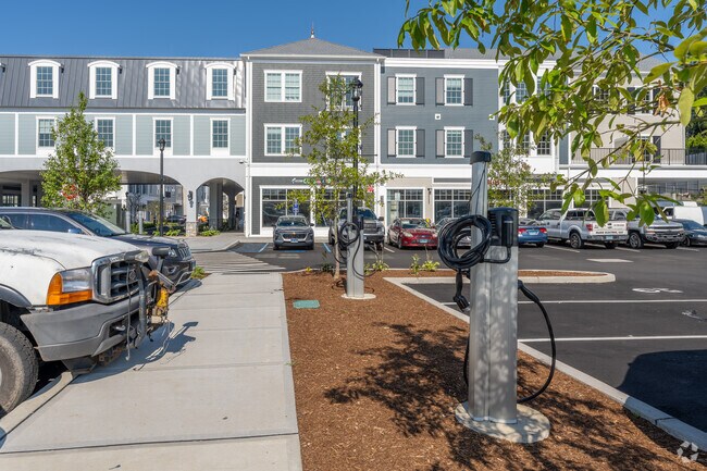
Property Record
346 Heights Rd, Darien, CT 06820

Property Detail
346 Heights Rd
DARI-000075-000000-000022-000023-24
Western Ct
Commercialnec
Connecticut
DC
3.96 AC
B and X Area of moderate flood hazard, usually the area between the limits of the 100-year and 500-year floods.
Darien
2025
Westchester/So Connecticut
2025
Bridgeport-Stamford-Danbury, CT
030500
NEARBY LISTINGS FOR SALE OR LEASE
DEMOGRAPHICS near 346 Heights Rd
1 mile
3 mile
5 mile
2025 Total Population
12,006
114,900
217,070
2030 Population
12,310
117,917
222,205
Pop Growth 2025-2030
+ 2.53%
+ 2.63%
+ 2.37%
Average Age
39
39
40
2025 Total Households
4,029
45,575
82,722
HH Growth 2025-2030
+ 2.46%
+ 2.82%
+ 2.55%
Median Household Inc
$200,297
$111,902
$114,771
Avg Household Size
2.90
2.40
2.50
2025 Avg HH Vehicles
2.00
2.00
2.00
Median Home Value
$1,055,189
$741,995
$788,950
Median Year Built
1957
1970
1969
Nearby Places
Map Layers
Map Styles
 Street
 Aerial
Layers
 Traffic
 Biking
Places
Listings with unknown addresses are not visible on the map
- Restaurants
- Banks
- Shops
- Fitness
- Groceries
PUBLIC TRANSPORTATION
COMMUTER RAIL
Noroton Heights Station (New Haven Line - Metro-North Commuter Railroad Company (Metro-North))
Drive
Walk
Distance
Noroton Heights Station (New Haven Line - Metro-North Commuter Railroad Company (Metro-North))
1 min
3 min
0.2 mi
Glenbrook Station (New Haven Line - Metro-North Commuter Railroad Company (Metro-North))
Drive
Walk
Distance
Glenbrook Station (New Haven Line - Metro-North Commuter Railroad Company (Metro-North))
3 min
1.4 mi
AIRPORT
Westchester County
Drive
Walk
Distance
Westchester County
27 min
15.7 mi
LaGuardia
Drive
Walk
Distance
LaGuardia
53 min
34.9 mi
Freight Ports
Port of New Haven
Drive
Walk
Distance
Port of New Haven
57 min
39.1 mi
Nearby Properties
Address
Land Use
TOTAL SIZE
Lot Size
Zoning
Address
Land Use
TOTAL SIZE
Lot Size
Zoning
13.21 AC
CSCD
Address
Land Use
TOTAL SIZE
Lot Size
Zoning
8.91 AC
DC
Address
Land Use
TOTAL SIZE
Lot Size
Zoning
336,000 SF
40 AC
MU
Address
Land Use
TOTAL SIZE
Lot Size
Zoning
5.10 AC
MXD
Address
Land Use
TOTAL SIZE
Lot Size
Zoning
Address
Land Use
TOTAL SIZE
Lot Size
Zoning
397,378 SF
4.25 AC
CC
Address
Land Use
TOTAL SIZE
Lot Size
Zoning
543,005 SF
2.23 AC
RHD
Address
Land Use
TOTAL SIZE
Lot Size
Zoning
411,596 SF
3.30 AC
MZN
Address
Land Use
TOTAL SIZE
Lot Size
Zoning
4.13 AC
CC
Address
Land Use
TOTAL SIZE
Lot Size
Zoning
46,302 SF
23.50 AC
MG
Address
Land Use
TOTAL SIZE
Lot Size
Zoning
9.62 AC
MZN
Address
Land Use
TOTAL SIZE
Lot Size
Zoning
359,686 SF
1.67 AC
CCN
Address
Land Use
TOTAL SIZE
Lot Size
Zoning
377,754 SF
2.06 AC
PD
Address
Land Use
TOTAL SIZE
Lot Size
Zoning
79.29 AC
P
Address
Land Use
TOTAL SIZE
Lot Size
Zoning
32.68 AC
MD
Address
Land Use
TOTAL SIZE
Lot Size
Zoning
8.21 AC
CWD
Address
Land Use
TOTAL SIZE
Lot Size
Zoning
304,617 SF
CI
Address
Land Use
TOTAL SIZE
Lot Size
Zoning
304,345 SF
1.15 AC
PD
Address
Land Use
TOTAL SIZE
Lot Size
Zoning
277,740 SF
2.82 AC
TCDD
Address
Land Use
TOTAL SIZE
Lot Size
Zoning
308,621 SF
CI
Address
Land Use
TOTAL SIZE
Lot Size
Zoning
32.06 AC
DMR
Address
Land Use
TOTAL SIZE
Lot Size
Zoning
235,186 SF
1.29 AC
CG
Address
Land Use
TOTAL SIZE
Lot Size
Zoning
3.14 AC
RH
Address
Land Use
TOTAL SIZE
Lot Size
Zoning
243,000 SF
3.02 AC
CG
Address
Land Use
TOTAL SIZE
Lot Size
Zoning
334,905 SF
2.52 AC
MXD
Address
Land Use
TOTAL SIZE
Lot Size
Zoning
4.53 AC
RH
Address
Land Use
TOTAL SIZE
Lot Size
Zoning
5.18 AC
CC
Address
Land Use
TOTAL SIZE
Lot Size
Zoning
42.18 AC
P
Address
Land Use
TOTAL SIZE
Lot Size
Zoning
25.91 AC
MZN
Address
Land Use
TOTAL SIZE
Lot Size
Zoning
322,812 SF
3.17 AC
MZN
The World's #1 Commercial Real Estate Marketplace
Connect with us
© 2026 CoStar Group
The information above has been obtained from sources believed reliable. While we do not doubt its accuracy we have not verified it and make no guarantee, warranty or representation about it. It is your responsibility to independently confirm its accuracy and completeness. Any projections, opinions, assumptions, or estimates used are for example only and do not represent the current or future performance of the property. The value of this transaction to you depends on tax and other factors which should be evaluated by your tax, financial, and legal advisors. You and your advisors should conduct a careful, independent investigation of the property to determine to your satisfaction the suitability of the property for your needs.