Property Record
Oakleaf Plantation Pkwy, Orange Park, FL 32065


NEARBY LISTINGS FOR SALE OR LEASE
-
-
View all Orange Park listings for sale on LoopNet.com
Property Detail
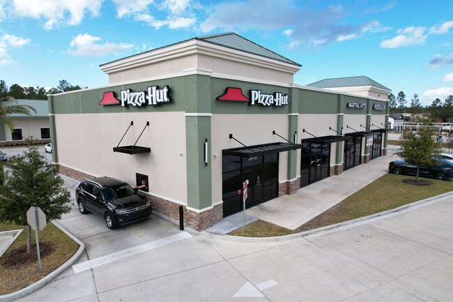
Oakleaf Plantation Pkwy
Jacksonville (Florida)
Armstrong Plat
Jacksonville, FL
Clay
07-04-25-007869-001-08
Florida
Residentialcommonelementscondominiumcorporation
2.11 AC
X
Orange Park/Clay County
12019C0065E
DEMOGRAPHICS near Oakleaf Plantation Pkwy
1 Mile
3 Mile
5 Mile
2024 Total Population
7,705
45,481
106,905
2029 Population
8,564
50,088
116,469
Pop Growth 2024-2029
+ 11.15%
+ 10.13%
+ 8.95%
Average Age
35
36
38
2024 Total Households
2,284
14,572
37,029
HH Growth 2024-2029
+ 11.30%
+ 10.23%
+ 8.97%
Median Household Inc
$107,528
$92,369
$84,103
Avg Household Size
3.30
3.10
2.80
2024 Avg HH Vehicles
2.00
2.00
2.00
Median Home Value
$341,267
$291,210
$252,572
Median Year Built
2010
2007
2001
Nearby Places
Map Layers
Map Styles
 Street
 Aerial
- Restaurants
- Banks
- Shops
- Fitness
- Groceries
PUBLIC TRANSPORTATION
AIRPORT
Jacksonville International
DRIVE
WALK
Distance
Jacksonville International
50 min
30.8 mi
Freight Ports
Jacksonville Port
DRIVE
WALK
Distance
Jacksonville Port
43 min
23.3 mi
SALE & LEASE HISTORY
LISTING DATE
SALE/LEASE

Jan 06, 2025
For Sale
Feb 12, 2024
For Sale
Nearby Properties
Address
Land Use
TOTAL SIZE
Lot Size
Zoning
Address
Land Use
TOTAL SIZE
Lot Size
Zoning
799,320 SF
150.55 AC
Address
Land Use
TOTAL SIZE
Lot Size
Zoning
365,663 SF
23.12 AC
PUD
Address
Land Use
TOTAL SIZE
Lot Size
Zoning
264,898 SF
17.50 AC
Address
Land Use
TOTAL SIZE
Lot Size
Zoning
242,778 SF
14.51 AC
PUD
Address
Land Use
TOTAL SIZE
Lot Size
Zoning
257,608 SF
27.17 AC
Address
Land Use
TOTAL SIZE
Lot Size
Zoning
150,882 SF
109.60 AC
Address
Land Use
TOTAL SIZE
Lot Size
Zoning
146,640 SF
3.90 AC
Address
Land Use
TOTAL SIZE
Lot Size
Zoning
146,640 SF
5.43 AC
Address
Land Use
TOTAL SIZE
Lot Size
Zoning
168,818 SF
17.64 AC
PUD
Address
Land Use
TOTAL SIZE
Lot Size
Zoning
133,592 SF
37.12 AC
Address
Land Use
TOTAL SIZE
Lot Size
Zoning
156,028 SF
10.58 AC
PUD
Address
Land Use
TOTAL SIZE
Lot Size
Zoning
132,912 SF
30.12 AC
Address
Land Use
TOTAL SIZE
Lot Size
Zoning
31,812 SF
8.80 AC
PUD
Address
Land Use
TOTAL SIZE
Lot Size
Zoning
117,736 SF
3.97 AC
Address
Land Use
TOTAL SIZE
Lot Size
Zoning
142,830 SF
5.46 AC
Address
Land Use
TOTAL SIZE
Lot Size
Zoning
67,490 SF
1.40 AC
Address
Land Use
TOTAL SIZE
Lot Size
Zoning
147,613 SF
15.68 AC
PUD
Address
Land Use
TOTAL SIZE
Lot Size
Zoning
159,296 SF
20.54 AC
PUD
Address
Land Use
TOTAL SIZE
Lot Size
Zoning
74,468 SF
14.47 AC
Address
Land Use
TOTAL SIZE
Lot Size
Zoning
187,550 SF
13.44 AC
PUD
Address
Land Use
TOTAL SIZE
Lot Size
Zoning
93,150 SF
4.82 AC
Address
Land Use
TOTAL SIZE
Lot Size
Zoning
81,842 SF
8.41 AC
PUD
Address
Land Use
TOTAL SIZE
Lot Size
Zoning
103,301 SF
2.94 AC
Address
Land Use
TOTAL SIZE
Lot Size
Zoning
101,582 SF
36.73 AC
Address
Land Use
TOTAL SIZE
Lot Size
Zoning
69,960 SF
15.36 AC
Address
Land Use
TOTAL SIZE
Lot Size
Zoning
102,959 SF
5.58 AC
PUD
Address
Land Use
TOTAL SIZE
Lot Size
Zoning
2,406 SF
48.93 AC
Address
Land Use
TOTAL SIZE
Lot Size
Zoning
56,264 SF
6.10 AC
PUD
Address
Land Use
TOTAL SIZE
Lot Size
Zoning
12,585 SF
20.16 AC
Address
Land Use
TOTAL SIZE
Lot Size
Zoning
138.86 AC
The World's #1 Commercial Real Estate Marketplace
Connect with us
© 2026 CoStar Group
The information above has been obtained from sources believed reliable. While we do not doubt its accuracy we have not verified it and make no guarantee, warranty or representation about it. It is your responsibility to independently confirm its accuracy and completeness. Any projections, opinions, assumptions, or estimates used are for example only and do not represent the current or future performance of the property. The value of this transaction to you depends on tax and other factors which should be evaluated by your tax, financial, and legal advisors. You and your advisors should conduct a careful, independent investigation of the property to determine to your satisfaction the suitability of the property for your needs.