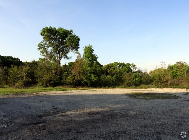
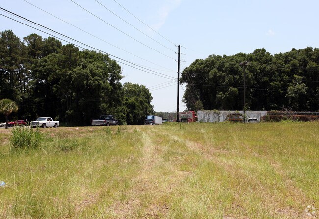
Property Record
3462 Trask Pky, Beaufort, SC 29906

NEARBY LISTINGS FOR SALE OR LEASE
Property Detail
3462 Trask Pky
Hilton Head Island-Bluffton-Port Royal, SC
Us Hwy 21 N. Commercial Corrid
R120-025-000-0012-0000
PARKER'S SPLIT 11/87 .2AC 25/12C 4/12 0.10 AC DEDUCTED TO R/W (25000) DB3079 P
Servicestationmarket
Beaufort
2025
South Carolina
2024
2.60 AC
000501
Hilton Head/Beaufort
4,374 SF
Other Market Areas
DEMOGRAPHICS near 3462 Trask Pky
1 Mile
3 Mile
5 Mile
2024 Total Population
854
13,924
41,118
2029 Population
928
15,206
45,373
Pop Growth 2024-2029
+ 8.67%
+ 9.21%
+ 10.35%
Average Age
35
36
38
2024 Total Households
304
4,648
15,682
HH Growth 2024-2029
+ 8.22%
+ 10.05%
+ 10.36%
Median Household Inc
$43,624
$47,658
$57,329
Avg Household Size
2.70
2.50
2.40
2024 Avg HH Vehicles
2.00
2.00
2.00
Median Home Value
$124,305
$209,158
$257,892
Median Year Built
1984
1991
1991
Nearby Places
Map Layers
Map Styles
 Street
 Aerial
- Restaurants
- Banks
- Shops
- Fitness
- Groceries
PUBLIC TRANSPORTATION
AIRPORT
Hilton Head
DRIVE
WALK
Distance
Hilton Head
48 min
37.0 mi
Freight Ports
Georgia Ports - Savannah
DRIVE
WALK
Distance
Georgia Ports - Savannah
58 min
46.4 mi
Nearby Properties
Address
Land Use
TOTAL SIZE
Lot Size
Zoning
Address
Land Use
TOTAL SIZE
Lot Size
Zoning
4,613 AC
6601
Address
Land Use
TOTAL SIZE
Lot Size
Zoning
24,000 SF
4.45 AC
6601
Address
Land Use
TOTAL SIZE
Lot Size
Zoning
23,136 SF
9.67 AC
6101
Address
Land Use
TOTAL SIZE
Lot Size
Zoning
217,792 SF
60 AC
6611
Address
Land Use
TOTAL SIZE
Lot Size
Zoning
85,656 SF
22.54 AC
6611
Address
Land Use
TOTAL SIZE
Lot Size
Zoning
39,296 SF
2.05 AC
6611
Address
Land Use
TOTAL SIZE
Lot Size
Zoning
34,200 SF
4.18 AC
6601
Address
Land Use
TOTAL SIZE
Lot Size
Zoning
142,753 SF
47.79 AC
6611
Address
Land Use
TOTAL SIZE
Lot Size
Zoning
214,795 SF
24.94 AC
6611
Address
Land Use
TOTAL SIZE
Lot Size
Zoning
60,814 SF
3 AC
Address
Land Use
TOTAL SIZE
Lot Size
Zoning
2,760 SF
4.16 AC
6611
Address
Land Use
TOTAL SIZE
Lot Size
Zoning
92,125 SF
10.14 AC
6611
Address
Land Use
TOTAL SIZE
Lot Size
Zoning
134,446 SF
19.90 AC
6611
Address
Land Use
TOTAL SIZE
Lot Size
Zoning
53,684 SF
24.30 AC
6611
Address
Land Use
TOTAL SIZE
Lot Size
Zoning
71,309 SF
2.30 AC
6601
Address
Land Use
TOTAL SIZE
Lot Size
Zoning
44,312 SF
1.87 AC
Address
Land Use
TOTAL SIZE
Lot Size
Zoning
52,322 SF
6.86 AC
6601
Address
Land Use
TOTAL SIZE
Lot Size
Zoning
20,800 SF
12.55 AC
6611
Address
Land Use
TOTAL SIZE
Lot Size
Zoning
64,000 SF
5.92 AC
Address
Land Use
TOTAL SIZE
Lot Size
Zoning
32,035 SF
7.39 AC
4201
Address
Land Use
TOTAL SIZE
Lot Size
Zoning
192 SF
368 AC
6111
Address
Land Use
TOTAL SIZE
Lot Size
Zoning
73,938 SF
20.18 AC
4201
Address
Land Use
TOTAL SIZE
Lot Size
Zoning
85,127 SF
35.70 AC
6611
Address
Land Use
TOTAL SIZE
Lot Size
Zoning
17,432 SF
7.15 AC
6611
Address
Land Use
TOTAL SIZE
Lot Size
Zoning
94,533 SF
9.64 AC
6611
Address
Land Use
TOTAL SIZE
Lot Size
Zoning
5,990 SF
2 AC
Address
Land Use
TOTAL SIZE
Lot Size
Zoning
25,151 SF
6.41 AC
6601
Address
Land Use
TOTAL SIZE
Lot Size
Zoning
128,522 SF
7.32 AC
6611
Address
Land Use
TOTAL SIZE
Lot Size
Zoning
39,458 SF
2.13 AC
6611
The World's #1 Commercial Real Estate Marketplace
Connect with us
© 2026 CoStar Group
The information above has been obtained from sources believed reliable. While we do not doubt its accuracy we have not verified it and make no guarantee, warranty or representation about it. It is your responsibility to independently confirm its accuracy and completeness. Any projections, opinions, assumptions, or estimates used are for example only and do not represent the current or future performance of the property. The value of this transaction to you depends on tax and other factors which should be evaluated by your tax, financial, and legal advisors. You and your advisors should conduct a careful, independent investigation of the property to determine to your satisfaction the suitability of the property for your needs.