Property Record
3465 L St, Omaha, NE 68107

NEARBY LISTINGS FOR SALE OR LEASE
Property Detail
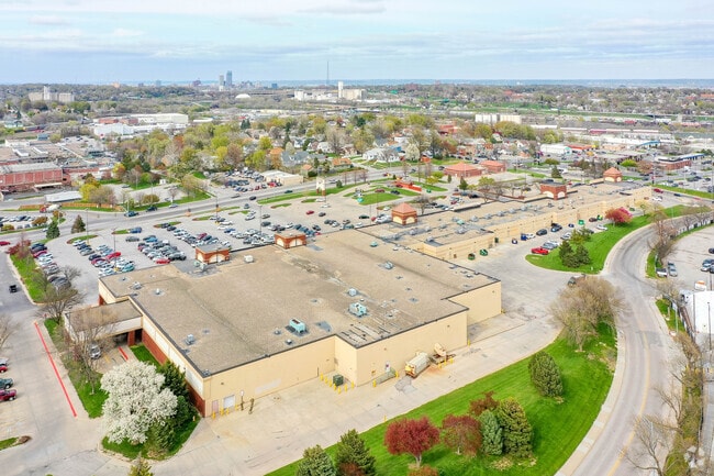
3465 L St
Omaha-Council Bluffs, NE-IA
Stockyards Plaza
4699-5122-22
STOCKYARDS PLAZA REPLAT ONE LOT 1 BLOCK 0 LOT 1 5.19 AC
Restaurantbuilding
Douglas
X
Nebraska
31153C0080G
1
2024
0.97 AC
2025
Southeast Omaha
003100
Omaha/Council Bluffs
566 SF
DEMOGRAPHICS near 3465 L St
1 Mile
3 Mile
5 Mile
2024 Total Population
13,658
100,224
245,715
2029 Population
13,746
102,278
253,181
Pop Growth 2024-2029
+ 0.64%
+ 2.05%
+ 3.04%
Average Age
34
36
37
2024 Total Households
4,408
36,260
98,816
HH Growth 2024-2029
+ 0.66%
+ 2.15%
+ 3.18%
Median Household Inc
$43,497
$53,962
$58,352
Avg Household Size
3.00
2.60
2.30
2024 Avg HH Vehicles
2.00
2.00
2.00
Median Home Value
$136,510
$153,969
$186,878
Median Year Built
1948
1953
1963
Nearby Places
Map Layers
Map Styles
 Street
 Aerial
- Restaurants
- Banks
- Shops
- Fitness
- Groceries
PUBLIC TRANSPORTATION
COMMUTER RAIL
DRIVE
WALK
Distance
9 min
4.8 mi
DRIVE
WALK
Distance
9 min
5.0 mi
AIRPORT
Eppley Airfield
DRIVE
WALK
Distance
Eppley Airfield
17 min
8.8 mi
SALE & LEASE HISTORY
LISTING DATE
SALE/LEASE

Sep 25, 2016
For Lease
Aug 09, 2023
For Lease
Nearby Properties
Address
Land Use
TOTAL SIZE
Lot Size
Zoning
Address
Land Use
TOTAL SIZE
Lot Size
Zoning
389,488 SF
4.30 AC
Address
Land Use
TOTAL SIZE
Lot Size
Zoning
198,447 SF
1.36 AC
Address
Land Use
TOTAL SIZE
Lot Size
Zoning
97,617 SF
49.05 AC
Address
Land Use
TOTAL SIZE
Lot Size
Zoning
215,353 SF
1.77 AC
Address
Land Use
TOTAL SIZE
Lot Size
Zoning
247,802 SF
0.98 AC
Address
Land Use
TOTAL SIZE
Lot Size
Zoning
185,179 SF
2.64 AC
Address
Land Use
TOTAL SIZE
Lot Size
Zoning
225,975 SF
1.31 AC
Address
Land Use
TOTAL SIZE
Lot Size
Zoning
193,967 SF
7.27 AC
Address
Land Use
TOTAL SIZE
Lot Size
Zoning
236,067 SF
10.12 AC
HI
Address
Land Use
TOTAL SIZE
Lot Size
Zoning
33,713 SF
14.39 AC
Address
Land Use
TOTAL SIZE
Lot Size
Zoning
4.53 AC
Address
Land Use
TOTAL SIZE
Lot Size
Zoning
270,446 SF
13.68 AC
R7
Address
Land Use
TOTAL SIZE
Lot Size
Zoning
126,910 SF
13.49 AC
Address
Land Use
TOTAL SIZE
Lot Size
Zoning
257,234 SF
17.88 AC
Address
Land Use
TOTAL SIZE
Lot Size
Zoning
173,616 SF
9.30 AC
Address
Land Use
TOTAL SIZE
Lot Size
Zoning
178,600 SF
8.27 AC
R6PUD
Address
Land Use
TOTAL SIZE
Lot Size
Zoning
230,995 SF
11.29 AC
HI
Address
Land Use
TOTAL SIZE
Lot Size
Zoning
252,694 SF
17.74 AC
HI
Address
Land Use
TOTAL SIZE
Lot Size
Zoning
177,858 SF
9.67 AC
R6
Address
Land Use
TOTAL SIZE
Lot Size
Zoning
148,963 SF
9.80 AC
Address
Land Use
TOTAL SIZE
Lot Size
Zoning
116,718 SF
8.28 AC
Address
Land Use
TOTAL SIZE
Lot Size
Zoning
161,765 SF
18.32 AC
Address
Land Use
TOTAL SIZE
Lot Size
Zoning
110,084 SF
14.59 AC
GI
Address
Land Use
TOTAL SIZE
Lot Size
Zoning
87,244 SF
1.15 AC
GI
Address
Land Use
TOTAL SIZE
Lot Size
Zoning
38,595 SF
2.07 AC
Address
Land Use
TOTAL SIZE
Lot Size
Zoning
85,320 SF
6.60 AC
HI
Address
Land Use
TOTAL SIZE
Lot Size
Zoning
81,172 SF
4 AC
Address
Land Use
TOTAL SIZE
Lot Size
Zoning
1,768 SF
14.80 AC
Address
Land Use
TOTAL SIZE
Lot Size
Zoning
100,350 SF
4.77 AC
CC
Address
Land Use
TOTAL SIZE
Lot Size
Zoning
63,354 SF
1.74 AC
The World's #1 Commercial Real Estate Marketplace
Connect with us
© 2025 CoStar Group
The information above has been obtained from sources believed reliable. While we do not doubt its accuracy we have not verified it and make no guarantee, warranty or representation about it. It is your responsibility to independently confirm its accuracy and completeness. Any projections, opinions, assumptions, or estimates used are for example only and do not represent the current or future performance of the property. The value of this transaction to you depends on tax and other factors which should be evaluated by your tax, financial, and legal advisors. You and your advisors should conduct a careful, independent investigation of the property to determine to your satisfaction the suitability of the property for your needs.