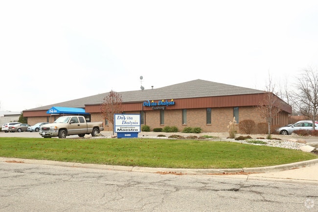
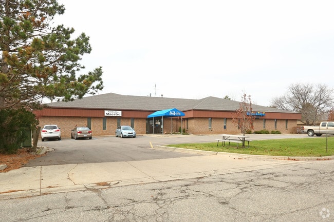
Property Record
3469 Pierson Pl, Flushing, MI 48433

Property Detail
3469 Pierson Pl
Flint, MI
LOTS 14, 15 & 16 PIERSON COMMERCIAL PARK EXCEPT ALL THAT PART OF LOTS 15 & 16 LYING N OF FOLLOWING DESCR LINE BEG N 0 DEG 31
14-32-503-014
Genesee
Commercialnec
Michigan
B and X Area of moderate flood hazard, usually the area between the limits of the 100-year and 500-year floods.
14-16
2024
0.89 AC
2025
Flint
010502
Detroit
NEARBY LISTINGS FOR SALE OR LEASE
DEMOGRAPHICS near 3469 Pierson Pl
1 mile
3 mile
5 mile
2025 Total Population
2,242
27,750
96,181
2030 Population
2,191
27,501
96,892
Pop Growth 2025-2030
(2.27%)
(0.90%)
+ 0.74%
Average Age
42
42
41
2025 Total Households
1,027
11,425
39,670
HH Growth 2025-2030
(2.24%)
(0.86%)
+ 0.76%
Median Household Inc
$52,897
$57,264
$49,580
Avg Household Size
2.10
2.30
2.30
2025 Avg HH Vehicles
2.00
2.00
2.00
Median Home Value
$153,685
$166,415
$108,740
Median Year Built
1974
1968
1962
Nearby Places
Map Layers
Map Styles
 Street
 Aerial
Layers
 Traffic
 Biking
Places
Listings with unknown addresses are not visible on the map
- Restaurants
- Banks
- Shops
- Fitness
- Groceries
PUBLIC TRANSPORTATION
AIRPORT
Bishop International
Drive
Walk
Distance
Bishop International
25 min
11.4 mi
MBS International
Drive
Walk
Distance
MBS International
61 min
46.8 mi
Nearby Properties
Address
Land Use
TOTAL SIZE
Lot Size
Zoning
Address
Land Use
TOTAL SIZE
Lot Size
Zoning
571,389 SF
584 AC
Address
Land Use
TOTAL SIZE
Lot Size
Zoning
72,367 SF
10.60 AC
R3-B (HDR)
Address
Land Use
TOTAL SIZE
Lot Size
Zoning
157,068 SF
160 AC
Address
Land Use
TOTAL SIZE
Lot Size
Zoning
11.97 AC
Address
Land Use
TOTAL SIZE
Lot Size
Zoning
10.30 AC
Address
Land Use
TOTAL SIZE
Lot Size
Zoning
41,298 SF
9.49 AC
Address
Land Use
TOTAL SIZE
Lot Size
Zoning
Address
Land Use
TOTAL SIZE
Lot Size
Zoning
59,173 SF
11.43 AC
Address
Land Use
TOTAL SIZE
Lot Size
Zoning
224,263 SF
24.98 AC
CC
Address
Land Use
TOTAL SIZE
Lot Size
Zoning
11.12 AC
Address
Land Use
TOTAL SIZE
Lot Size
Zoning
101,744 SF
4.90 AC
TN-2
Address
Land Use
TOTAL SIZE
Lot Size
Zoning
33.39 AC
Address
Land Use
TOTAL SIZE
Lot Size
Zoning
9.46 AC
Address
Land Use
TOTAL SIZE
Lot Size
Zoning
13.20 AC
Address
Land Use
TOTAL SIZE
Lot Size
Zoning
Address
Land Use
TOTAL SIZE
Lot Size
Zoning
2.45 AC
Address
Land Use
TOTAL SIZE
Lot Size
Zoning
5.10 AC
Address
Land Use
TOTAL SIZE
Lot Size
Zoning
62,121 SF
6.23 AC
B-2 CC GEN
Address
Land Use
TOTAL SIZE
Lot Size
Zoning
45,370 SF
12.58 AC
Address
Land Use
TOTAL SIZE
Lot Size
Zoning
104.81 AC
Address
Land Use
TOTAL SIZE
Lot Size
Zoning
Address
Land Use
TOTAL SIZE
Lot Size
Zoning
5.70 AC
Address
Land Use
TOTAL SIZE
Lot Size
Zoning
2.02 AC
Address
Land Use
TOTAL SIZE
Lot Size
Zoning
1.41 AC
Address
Land Use
TOTAL SIZE
Lot Size
Zoning
19.75 AC
Address
Land Use
TOTAL SIZE
Lot Size
Zoning
3.32 AC
Address
Land Use
TOTAL SIZE
Lot Size
Zoning
100,022 SF
92 AC
Address
Land Use
TOTAL SIZE
Lot Size
Zoning
22,669 SF
6.89 AC
Address
Land Use
TOTAL SIZE
Lot Size
Zoning
21,763 SF
4.36 AC
B-2 CC GEN
Address
Land Use
TOTAL SIZE
Lot Size
Zoning
31,008 SF
6.14 AC
R3-B (HDR)
The World's #1 Commercial Real Estate Marketplace
Connect with us
© 2026 CoStar Group
The information above has been obtained from sources believed reliable. While we do not doubt its accuracy we have not verified it and make no guarantee, warranty or representation about it. It is your responsibility to independently confirm its accuracy and completeness. Any projections, opinions, assumptions, or estimates used are for example only and do not represent the current or future performance of the property. The value of this transaction to you depends on tax and other factors which should be evaluated by your tax, financial, and legal advisors. You and your advisors should conduct a careful, independent investigation of the property to determine to your satisfaction the suitability of the property for your needs.