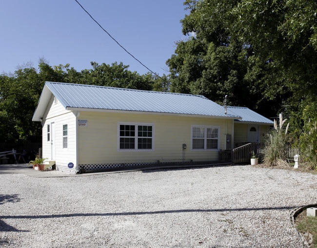
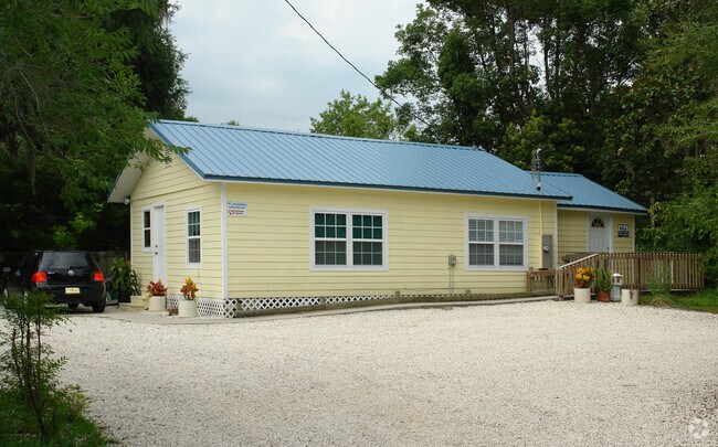
Property Record
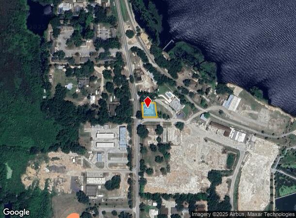
347 12Th St, Clermont, FL 34711
NEARBY LISTINGS FOR SALE OR LEASE
Property Detail
347 12Th St
Orlando-Kissimmee-Sanford, FL
Johnsons Replat
23-22-25-0400-118-00100
CLERMONT JOHNSONS REPLAT W 93 FT OF LOTS 1 2 BLK 118 PB 8 PB 71 ORB 4289 PG 401
Medicalbuilding
Lake
X
Florida
12069C0570E
1
2024
0.22 AC
2026
Lake County
031309
Orlando
929 SF
DEMOGRAPHICS near 347 12Th St
1 Mile
3 Mile
5 Mile
2024 Total Population
3,626
35,125
92,629
2029 Population
4,244
40,959
108,295
Pop Growth 2024-2029
+ 17.04%
+ 16.61%
+ 16.91%
Average Age
41
40
41
2024 Total Households
1,453
12,959
33,667
HH Growth 2024-2029
+ 16.79%
+ 16.31%
+ 16.68%
Median Household Inc
$72,972
$77,656
$81,702
Avg Household Size
2.50
2.70
2.70
2024 Avg HH Vehicles
2.00
2.00
2.00
Median Home Value
$316,357
$293,004
$318,304
Median Year Built
1988
2000
2003
Nearby Places
Map Layers
Map Styles
 Street
 Aerial
- Restaurants
- Banks
- Shops
- Fitness
- Groceries
PUBLIC TRANSPORTATION
AIRPORT
Orlando International
DRIVE
WALK
Distance
Orlando International
49 min
35.0 mi
Nearby Properties
Address
Land Use
TOTAL SIZE
Lot Size
Zoning
Address
Land Use
TOTAL SIZE
Lot Size
Zoning
403,970 SF
30.99 AC
PUD
Address
Land Use
TOTAL SIZE
Lot Size
Zoning
269,594 SF
25.23 AC
PUD
Address
Land Use
TOTAL SIZE
Lot Size
Zoning
179,290 SF
23.79 AC
Address
Land Use
TOTAL SIZE
Lot Size
Zoning
204,472 SF
43.52 AC
Address
Land Use
TOTAL SIZE
Lot Size
Zoning
Address
Land Use
TOTAL SIZE
Lot Size
Zoning
142,824 SF
9.90 AC
C2
Address
Land Use
TOTAL SIZE
Lot Size
Zoning
203,762 SF
18.28 AC
R1
Address
Land Use
TOTAL SIZE
Lot Size
Zoning
95,182 SF
12.34 AC
PUD
Address
Land Use
TOTAL SIZE
Lot Size
Zoning
158,351 SF
19.10 AC
C2
Address
Land Use
TOTAL SIZE
Lot Size
Zoning
80,774 SF
6.61 AC
Address
Land Use
TOTAL SIZE
Lot Size
Zoning
80,546 SF
6.75 AC
B1
Address
Land Use
TOTAL SIZE
Lot Size
Zoning
74,375 SF
6.69 AC
Address
Land Use
TOTAL SIZE
Lot Size
Zoning
99,348 SF
34.10 AC
R1A
Address
Land Use
TOTAL SIZE
Lot Size
Zoning
66,526 SF
8.98 AC
C1
Address
Land Use
TOTAL SIZE
Lot Size
Zoning
2,000 SF
55.61 AC
CFD
Address
Land Use
TOTAL SIZE
Lot Size
Zoning
123,387 SF
47.51 AC
R3
Address
Land Use
TOTAL SIZE
Lot Size
Zoning
41,006 SF
8.43 AC
A
Address
Land Use
TOTAL SIZE
Lot Size
Zoning
30,926 SF
0.38 AC
Address
Land Use
TOTAL SIZE
Lot Size
Zoning
81,188 SF
7.70 AC
C2
Address
Land Use
TOTAL SIZE
Lot Size
Zoning
59,648 SF
8.86 AC
R6
Address
Land Use
TOTAL SIZE
Lot Size
Zoning
73,040 SF
4.89 AC
I1
Address
Land Use
TOTAL SIZE
Lot Size
Zoning
104,532 SF
8.35 AC
Address
Land Use
TOTAL SIZE
Lot Size
Zoning
47,210 SF
3.75 AC
M1
Address
Land Use
TOTAL SIZE
Lot Size
Zoning
40,798 SF
7.51 AC
P
Address
Land Use
TOTAL SIZE
Lot Size
Zoning
52,788 SF
3.21 AC
R2
Address
Land Use
TOTAL SIZE
Lot Size
Zoning
95,176 SF
11.02 AC
PUD
Address
Land Use
TOTAL SIZE
Lot Size
Zoning
102,584 SF
9.21 AC
R3
Address
Land Use
TOTAL SIZE
Lot Size
Zoning
24,910 SF
3.44 AC
CBD
Address
Land Use
TOTAL SIZE
Lot Size
Zoning
29,892 SF
2.46 AC
R3
Address
Land Use
TOTAL SIZE
Lot Size
Zoning
44,277 SF
3.44 AC
C2
The World's #1 Commercial Real Estate Marketplace
Connect with us
© 2025 CoStar Group
The information above has been obtained from sources believed reliable. While we do not doubt its accuracy we have not verified it and make no guarantee, warranty or representation about it. It is your responsibility to independently confirm its accuracy and completeness. Any projections, opinions, assumptions, or estimates used are for example only and do not represent the current or future performance of the property. The value of this transaction to you depends on tax and other factors which should be evaluated by your tax, financial, and legal advisors. You and your advisors should conduct a careful, independent investigation of the property to determine to your satisfaction the suitability of the property for your needs.