Property Record
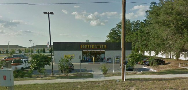
3474 E State Road 60 Hwy, Valrico, FL 33594


Save to a Folder
{{folder.Name}}
{{folder.ListingIds.length}} Properties
{{folder.ListingIds.length}} Property
Create a New Folder
Property Detail
3474 E State Road 60 Hwy
U-20-29-21-92M-000000-K0000.0
KINGS MILL COMMERCIAL LOT K
Storemultistory
HILLSBOROUGH
PD
Florida
B and X Area of moderate flood hazard, usually the area between the limits of the 100-year and 500-year floods.
k
2024
1.16 AC
2025
Eastern Outlying
013203
Tampa/St Petersburg
9,012 SF
Tampa-St. Petersburg-Clearwater, FL
NEARBY LISTINGS FOR SALE OR LEASE
DEMOGRAPHICS near 3474 E State Road 60 Hwy
1 mile
3 mile
5 mile
2025 Total Population
9,657
55,887
137,758
2030 Population
10,301
59,808
147,371
Pop Growth 2025-2030
+ 6.67%
+ 7.02%
+ 6.98%
Average Age
42
41
41
2025 Total Households
3,930
20,042
48,855
HH Growth 2025-2030
+ 6.84%
+ 7.16%
+ 7.11%
Median Household Inc
$83,186
$95,216
$91,738
Avg Household Size
2.40
2.70
2.70
2025 Avg HH Vehicles
2.00
2.00
2.00
Median Home Value
$333,789
$407,103
$392,784
Median Year Built
1998
1994
1990
Nearby Places
Map Layers
Map Styles
 Street
 Aerial
Layers
 Traffic
 Biking
Places
Listings with unknown addresses are not visible on the map
- Restaurants
- Banks
- Shops
- Fitness
- Groceries
PUBLIC TRANSPORTATION
AIRPORT
Tampa International
Drive
Walk
Distance
Tampa International
37 min
22.9 mi
St Pete-Clearwater International
Drive
Walk
Distance
St Pete-Clearwater International
55 min
32.9 mi
Nearby Properties
Address
Land Use
TOTAL SIZE
Lot Size
Zoning
Address
Land Use
TOTAL SIZE
Lot Size
Zoning
88,895 SF
587.01 AC
AR
Address
Land Use
TOTAL SIZE
Lot Size
Zoning
185,184 SF
9.65 AC
PD
Address
Land Use
TOTAL SIZE
Lot Size
Zoning
134,594 SF
13.22 AC
PD
Address
Land Use
TOTAL SIZE
Lot Size
Zoning
140,058 SF
8.71 AC
RMC-20
Address
Land Use
TOTAL SIZE
Lot Size
Zoning
156,266 SF
9.27 AC
PD
Address
Land Use
TOTAL SIZE
Lot Size
Zoning
361,657 SF
24.15 AC
PD
Address
Land Use
TOTAL SIZE
Lot Size
Zoning
124,207 SF
28.64 AC
RSC-6
Address
Land Use
TOTAL SIZE
Lot Size
Zoning
209,392 SF
27.16 AC
PD
Address
Land Use
TOTAL SIZE
Lot Size
Zoning
107,525 SF
2.84 AC
PD
Address
Land Use
TOTAL SIZE
Lot Size
Zoning
147,527 SF
9.25 AC
PD
Address
Land Use
TOTAL SIZE
Lot Size
Zoning
85,972 SF
10.49 AC
PD
Address
Land Use
TOTAL SIZE
Lot Size
Zoning
90,441 SF
20.39 AC
AS-1
Address
Land Use
TOTAL SIZE
Lot Size
Zoning
113,930 SF
19.85 AC
ASC-1
Address
Land Use
TOTAL SIZE
Lot Size
Zoning
135,456 SF
18.76 AC
PD
Address
Land Use
TOTAL SIZE
Lot Size
Zoning
68,000 SF
5.21 AC
PD
Address
Land Use
TOTAL SIZE
Lot Size
Zoning
59,406 SF
11.04 AC
CG
Address
Land Use
TOTAL SIZE
Lot Size
Zoning
108,934 SF
12.40 AC
PD
Address
Land Use
TOTAL SIZE
Lot Size
Zoning
104,890 SF
15.03 AC
ASC-1
Address
Land Use
TOTAL SIZE
Lot Size
Zoning
76,776 SF
3.64 AC
PD
Address
Land Use
TOTAL SIZE
Lot Size
Zoning
52,448 SF
9.37 AC
PD
Address
Land Use
TOTAL SIZE
Lot Size
Zoning
1,512 SF
567.66 AC
AR
Address
Land Use
TOTAL SIZE
Lot Size
Zoning
64,308 SF
8.39 AC
PD
Address
Land Use
TOTAL SIZE
Lot Size
Zoning
101,118 SF
8.90 AC
PD
Address
Land Use
TOTAL SIZE
Lot Size
Zoning
20,501 SF
9.05 AC
PD
Address
Land Use
TOTAL SIZE
Lot Size
Zoning
61,404 SF
20.34 AC
AS-1
Address
Land Use
TOTAL SIZE
Lot Size
Zoning
22,336 SF
3.56 AC
ASC-1
Address
Land Use
TOTAL SIZE
Lot Size
Zoning
20,223 SF
2.09 AC
PD
Address
Land Use
TOTAL SIZE
Lot Size
Zoning
33,637 SF
3.28 AC
CG
Address
Land Use
TOTAL SIZE
Lot Size
Zoning
61,298 SF
4.66 AC
RMC-9
Address
Land Use
TOTAL SIZE
Lot Size
Zoning
20,050 SF
2.70 AC
PD
The World's #1 Commercial Real Estate Marketplace
Connect with us
© 2026 CoStar Group
The information above has been obtained from sources believed reliable. While we do not doubt its accuracy we have not verified it and make no guarantee, warranty or representation about it. It is your responsibility to independently confirm its accuracy and completeness. Any projections, opinions, assumptions, or estimates used are for example only and do not represent the current or future performance of the property. The value of this transaction to you depends on tax and other factors which should be evaluated by your tax, financial, and legal advisors. You and your advisors should conduct a careful, independent investigation of the property to determine to your satisfaction the suitability of the property for your needs.