Property Record
348 N Flag Chapel Rd, Jackson, MS 39209
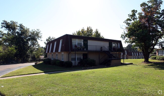
Property Detail
348 N Flag Chapel Rd
Jackson, MS
BEG SW COR LOT 6 WESTWICK SUBN PT 2 E 120 FT N 439.10 FT SELY 892.91 FT S 266.55 FT W 725.27 FT TO E/L FLAG CHAPEL RD N 60 FT E 120 FT N 365 FT W 120 FT N 50 FT TO POB IN SE 1/4 SE 1/4 SEC 23 & NE 1/4 NE 1/4 SEC 26 T6 R1W
0809-0211-000
Hinds
Apartment
Mississippi
B and X Area of moderate flood hazard, usually the area between the limits of the 100-year and 500-year floods.
6
2024
8.54 AC
2025
West Jackson
000700
Jackson
103,814 SF
NEARBY LISTINGS FOR SALE OR LEASE
-
-
View all Jackson listings for sale on LoopNet.com
DEMOGRAPHICS near 348 N Flag Chapel Rd
1 mile
3 mile
5 mile
2025 Total Population
4,933
30,727
88,499
2030 Population
4,672
29,615
86,227
Pop Growth 2025-2030
(5.29%)
(3.62%)
(2.57%)
Average Age
39
39
39
2025 Total Households
1,949
12,488
35,658
HH Growth 2025-2030
(5.75%)
(3.91%)
(2.62%)
Median Household Inc
$42,833
$42,472
$40,741
Avg Household Size
2.40
2.30
2.30
2025 Avg HH Vehicles
2.00
2.00
2.00
Median Home Value
$74,160
$95,459
$98,659
Median Year Built
1967
1971
1970
Nearby Places
Map Layers
Map Styles
 Street
 Aerial
Transit
 Traffic
 Biking
Places
Listings with unknown addresses are not visible on the map
- Restaurants
- Banks
- Shops
- Fitness
- Groceries
PUBLIC TRANSPORTATION
COMMUTER RAIL
Jackson (City of New Orleans - Amtrak)
Drive
Walk
Distance
Jackson (City of New Orleans - Amtrak)
10 min
5.6 mi
AIRPORT
Jackson-Medgar Wiley Evers International
Drive
Walk
Distance
Jackson-Medgar Wiley Evers International
28 min
18.2 mi
Freight Ports
Port of Greater Baton Rouge
Drive
Walk
Distance
Port of Greater Baton Rouge
203 min
180.5 mi
Nearby Properties
Address
Land Use
TOTAL SIZE
Lot Size
Zoning
Address
Land Use
TOTAL SIZE
Lot Size
Zoning
10,100 SF
548 AC
Address
Land Use
TOTAL SIZE
Lot Size
Zoning
126,628 SF
6.74 AC
Address
Land Use
TOTAL SIZE
Lot Size
Zoning
41,616 SF
176,418.04 AC
Address
Land Use
TOTAL SIZE
Lot Size
Zoning
37,293 SF
10 AC
Address
Land Use
TOTAL SIZE
Lot Size
Zoning
Address
Land Use
TOTAL SIZE
Lot Size
Zoning
108,979 SF
5 AC
Address
Land Use
TOTAL SIZE
Lot Size
Zoning
188,317 SF
23 AC
Address
Land Use
TOTAL SIZE
Lot Size
Zoning
132,342 SF
4 AC
Address
Land Use
TOTAL SIZE
Lot Size
Zoning
50,314 SF
115 AC
Address
Land Use
TOTAL SIZE
Lot Size
Zoning
Address
Land Use
TOTAL SIZE
Lot Size
Zoning
171,950 SF
9 AC
Address
Land Use
TOTAL SIZE
Lot Size
Zoning
148,263 SF
11.26 AC
Address
Land Use
TOTAL SIZE
Lot Size
Zoning
242,035 SF
15.80 AC
Address
Land Use
TOTAL SIZE
Lot Size
Zoning
253,477 SF
23 AC
Address
Land Use
TOTAL SIZE
Lot Size
Zoning
39,928 SF
1 AC
Address
Land Use
TOTAL SIZE
Lot Size
Zoning
0.03 AC
Address
Land Use
TOTAL SIZE
Lot Size
Zoning
226,835 SF
21 AC
Address
Land Use
TOTAL SIZE
Lot Size
Zoning
106,127 SF
8.27 AC
Address
Land Use
TOTAL SIZE
Lot Size
Zoning
582,942 SF
31.22 AC
Address
Land Use
TOTAL SIZE
Lot Size
Zoning
8,610 SF
2 AC
Address
Land Use
TOTAL SIZE
Lot Size
Zoning
108,570 SF
8 AC
Address
Land Use
TOTAL SIZE
Lot Size
Zoning
357,468 SF
15 AC
Address
Land Use
TOTAL SIZE
Lot Size
Zoning
1,550 SF
19.71 AC
Address
Land Use
TOTAL SIZE
Lot Size
Zoning
96,372 SF
9.19 AC
Address
Land Use
TOTAL SIZE
Lot Size
Zoning
98,531 SF
348,480.26 AC
Address
Land Use
TOTAL SIZE
Lot Size
Zoning
127,296 SF
3.78 AC
Address
Land Use
TOTAL SIZE
Lot Size
Zoning
33,519 SF
5.94 AC
Address
Land Use
TOTAL SIZE
Lot Size
Zoning
56,960 SF
0.76 AC
Address
Land Use
TOTAL SIZE
Lot Size
Zoning
138,902 SF
8 AC
Address
Land Use
TOTAL SIZE
Lot Size
Zoning
92,260 SF
9.60 AC
The World's #1 Commercial Real Estate Marketplace
Connect with us
© 2026 CoStar Group
The information above has been obtained from sources believed reliable. While we do not doubt its accuracy we have not verified it and make no guarantee, warranty or representation about it. It is your responsibility to independently confirm its accuracy and completeness. Any projections, opinions, assumptions, or estimates used are for example only and do not represent the current or future performance of the property. The value of this transaction to you depends on tax and other factors which should be evaluated by your tax, financial, and legal advisors. You and your advisors should conduct a careful, independent investigation of the property to determine to your satisfaction the suitability of the property for your needs.