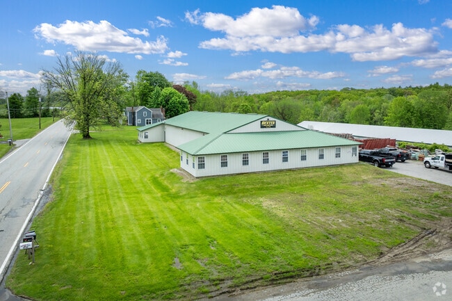
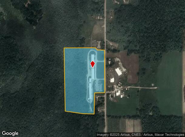
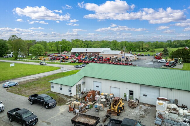
Property Record
348 Orchard Hill Rd, Pomfret Center, CT 06259
NEARBY LISTINGS FOR SALE OR LEASE
Property Detail
348 Orchard Hill Rd
POMF-000041-B000000-000003
Windham
Commercialnec
Connecticut
A
3.00
09015C0230F
20.18 AC
2025
Windham County
2025
Hartford
902500
Worcester, MA-CT
2,000 SF
DEMOGRAPHICS near 348 Orchard Hill Rd
1 Mile
3 Mile
5 Mile
2024 Total Population
255
3,833
21,891
2029 Population
253
3,776
21,859
Pop Growth 2024-2029
(0.78%)
(1.49%)
(0.15%)
Average Age
43
42
42
2024 Total Households
98
1,440
8,634
HH Growth 2024-2029
(1.02%)
(1.67%)
(0.15%)
Median Household Inc
$84,868
$82,054
$73,663
Avg Household Size
2.60
2.50
2.40
2024 Avg HH Vehicles
2.00
2.00
2.00
Median Home Value
$327,272
$288,760
$255,034
Median Year Built
1978
1976
1969
Nearby Places
Map Layers
Map Styles
 Street
 Aerial
- Restaurants
- Banks
- Shops
- Fitness
- Groceries
PUBLIC TRANSPORTATION
AIRPORT
Rhode Island Tf Green International
DRIVE
WALK
Distance
Rhode Island Tf Green International
54 min
38.8 mi
Freight Ports
Port of Davisville, RI
DRIVE
WALK
Distance
Port of Davisville, RI
65 min
48.0 mi
SALE & LEASE HISTORY
LISTING DATE
SALE/LEASE

Nov 13, 2024
For Lease
Nearby Properties
Address
Land Use
TOTAL SIZE
Lot Size
Zoning
Address
Land Use
TOTAL SIZE
Lot Size
Zoning
65,888 SF
9.40 AC
RR
Address
Land Use
TOTAL SIZE
Lot Size
Zoning
25.60 AC
PSR
Address
Land Use
TOTAL SIZE
Lot Size
Zoning
45.60 AC
RR
Address
Land Use
TOTAL SIZE
Lot Size
Zoning
27.10 AC
BV/CB
Address
Land Use
TOTAL SIZE
Lot Size
Zoning
8.63 AC
MD
Address
Land Use
TOTAL SIZE
Lot Size
Zoning
31 AC
RA
Address
Land Use
TOTAL SIZE
Lot Size
Zoning
18,073 SF
5.10 AC
PSR
Address
Land Use
TOTAL SIZE
Lot Size
Zoning
74 AC
I
Address
Land Use
TOTAL SIZE
Lot Size
Zoning
5.25 AC
MD
Address
Land Use
TOTAL SIZE
Lot Size
Zoning
6.12 AC
MD
Address
Land Use
TOTAL SIZE
Lot Size
Zoning
13,078 SF
25.62 AC
LD
Address
Land Use
TOTAL SIZE
Lot Size
Zoning
Address
Land Use
TOTAL SIZE
Lot Size
Zoning
470.60 AC
RR
Address
Land Use
TOTAL SIZE
Lot Size
Zoning
473.10 AC
RR
Address
Land Use
TOTAL SIZE
Lot Size
Zoning
115.72 AC
CB/RR
Address
Land Use
TOTAL SIZE
Lot Size
Zoning
Address
Land Use
TOTAL SIZE
Lot Size
Zoning
5,222 SF
157.70 AC
R30
Address
Land Use
TOTAL SIZE
Lot Size
Zoning
36.20 AC
RR
Address
Land Use
TOTAL SIZE
Lot Size
Zoning
0.13 AC
RR
Address
Land Use
TOTAL SIZE
Lot Size
Zoning
10,923 SF
4.10 AC
RR
Address
Land Use
TOTAL SIZE
Lot Size
Zoning
5,412 SF
25.03 AC
RR
Address
Land Use
TOTAL SIZE
Lot Size
Zoning
246.50 AC
RR
Address
Land Use
TOTAL SIZE
Lot Size
Zoning
5.30 AC
BV
Address
Land Use
TOTAL SIZE
Lot Size
Zoning
10,601 SF
14.44 AC
RR
Address
Land Use
TOTAL SIZE
Lot Size
Zoning
90.31 AC
CB
Address
Land Use
TOTAL SIZE
Lot Size
Zoning
128.60 AC
RR
Address
Land Use
TOTAL SIZE
Lot Size
Zoning
5.60 AC
I
Address
Land Use
TOTAL SIZE
Lot Size
Zoning
186.11 AC
RA
Address
Land Use
TOTAL SIZE
Lot Size
Zoning
4.05 AC
RR
The World's #1 Commercial Real Estate Marketplace
Connect with us
© 2025 CoStar Group
The information above has been obtained from sources believed reliable. While we do not doubt its accuracy we have not verified it and make no guarantee, warranty or representation about it. It is your responsibility to independently confirm its accuracy and completeness. Any projections, opinions, assumptions, or estimates used are for example only and do not represent the current or future performance of the property. The value of this transaction to you depends on tax and other factors which should be evaluated by your tax, financial, and legal advisors. You and your advisors should conduct a careful, independent investigation of the property to determine to your satisfaction the suitability of the property for your needs.