Property Record
348 Us Highway 206, Branchville, NJ 07826


NEARBY LISTINGS FOR SALE OR LEASE
Property Detail
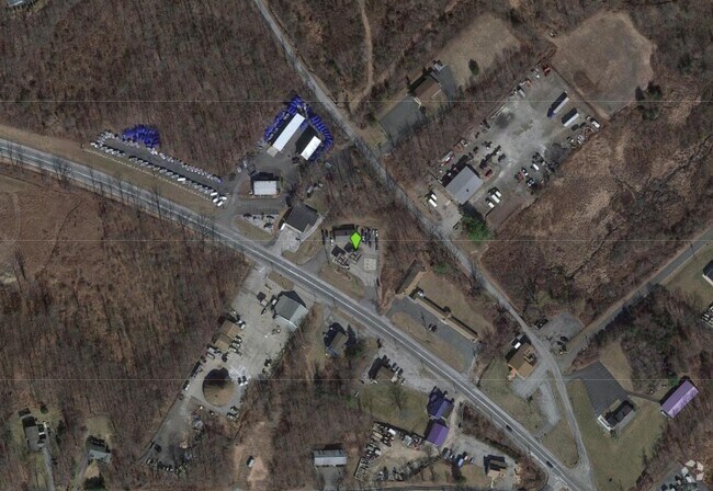
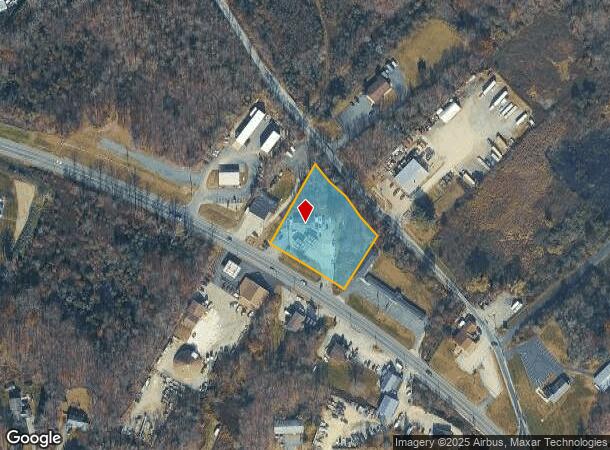
348 Us Highway 206
05-00050-0000-00005
Sussex
Servicestation
New Jersey
A
5
34037C0144E
1.40 AC
2024
Sussex County
2025
Northern New Jersey
372200
Newark, NJ-PA
DEMOGRAPHICS near 348 Us Highway 206
1 Mile
3 Mile
5 Mile
2024 Total Population
968
5,859
10,865
2029 Population
982
5,934
10,943
Pop Growth 2024-2029
+ 1.45%
+ 1.28%
+ 0.72%
Average Age
46
46
45
2024 Total Households
411
2,408
4,311
HH Growth 2024-2029
+ 1.46%
+ 1.45%
+ 0.84%
Median Household Inc
$99,754
$100,074
$100,816
Avg Household Size
2.40
2.40
2.50
2024 Avg HH Vehicles
2.00
2.00
2.00
Median Home Value
$311,728
$345,056
$350,000
Median Year Built
1957
1965
1969
Nearby Places
Map Layers
Map Styles
 Street
 Aerial
- Restaurants
- Banks
- Shops
- Fitness
- Groceries
SALE & LEASE HISTORY
LISTING DATE
SALE/LEASE

Feb 19, 2019
For Lease
Nearby Properties
Address
Land Use
TOTAL SIZE
Lot Size
Zoning
Address
Land Use
TOTAL SIZE
Lot Size
Zoning
55.05 AC
O
Address
Land Use
TOTAL SIZE
Lot Size
Zoning
1,762 SF
21.87 AC
AR
Address
Land Use
TOTAL SIZE
Lot Size
Zoning
14.14 AC
AR
Address
Land Use
TOTAL SIZE
Lot Size
Zoning
4.46 AC
COM
Address
Land Use
TOTAL SIZE
Lot Size
Zoning
864 SF
19.72 AC
R-2
Address
Land Use
TOTAL SIZE
Lot Size
Zoning
592 AC
AR
Address
Land Use
TOTAL SIZE
Lot Size
Zoning
4.44 AC
AR
Address
Land Use
TOTAL SIZE
Lot Size
Zoning
351.51 AC
AR
Address
Land Use
TOTAL SIZE
Lot Size
Zoning
595 AC
E
Address
Land Use
TOTAL SIZE
Lot Size
Zoning
4.08 AC
AR
Address
Land Use
TOTAL SIZE
Lot Size
Zoning
199.30 AC
AR
Address
Land Use
TOTAL SIZE
Lot Size
Zoning
374.06 AC
R-3
Address
Land Use
TOTAL SIZE
Lot Size
Zoning
30.93 AC
AR
Address
Land Use
TOTAL SIZE
Lot Size
Zoning
187 AC
AR
Address
Land Use
TOTAL SIZE
Lot Size
Zoning
5.60 AC
CED2
Address
Land Use
TOTAL SIZE
Lot Size
Zoning
1,792 SF
24.32 AC
D 2A
Address
Land Use
TOTAL SIZE
Lot Size
Zoning
351.14 AC
E 5A
Address
Land Use
TOTAL SIZE
Lot Size
Zoning
1,229 SF
40 AC
CRAR
Address
Land Use
TOTAL SIZE
Lot Size
Zoning
3,400 SF
15.24 AC
R-2
Address
Land Use
TOTAL SIZE
Lot Size
Zoning
342.54 AC
E
Address
Land Use
TOTAL SIZE
Lot Size
Zoning
9.41 AC
FCNS
Address
Land Use
TOTAL SIZE
Lot Size
Zoning
182 AC
AR
Address
Land Use
TOTAL SIZE
Lot Size
Zoning
7.41 AC
CED1
Address
Land Use
TOTAL SIZE
Lot Size
Zoning
8,840 SF
1 AC
AR
Address
Land Use
TOTAL SIZE
Lot Size
Zoning
4.40 AC
LI
Address
Land Use
TOTAL SIZE
Lot Size
Zoning
3,494 SF
1 AC
AR
Address
Land Use
TOTAL SIZE
Lot Size
Zoning
10.27 AC
LI
Address
Land Use
TOTAL SIZE
Lot Size
Zoning
153.64 AC
AR
Address
Land Use
TOTAL SIZE
Lot Size
Zoning
0.20 AC
COM
Address
Land Use
TOTAL SIZE
Lot Size
Zoning
2.31 AC
R-1
The World's #1 Commercial Real Estate Marketplace
Connect with us
© 2025 CoStar Group
The information above has been obtained from sources believed reliable. While we do not doubt its accuracy we have not verified it and make no guarantee, warranty or representation about it. It is your responsibility to independently confirm its accuracy and completeness. Any projections, opinions, assumptions, or estimates used are for example only and do not represent the current or future performance of the property. The value of this transaction to you depends on tax and other factors which should be evaluated by your tax, financial, and legal advisors. You and your advisors should conduct a careful, independent investigation of the property to determine to your satisfaction the suitability of the property for your needs.