Property Record
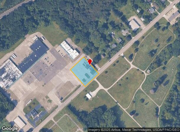
348 W Main Rd, Conneaut, OH 44030


NEARBY LISTINGS FOR SALE OR LEASE
Property Detail
348 W Main Rd
Cleveland-Elyria, OH
Connecticut Western Reserve
123230007501
59
Restaurantbuilding
Ashtabula
X
Ohio
42049C0300D
59
2024
0.92 AC
2024
Ashtabula County
000101
Cleveland
4,691 SF
DEMOGRAPHICS near 348 W Main Rd
1 mile
3 mile
5 mile
2024 Total Population
1,359
11,224
16,749
2029 Population
1,362
11,258
16,751
Pop Growth 2024-2029
+ 0.22%
+ 0.30%
+ 0.01%
Average Age
45
43
43
2024 Total Households
620
4,610
6,392
HH Growth 2024-2029
+ 0.16%
+ 0.28%
(0.06%)
Median Household Inc
$56,874
$50,202
$48,239
Avg Household Size
1.90
2.20
2.20
2024 Avg HH Vehicles
2.00
2.00
2.00
Median Home Value
$123,177
$103,474
$112,737
Median Year Built
1956
1952
1953
Nearby Places
Map Layers
Map Styles
 Street
 Aerial
Transit
 Traffic
 Biking
Places
Listings with unknown addresses are not visible on the map
- Restaurants
- Banks
- Shops
- Fitness
- Groceries
PUBLIC TRANSPORTATION
AIRPORT
Erie International/Tom Ridge Field
Drive
Walk
Distance
Erie International/Tom Ridge Field
41 min
31.5 mi
SALE & LEASE HISTORY
LISTING DATE
SALE/LEASE

Sep 25, 2019
For Sale
Nearby Properties
Address
Land Use
TOTAL SIZE
Lot Size
Zoning
Address
Land Use
TOTAL SIZE
Lot Size
Zoning
Address
Land Use
TOTAL SIZE
Lot Size
Zoning
213,400 SF
10.02 AC
Address
Land Use
TOTAL SIZE
Lot Size
Zoning
94,656 SF
27.89 AC
Address
Land Use
TOTAL SIZE
Lot Size
Zoning
78,100 SF
7.28 AC
Address
Land Use
TOTAL SIZE
Lot Size
Zoning
Address
Land Use
TOTAL SIZE
Lot Size
Zoning
0.09 AC
Address
Land Use
TOTAL SIZE
Lot Size
Zoning
70,523 SF
17.69 AC
Address
Land Use
TOTAL SIZE
Lot Size
Zoning
105,869 SF
6.90 AC
Address
Land Use
TOTAL SIZE
Lot Size
Zoning
64,728 SF
21.53 AC
Address
Land Use
TOTAL SIZE
Lot Size
Zoning
5,607 SF
16.41 AC
Address
Land Use
TOTAL SIZE
Lot Size
Zoning
254,037 SF
16.47 AC
Address
Land Use
TOTAL SIZE
Lot Size
Zoning
57,714 SF
8.65 AC
Address
Land Use
TOTAL SIZE
Lot Size
Zoning
202,939 SF
36.27 AC
Address
Land Use
TOTAL SIZE
Lot Size
Zoning
1.01 AC
Address
Land Use
TOTAL SIZE
Lot Size
Zoning
Address
Land Use
TOTAL SIZE
Lot Size
Zoning
Address
Land Use
TOTAL SIZE
Lot Size
Zoning
102,157 SF
10 AC
Address
Land Use
TOTAL SIZE
Lot Size
Zoning
75,074 SF
5.61 AC
Address
Land Use
TOTAL SIZE
Lot Size
Zoning
3,032 SF
16.78 AC
Address
Land Use
TOTAL SIZE
Lot Size
Zoning
98,857 SF
18.62 AC
Address
Land Use
TOTAL SIZE
Lot Size
Zoning
16,103 SF
12.65 AC
Address
Land Use
TOTAL SIZE
Lot Size
Zoning
110,576 SF
17.91 AC
Address
Land Use
TOTAL SIZE
Lot Size
Zoning
31,756 SF
4.34 AC
Address
Land Use
TOTAL SIZE
Lot Size
Zoning
24,142 SF
11.46 AC
Address
Land Use
TOTAL SIZE
Lot Size
Zoning
53,569 SF
8.83 AC
Address
Land Use
TOTAL SIZE
Lot Size
Zoning
16,680 SF
0.90 AC
Address
Land Use
TOTAL SIZE
Lot Size
Zoning
6,136 SF
70.55 AC
Address
Land Use
TOTAL SIZE
Lot Size
Zoning
16,872 SF
45.37 AC
Address
Land Use
TOTAL SIZE
Lot Size
Zoning
10,468 SF
5.63 AC
Address
Land Use
TOTAL SIZE
Lot Size
Zoning
47,480 SF
0.53 AC
The World's #1 Commercial Real Estate Marketplace
Connect with us
© 2026 CoStar Group
The information above has been obtained from sources believed reliable. While we do not doubt its accuracy we have not verified it and make no guarantee, warranty or representation about it. It is your responsibility to independently confirm its accuracy and completeness. Any projections, opinions, assumptions, or estimates used are for example only and do not represent the current or future performance of the property. The value of this transaction to you depends on tax and other factors which should be evaluated by your tax, financial, and legal advisors. You and your advisors should conduct a careful, independent investigation of the property to determine to your satisfaction the suitability of the property for your needs.