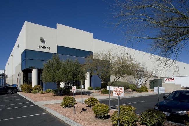
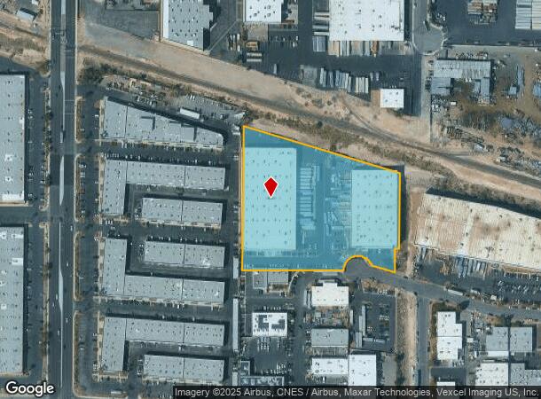
Property Record
3480 Birtcher Dr, Las Vegas, NV 89118
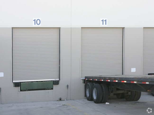
Current Lease Availabilities
NEARBY LISTINGS FOR SALE OR LEASE
Property Detail
3480 Birtcher Dr
Las Vegas-Henderson-Paradise, NV
Birtcher Palms Indst Center -Phase 1
162-32-310-021
BIRTCHER PALMS INDST CENTER -PHASE 1 PLAT BOOK 45 PAGE 60 PT LOT 1 BLOCK 1
Shipyard
Clark
X
Nevada
32003C2560F
1
2025
5.43 AC
2025
SW Las Vegas
002962
Las Vegas
115,070 SF
DEMOGRAPHICS near 3480 Birtcher Dr
1 Mile
3 Mile
5 Mile
2024 Total Population
269
80,246
371,456
2029 Population
293
86,538
401,223
Pop Growth 2024-2029
+ 8.92%
+ 7.84%
+ 8.01%
Average Age
39
39
40
2024 Total Households
100
34,293
153,283
HH Growth 2024-2029
+ 9.00%
+ 7.96%
+ 7.98%
Median Household Inc
$73,593
$56,406
$55,397
Avg Household Size
2.70
2.30
2.40
2024 Avg HH Vehicles
2.00
2.00
2.00
Median Home Value
$543,103
$357,677
$370,944
Median Year Built
2006
1995
1992
Nearby Places
Map Layers
Map Styles
 Street
 Aerial
- Restaurants
- Banks
- Shops
- Fitness
- Groceries
PUBLIC TRANSPORTATION
AIRPORT
Harry Reid International
DRIVE
WALK
Distance
Harry Reid International
38 min
7.6 mi
Boulder City Municipal
DRIVE
WALK
Distance
Boulder City Municipal
36 min
24.9 mi
Nearby Properties
Address
Land Use
TOTAL SIZE
Lot Size
Zoning
Address
Land Use
TOTAL SIZE
Lot Size
Zoning
2,000,377 SF
118.89 AC
Address
Land Use
TOTAL SIZE
Lot Size
Zoning
1,546,466 SF
61.43 AC
H1
Address
Land Use
TOTAL SIZE
Lot Size
Zoning
2,207,746 SF
74.17 AC
Address
Land Use
TOTAL SIZE
Lot Size
Zoning
2,828,726 SF
101.88 AC
Address
Land Use
TOTAL SIZE
Lot Size
Zoning
937,376 SF
59.19 AC
Address
Land Use
TOTAL SIZE
Lot Size
Zoning
820,224 SF
59.80 AC
H1
Address
Land Use
TOTAL SIZE
Lot Size
Zoning
2,414,853 SF
16.59 AC
H1
Address
Land Use
TOTAL SIZE
Lot Size
Zoning
1,166,098 SF
57.58 AC
Address
Land Use
TOTAL SIZE
Lot Size
Zoning
763,204 SF
10.47 AC
H1
Address
Land Use
TOTAL SIZE
Lot Size
Zoning
225,512 SF
50.14 AC
Address
Land Use
TOTAL SIZE
Lot Size
Zoning
114,591 SF
20.60 AC
Address
Land Use
TOTAL SIZE
Lot Size
Zoning
742,547 SF
19.87 AC
H1
Address
Land Use
TOTAL SIZE
Lot Size
Zoning
318,259 SF
29.92 AC
Address
Land Use
TOTAL SIZE
Lot Size
Zoning
1,911,901 SF
1.24 AC
Address
Land Use
TOTAL SIZE
Lot Size
Zoning
299,144 SF
19.37 AC
Address
Land Use
TOTAL SIZE
Lot Size
Zoning
79.03 AC
PF
Address
Land Use
TOTAL SIZE
Lot Size
Zoning
777,838 SF
36.14 AC
H1
Address
Land Use
TOTAL SIZE
Lot Size
Zoning
3,200 SF
16.74 AC
Address
Land Use
TOTAL SIZE
Lot Size
Zoning
1,744,547 SF
8.25 AC
Address
Land Use
TOTAL SIZE
Lot Size
Zoning
754,711 SF
24.79 AC
H1
Address
Land Use
TOTAL SIZE
Lot Size
Zoning
1,345,377 SF
88.53 AC
H1
Address
Land Use
TOTAL SIZE
Lot Size
Zoning
764,918 SF
94.41 AC
H1
Address
Land Use
TOTAL SIZE
Lot Size
Zoning
323,696 SF
24.62 AC
H1
Address
Land Use
TOTAL SIZE
Lot Size
Zoning
76.93 AC
PF
Address
Land Use
TOTAL SIZE
Lot Size
Zoning
278,297 SF
35.11 AC
Address
Land Use
TOTAL SIZE
Lot Size
Zoning
126,656 SF
8.18 AC
H1
Address
Land Use
TOTAL SIZE
Lot Size
Zoning
945,212 SF
0.60 AC
Address
Land Use
TOTAL SIZE
Lot Size
Zoning
566,218 SF
12.98 AC
Address
Land Use
TOTAL SIZE
Lot Size
Zoning
611,977 SF
6.82 AC
Address
Land Use
TOTAL SIZE
Lot Size
Zoning
94,198 SF
34.53 AC
H1
The World's #1 Commercial Real Estate Marketplace
Connect with us
© 2025 CoStar Group
The information above has been obtained from sources believed reliable. While we do not doubt its accuracy we have not verified it and make no guarantee, warranty or representation about it. It is your responsibility to independently confirm its accuracy and completeness. Any projections, opinions, assumptions, or estimates used are for example only and do not represent the current or future performance of the property. The value of this transaction to you depends on tax and other factors which should be evaluated by your tax, financial, and legal advisors. You and your advisors should conduct a careful, independent investigation of the property to determine to your satisfaction the suitability of the property for your needs.