Property Record
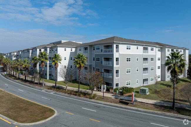
3483 Sw 45Th St, Gainesville, FL 32608


Property Detail
3483 Sw 45Th St
06820-002-010
COM SE COR SEC W 923.35 FT N 31 DEG W 327.55 FT NWLY ALG CURVE 147.85 FT N 02 DEG W 815.98 FT NWLY ALG CURVE 322.63 FT POB NWLY ALG CURVE 250.32 FT N 662.97 FT NELY ALG CURVE 1.57 FT NELY ALG CURVE 8.50 FT N 75 DEG 57 MIN 50 SEC E 26.10 FT E 22.40 FT
Multifamilydwelling
Alachua
R-1AA
Florida
A Areas with a 1% annual chance of flooding and a 26% chance of flooding over the life of a 30-year mortgage.
5.14 AC
2025
West Gainesville
2025
Other Market Areas
002219
Gainesville, FL
170,185 SF
NEARBY LISTINGS FOR SALE OR LEASE
DEMOGRAPHICS near 3483 Sw 45Th St
1 mile
3 mile
5 mile
2025 Total Population
6,225
79,314
158,405
2030 Population
6,641
82,290
164,014
Pop Growth 2025-2030
+ 6.68%
+ 3.75%
+ 3.54%
Average Age
34
33
34
2025 Total Households
2,740
32,687
63,789
HH Growth 2025-2030
+ 7.37%
+ 4.11%
+ 4.05%
Median Household Inc
$39,768
$51,059
$56,217
Avg Household Size
2.20
2.20
2.20
2025 Avg HH Vehicles
1.00
2.00
2.00
Median Home Value
$180,194
$332,480
$359,001
Median Year Built
1995
1990
1988
Nearby Places
Map Layers
Map Styles
 Street
 Aerial
Layers
 Traffic
 Biking
Places
Listings with unknown addresses are not visible on the map
- Restaurants
- Banks
- Shops
- Fitness
- Groceries
PUBLIC TRANSPORTATION
AIRPORT
Gainesville Regional
Drive
Walk
Distance
Gainesville Regional
25 min
11.0 mi
Freight Ports
Jacksonville Port
Drive
Walk
Distance
Jacksonville Port
111 min
80.8 mi
Nearby Properties
Address
Land Use
TOTAL SIZE
Lot Size
Zoning
Address
Land Use
TOTAL SIZE
Lot Size
Zoning
3,617,778 SF
276.74 AC
ED
Address
Land Use
TOTAL SIZE
Lot Size
Zoning
790,340 SF
526 AC
ED
Address
Land Use
TOTAL SIZE
Lot Size
Zoning
1,005,666 SF
11.60 AC
MD
Address
Land Use
TOTAL SIZE
Lot Size
Zoning
1,142,852 SF
106.08 AC
PD
Address
Land Use
TOTAL SIZE
Lot Size
Zoning
348,458 SF
81.44 AC
ED
Address
Land Use
TOTAL SIZE
Lot Size
Zoning
508,106 SF
27.40 AC
PD
Address
Land Use
TOTAL SIZE
Lot Size
Zoning
233,910 SF
3.64 AC
PD
Address
Land Use
TOTAL SIZE
Lot Size
Zoning
571,635 SF
55.49 AC
RMF6
Address
Land Use
TOTAL SIZE
Lot Size
Zoning
392,241 SF
25 AC
U9
Address
Land Use
TOTAL SIZE
Lot Size
Zoning
490,069 SF
40.15 AC
RMF8
Address
Land Use
TOTAL SIZE
Lot Size
Zoning
790,684 SF
57.09 AC
U8
Address
Land Use
TOTAL SIZE
Lot Size
Zoning
318,578 SF
21.24 AC
RMF7
Address
Land Use
TOTAL SIZE
Lot Size
Zoning
497,470 SF
33.60 AC
PD
Address
Land Use
TOTAL SIZE
Lot Size
Zoning
219,150 SF
9.99 AC
PD
Address
Land Use
TOTAL SIZE
Lot Size
Zoning
495,440 SF
14.88 AC
U9
Address
Land Use
TOTAL SIZE
Lot Size
Zoning
337,105 SF
7.87 AC
MU1
Address
Land Use
TOTAL SIZE
Lot Size
Zoning
299,984 SF
10.33 AC
MU2
Address
Land Use
TOTAL SIZE
Lot Size
Zoning
371,818 SF
14.05 AC
RMF8
Address
Land Use
TOTAL SIZE
Lot Size
Zoning
366,764 SF
26.03 AC
RMF6
Address
Land Use
TOTAL SIZE
Lot Size
Zoning
484,466 SF
7.44 AC
U9
Address
Land Use
TOTAL SIZE
Lot Size
Zoning
371,933 SF
15 AC
PD
Address
Land Use
TOTAL SIZE
Lot Size
Zoning
230,564 SF
6.34 AC
U9
Address
Land Use
TOTAL SIZE
Lot Size
Zoning
332,878 SF
34.15 AC
PD
Address
Land Use
TOTAL SIZE
Lot Size
Zoning
344,284 SF
31.74 AC
PD
Address
Land Use
TOTAL SIZE
Lot Size
Zoning
228,729 SF
8.10 AC
U9
Address
Land Use
TOTAL SIZE
Lot Size
Zoning
22,710 SF
30 AC
ED
Address
Land Use
TOTAL SIZE
Lot Size
Zoning
440,687 SF
33.32 AC
RMF8
Address
Land Use
TOTAL SIZE
Lot Size
Zoning
214,608 SF
21.23 AC
MU2
Address
Land Use
TOTAL SIZE
Lot Size
Zoning
205,916 SF
9.89 AC
U9
The World's #1 Commercial Real Estate Marketplace
Connect with us
© 2026 CoStar Group
The information above has been obtained from sources believed reliable. While we do not doubt its accuracy we have not verified it and make no guarantee, warranty or representation about it. It is your responsibility to independently confirm its accuracy and completeness. Any projections, opinions, assumptions, or estimates used are for example only and do not represent the current or future performance of the property. The value of this transaction to you depends on tax and other factors which should be evaluated by your tax, financial, and legal advisors. You and your advisors should conduct a careful, independent investigation of the property to determine to your satisfaction the suitability of the property for your needs.