Property Record
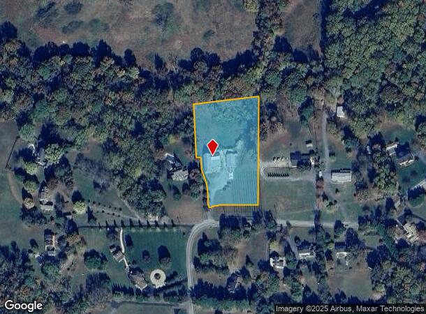
3485 Chaneyville Rd, Owings, MD 20736
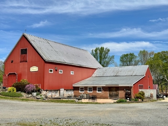
This Property Is For Sale
NEARBY LISTINGS FOR SALE OR LEASE
-
-
View all Owings listings for sale on LoopNet.com
Property Detail
3485 Chaneyville Rd
Washington-Arlington-Alexandria, DC-VA-MD-WV
Gantts Purchase
02-108496
OPEN SPACE REV GANTT'S PURCHASE
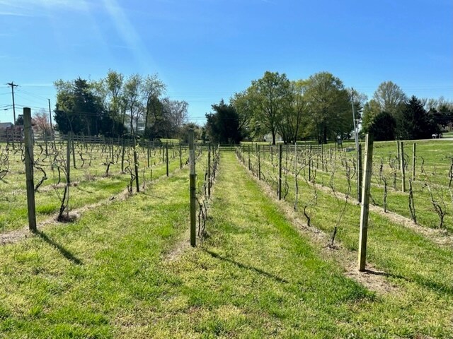
Agriculturalland
Calvert
X
Maryland
24033C0391E
2.94 AC
2025
Calvert County
2025
Washington, DC
860200
DEMOGRAPHICS near 3485 Chaneyville Rd
1 Mile
3 Mile
5 Mile
2024 Total Population
580
6,413
18,370
2029 Population
599
6,632
18,963
Pop Growth 2024-2029
+ 3.28%
+ 3.41%
+ 3.23%
Average Age
42
42
42
2024 Total Households
192
2,121
6,180
HH Growth 2024-2029
+ 3.13%
+ 3.39%
+ 3.19%
Median Household Inc
$220,561
$175,936
$155,012
Avg Household Size
3.00
3.00
2.90
2024 Avg HH Vehicles
3.00
3.00
3.00
Median Home Value
$526,316
$535,543
$492,831
Median Year Built
1983
1989
1987
Nearby Places
Map Layers
Map Styles
 Street
 Aerial
- Restaurants
- Banks
- Shops
- Fitness
- Groceries
PUBLIC TRANSPORTATION
AIRPORT
Ronald Reagan Washington Ntl
DRIVE
WALK
Distance
Ronald Reagan Washington Ntl
57 min
35.4 mi
Baltimore/Washington International Thurgood Marshall
DRIVE
WALK
Distance
Baltimore/Washington International Thurgood Marshall
69 min
45.1 mi
Freight Ports
Port of Baltimore
DRIVE
WALK
Distance
Port of Baltimore
76 min
50.6 mi
Nearby Properties
Address
Land Use
TOTAL SIZE
Lot Size
Zoning
Address
Land Use
TOTAL SIZE
Lot Size
Zoning
18,400 SF
111 AC
RUR
Address
Land Use
TOTAL SIZE
Lot Size
Zoning
47,434 SF
15.47 AC
TC
Address
Land Use
TOTAL SIZE
Lot Size
Zoning
23,840 SF
58.70 AC
RUR
Address
Land Use
TOTAL SIZE
Lot Size
Zoning
42,078 SF
6.82 AC
TC
Address
Land Use
TOTAL SIZE
Lot Size
Zoning
48,816 SF
4.87 AC
TC
Address
Land Use
TOTAL SIZE
Lot Size
Zoning
32,360 SF
4.34 AC
TC
Address
Land Use
TOTAL SIZE
Lot Size
Zoning
38,380 SF
8.85 AC
I-1
Address
Land Use
TOTAL SIZE
Lot Size
Zoning
14,046 SF
3.01 AC
TC
Address
Land Use
TOTAL SIZE
Lot Size
Zoning
4,252 SF
4.30 AC
TC
Address
Land Use
TOTAL SIZE
Lot Size
Zoning
22,082 SF
2.96 AC
RC
Address
Land Use
TOTAL SIZE
Lot Size
Zoning
5,468 SF
1.69 AC
TC
Address
Land Use
TOTAL SIZE
Lot Size
Zoning
7,265 SF
2.46 AC
TC
Address
Land Use
TOTAL SIZE
Lot Size
Zoning
13,212 SF
1.69 AC
TC
Address
Land Use
TOTAL SIZE
Lot Size
Zoning
272.95 AC
RUR
Address
Land Use
TOTAL SIZE
Lot Size
Zoning
13,500 SF
2.75 AC
Address
Land Use
TOTAL SIZE
Lot Size
Zoning
9,072 SF
4.01 AC
TC
Address
Land Use
TOTAL SIZE
Lot Size
Zoning
10,698 SF
1.36 AC
RC
Address
Land Use
TOTAL SIZE
Lot Size
Zoning
4,800 SF
1.47 AC
TC
Address
Land Use
TOTAL SIZE
Lot Size
Zoning
26,784 SF
2.60 AC
I-1
Address
Land Use
TOTAL SIZE
Lot Size
Zoning
3,387 SF
1.03 AC
TC
Address
Land Use
TOTAL SIZE
Lot Size
Zoning
1,833 SF
3.86 AC
TC
Address
Land Use
TOTAL SIZE
Lot Size
Zoning
14,296 SF
1.46 AC
TC
Address
Land Use
TOTAL SIZE
Lot Size
Zoning
5,000 SF
2.81 AC
I-1
Address
Land Use
TOTAL SIZE
Lot Size
Zoning
9,824 SF
1.01 AC
TC
Address
Land Use
TOTAL SIZE
Lot Size
Zoning
10,141 SF
1.34 AC
TC
Address
Land Use
TOTAL SIZE
Lot Size
Zoning
12,320 SF
1 AC
RC
Address
Land Use
TOTAL SIZE
Lot Size
Zoning
4,536 SF
3.21 AC
TC
Address
Land Use
TOTAL SIZE
Lot Size
Zoning
9,728 SF
0.60 AC
TC
Address
Land Use
TOTAL SIZE
Lot Size
Zoning
189.47 AC
ROS
Address
Land Use
TOTAL SIZE
Lot Size
Zoning
9,023 SF
2.60 AC
RC
The World's #1 Commercial Real Estate Marketplace
Connect with us
© 2025 CoStar Group
The information above has been obtained from sources believed reliable. While we do not doubt its accuracy we have not verified it and make no guarantee, warranty or representation about it. It is your responsibility to independently confirm its accuracy and completeness. Any projections, opinions, assumptions, or estimates used are for example only and do not represent the current or future performance of the property. The value of this transaction to you depends on tax and other factors which should be evaluated by your tax, financial, and legal advisors. You and your advisors should conduct a careful, independent investigation of the property to determine to your satisfaction the suitability of the property for your needs.