Property Record
3485 Woodley Rd, Montgomery, AL 36116

NEARBY LISTINGS FOR SALE OR LEASE
Property Detail
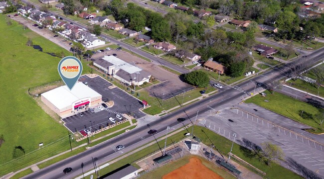
3485 Woodley Rd
Montgomery, AL
Ida M Davis 1
15-02-04-1-002-001.001
1502041002001001
Storebuilding
Montgomery
X
Alabama
01101C0209H
1
2025
1.16 AC
2025
South Montgomery
002902
Montgomery
8,345 SF
DEMOGRAPHICS near 3485 Woodley Rd
1 Mile
3 Mile
5 Mile
2024 Total Population
8,849
50,949
114,435
2029 Population
8,540
49,532
112,061
Pop Growth 2024-2029
(3.49%)
(2.78%)
(2.07%)
Average Age
38
37
38
2024 Total Households
3,616
20,473
47,676
HH Growth 2024-2029
(3.51%)
(2.81%)
(2.11%)
Median Household Inc
$34,919
$43,401
$42,985
Avg Household Size
2.30
2.40
2.30
2024 Avg HH Vehicles
2.00
2.00
2.00
Median Home Value
$93,576
$138,580
$135,059
Median Year Built
1975
1976
1974
Nearby Places
Map Layers
Map Styles
 Street
 Aerial
- Restaurants
- Banks
- Shops
- Fitness
- Groceries
PUBLIC TRANSPORTATION
AIRPORT
Montgomery Regional (Dannelly Field)
DRIVE
WALK
Distance
Montgomery Regional (Dannelly Field)
14 min
9.8 mi
Freight Ports
Port of Panama City
DRIVE
WALK
Distance
Port of Panama City
232 min
184.2 mi
SALE & LEASE HISTORY
LISTING DATE
SALE/LEASE

Dec 22, 2017
For Sale
Apr 20, 2017
For Sale
Nearby Properties
Address
Land Use
TOTAL SIZE
Lot Size
Zoning
Address
Land Use
TOTAL SIZE
Lot Size
Zoning
260,402 SF
17 AC
O-2
Address
Land Use
TOTAL SIZE
Lot Size
Zoning
1,343 SF
31.75 AC
R-65-M
Address
Land Use
TOTAL SIZE
Lot Size
Zoning
40,829 SF
50.49 AC
SD
Address
Land Use
TOTAL SIZE
Lot Size
Zoning
10,317 SF
16.70 AC
AGR-1
Address
Land Use
TOTAL SIZE
Lot Size
Zoning
164,528 SF
5.28 AC
B-3
Address
Land Use
TOTAL SIZE
Lot Size
Zoning
32,902 SF
14 AC
R-75-M
Address
Land Use
TOTAL SIZE
Lot Size
Zoning
8,519 SF
15.60 AC
B-2
Address
Land Use
TOTAL SIZE
Lot Size
Zoning
341,170 SF
O-2
Address
Land Use
TOTAL SIZE
Lot Size
Zoning
208,584 SF
21.10 AC
B-3
Address
Land Use
TOTAL SIZE
Lot Size
Zoning
21,634 SF
6.64 AC
Address
Land Use
TOTAL SIZE
Lot Size
Zoning
154,711 SF
31 AC
Address
Land Use
TOTAL SIZE
Lot Size
Zoning
14,733 SF
19 AC
O-2
Address
Land Use
TOTAL SIZE
Lot Size
Zoning
3,312 SF
15.73 AC
R-65-M
Address
Land Use
TOTAL SIZE
Lot Size
Zoning
249,231 SF
20 AC
INST
Address
Land Use
TOTAL SIZE
Lot Size
Zoning
135,573 SF
35 AC
O-2
Address
Land Use
TOTAL SIZE
Lot Size
Zoning
14,409 SF
16.01 AC
B-3
Address
Land Use
TOTAL SIZE
Lot Size
Zoning
2,164 SF
7.50 AC
R-60-A
Address
Land Use
TOTAL SIZE
Lot Size
Zoning
113,108 SF
3.70 AC
B-3
Address
Land Use
TOTAL SIZE
Lot Size
Zoning
2,115 SF
11.90 AC
R-65-M
Address
Land Use
TOTAL SIZE
Lot Size
Zoning
918 SF
8.86 AC
R-65-M
Address
Land Use
TOTAL SIZE
Lot Size
Zoning
45,034 SF
10.60 AC
B-2
Address
Land Use
TOTAL SIZE
Lot Size
Zoning
13,369 SF
14 AC
B-3
Address
Land Use
TOTAL SIZE
Lot Size
Zoning
5,400 SF
12.61 AC
M-1
Address
Land Use
TOTAL SIZE
Lot Size
Zoning
8,580 SF
6.80 AC
R-65-M
Address
Land Use
TOTAL SIZE
Lot Size
Zoning
8,028 SF
12.50 AC
R-65-M
Address
Land Use
TOTAL SIZE
Lot Size
Zoning
61,137 SF
59 AC
INST
Address
Land Use
TOTAL SIZE
Lot Size
Zoning
53,614 SF
21.68 AC
R-100
Address
Land Use
TOTAL SIZE
Lot Size
Zoning
95,886 SF
3.19 AC
B-4
Address
Land Use
TOTAL SIZE
Lot Size
Zoning
54,384 SF
0.65 AC
Address
Land Use
TOTAL SIZE
Lot Size
Zoning
154,202 SF
14.90 AC
B-4
The World's #1 Commercial Real Estate Marketplace
Connect with us
© 2026 CoStar Group
The information above has been obtained from sources believed reliable. While we do not doubt its accuracy we have not verified it and make no guarantee, warranty or representation about it. It is your responsibility to independently confirm its accuracy and completeness. Any projections, opinions, assumptions, or estimates used are for example only and do not represent the current or future performance of the property. The value of this transaction to you depends on tax and other factors which should be evaluated by your tax, financial, and legal advisors. You and your advisors should conduct a careful, independent investigation of the property to determine to your satisfaction the suitability of the property for your needs.