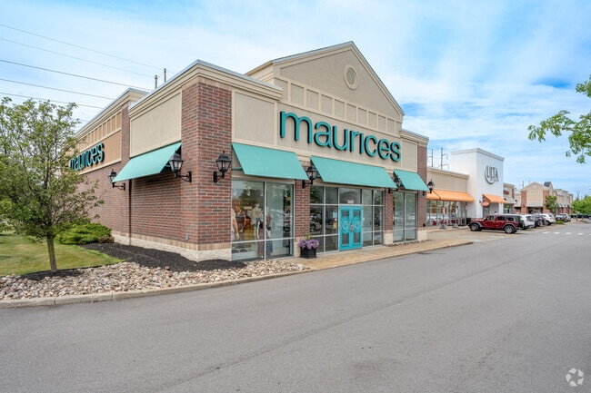
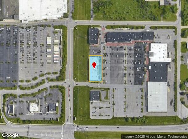
Property Record
3487 Amelia Dr, Orchard Park, NY 14127
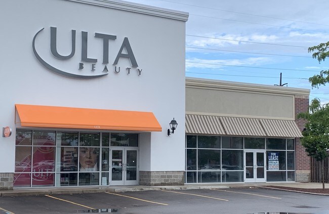
NEARBY LISTINGS FOR SALE OR LEASE
Property Detail
3487 Amelia Dr
146089 152.18-1-13.121
Erie
Storebuilding
New York
X
13.121
36029C0341H
0.68 AC
2024
South
2024
Buffalo/Niagara Falls
013701
Buffalo-Cheektowaga-Niagara Falls, NY
30,467 SF
DEMOGRAPHICS near 3487 Amelia Dr
1 Mile
3 Mile
5 Mile
2024 Total Population
3,406
51,891
143,220
2029 Population
3,380
51,624
141,823
Pop Growth 2024-2029
(0.76%)
(0.51%)
(0.98%)
Average Age
43
44
43
2024 Total Households
1,484
22,846
61,929
HH Growth 2024-2029
(0.81%)
(0.59%)
(1.05%)
Median Household Inc
$73,103
$68,794
$66,667
Avg Household Size
2.20
2.20
2.20
2024 Avg HH Vehicles
2.00
2.00
2.00
Median Home Value
$176,381
$195,734
$190,435
Median Year Built
1960
1965
1961
Nearby Places
- Restaurants
- Banks
- Shops
- Fitness
- Groceries
PUBLIC TRANSPORTATION
AIRPORT
Buffalo Niagara International
DRIVE
WALK
Distance
Buffalo Niagara International
21 min
15.5 mi
Freight Ports
Albany, NY Port
DRIVE
WALK
Distance
Albany, NY Port
1 min
255.3 mi
SALE & LEASE HISTORY
LISTING DATE
SALE/LEASE

Sep 25, 2016
For Lease
Nearby Properties
Address
Land Use
TOTAL SIZE
Lot Size
Zoning
Address
Land Use
TOTAL SIZE
Lot Size
Zoning
49,500 SF
108.40 AC
R1
Address
Land Use
TOTAL SIZE
Lot Size
Zoning
22,754 SF
41.80 AC
Address
Land Use
TOTAL SIZE
Lot Size
Zoning
183,334 SF
50.90 AC
B2
Address
Land Use
TOTAL SIZE
Lot Size
Zoning
197,584 SF
32.50 AC
B2
Address
Land Use
TOTAL SIZE
Lot Size
Zoning
48.14 AC
OP
Address
Land Use
TOTAL SIZE
Lot Size
Zoning
115,317 SF
17.87 AC
DR
Address
Land Use
TOTAL SIZE
Lot Size
Zoning
124,112 SF
53.10 AC
05 - COMME
Address
Land Use
TOTAL SIZE
Lot Size
Zoning
149,065 SF
21.53 AC
B2
Address
Land Use
TOTAL SIZE
Lot Size
Zoning
205,680 SF
37.40 AC
11
Address
Land Use
TOTAL SIZE
Lot Size
Zoning
59,421 SF
75.40 AC
B1
Address
Land Use
TOTAL SIZE
Lot Size
Zoning
202,597 SF
24.22 AC
Address
Land Use
TOTAL SIZE
Lot Size
Zoning
0.07 AC
Address
Land Use
TOTAL SIZE
Lot Size
Zoning
97,709 SF
14.13 AC
R2
Address
Land Use
TOTAL SIZE
Lot Size
Zoning
3,268 SF
1.68 AC
Address
Land Use
TOTAL SIZE
Lot Size
Zoning
Address
Land Use
TOTAL SIZE
Lot Size
Zoning
165,478 SF
9.79 AC
Address
Land Use
TOTAL SIZE
Lot Size
Zoning
191,026 SF
32.60 AC
10
Address
Land Use
TOTAL SIZE
Lot Size
Zoning
72.11 AC
Address
Land Use
TOTAL SIZE
Lot Size
Zoning
28,578 SF
10.46 AC
C1
Address
Land Use
TOTAL SIZE
Lot Size
Zoning
8,320 SF
22.10 AC
Address
Land Use
TOTAL SIZE
Lot Size
Zoning
149,858 SF
24.18 AC
Address
Land Use
TOTAL SIZE
Lot Size
Zoning
103,215 SF
6.14 AC
C1
Address
Land Use
TOTAL SIZE
Lot Size
Zoning
102,037 SF
9.95 AC
C2
Address
Land Use
TOTAL SIZE
Lot Size
Zoning
13,062 SF
26.07 AC
R4
Address
Land Use
TOTAL SIZE
Lot Size
Zoning
235,940 SF
62.47 AC
R2
Address
Land Use
TOTAL SIZE
Lot Size
Zoning
3,361 SF
28.04 AC
R3
Address
Land Use
TOTAL SIZE
Lot Size
Zoning
143,400 SF
11.33 AC
B1
Address
Land Use
TOTAL SIZE
Lot Size
Zoning
111,225 SF
10.52 AC
C2
Address
Land Use
TOTAL SIZE
Lot Size
Zoning
98,517 SF
4.60 AC
SFR
Address
Land Use
TOTAL SIZE
Lot Size
Zoning
87,835 SF
21.86 AC
The World's #1 Commercial Real Estate Marketplace
Connect with us
© 2025 CoStar Group
The information above has been obtained from sources believed reliable. While we do not doubt its accuracy we have not verified it and make no guarantee, warranty or representation about it. It is your responsibility to independently confirm its accuracy and completeness. Any projections, opinions, assumptions, or estimates used are for example only and do not represent the current or future performance of the property. The value of this transaction to you depends on tax and other factors which should be evaluated by your tax, financial, and legal advisors. You and your advisors should conduct a careful, independent investigation of the property to determine to your satisfaction the suitability of the property for your needs.