Property Record
3489 W Main Street Rd, Batavia, NY 14020
NEARBY LISTINGS FOR SALE OR LEASE
-
-
View all Batavia listings for sale on LoopNet.com
Property Detail
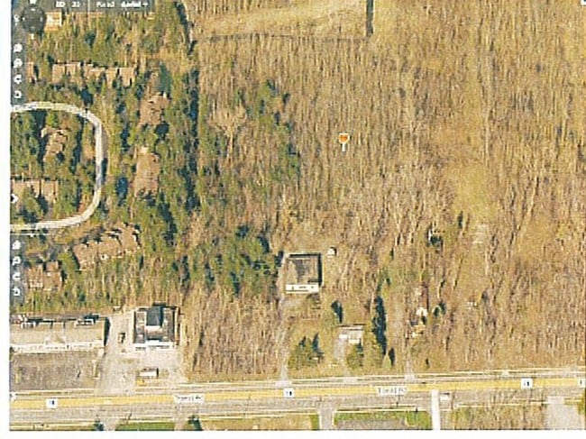
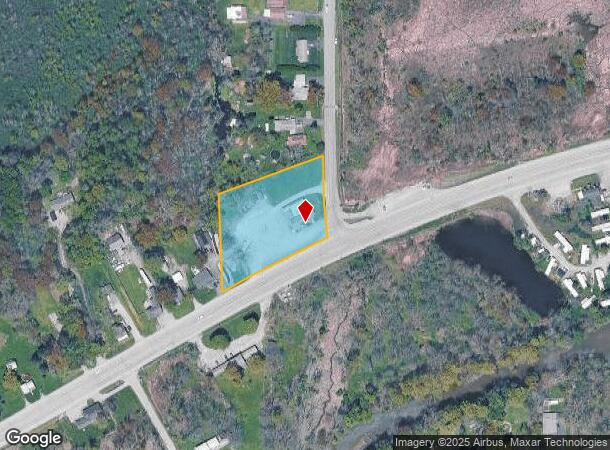
3489 W Main Street Rd
Batavia, NY
Genesee
182400-007-000-0001-042-000
New York
Commercialofficeresidentialmixeduse
42.000
2025
1.80 AC
2024
Rochester Other Areas
950401
Other Market Areas
5,138 SF
DEMOGRAPHICS near 3489 W Main Street Rd
1 Mile
3 Mile
5 Mile
2024 Total Population
764
6,944
22,873
2029 Population
744
6,820
22,367
Pop Growth 2024-2029
(2.62%)
(1.79%)
(2.21%)
Average Age
44
43
42
2024 Total Households
333
2,988
9,796
HH Growth 2024-2029
(2.70%)
(1.77%)
(2.26%)
Median Household Inc
$55,777
$55,605
$56,839
Avg Household Size
2.30
2.20
2.20
2024 Avg HH Vehicles
2.00
2.00
2.00
Median Home Value
$173,571
$143,119
$132,037
Median Year Built
1974
1959
1950
Nearby Places
Map Layers
Map Styles
 Street
 Aerial
- Restaurants
- Banks
- Shops
- Fitness
- Groceries
PUBLIC TRANSPORTATION
AIRPORT
Buffalo Niagara International
DRIVE
WALK
Distance
Buffalo Niagara International
39 min
27.6 mi
Freight Ports
Albany, NY Port
DRIVE
WALK
Distance
Albany, NY Port
299 min
254.4 mi
Nearby Properties
Address
Land Use
TOTAL SIZE
Lot Size
Zoning
Address
Land Use
TOTAL SIZE
Lot Size
Zoning
136,135 SF
44 AC
Address
Land Use
TOTAL SIZE
Lot Size
Zoning
64,890 SF
33.60 AC
Address
Land Use
TOTAL SIZE
Lot Size
Zoning
3.12 AC
Address
Land Use
TOTAL SIZE
Lot Size
Zoning
208,058 SF
25.70 AC
Address
Land Use
TOTAL SIZE
Lot Size
Zoning
126,835 SF
9.60 AC
Address
Land Use
TOTAL SIZE
Lot Size
Zoning
8,725 SF
14.70 AC
Address
Land Use
TOTAL SIZE
Lot Size
Zoning
102,404 SF
15.40 AC
Address
Land Use
TOTAL SIZE
Lot Size
Zoning
117,034 SF
8.40 AC
Address
Land Use
TOTAL SIZE
Lot Size
Zoning
92,080 SF
3.50 AC
Address
Land Use
TOTAL SIZE
Lot Size
Zoning
9,248 SF
23.10 AC
Address
Land Use
TOTAL SIZE
Lot Size
Zoning
147,000 SF
7 AC
Address
Land Use
TOTAL SIZE
Lot Size
Zoning
169,207 SF
8.70 AC
Address
Land Use
TOTAL SIZE
Lot Size
Zoning
69,906 SF
1.80 AC
Address
Land Use
TOTAL SIZE
Lot Size
Zoning
61,973 SF
4.40 AC
Address
Land Use
TOTAL SIZE
Lot Size
Zoning
122,414 SF
10.30 AC
Address
Land Use
TOTAL SIZE
Lot Size
Zoning
73,920 SF
7.38 AC
05 - COMME
Address
Land Use
TOTAL SIZE
Lot Size
Zoning
27,128 SF
33.20 AC
Address
Land Use
TOTAL SIZE
Lot Size
Zoning
125,941 SF
14.70 AC
Address
Land Use
TOTAL SIZE
Lot Size
Zoning
47,426 SF
1.91 AC
Address
Land Use
TOTAL SIZE
Lot Size
Zoning
36,700 SF
0.51 AC
Address
Land Use
TOTAL SIZE
Lot Size
Zoning
25,829 SF
3.59 AC
Address
Land Use
TOTAL SIZE
Lot Size
Zoning
35,280 SF
3.80 AC
Address
Land Use
TOTAL SIZE
Lot Size
Zoning
37,320 SF
2.97 AC
Address
Land Use
TOTAL SIZE
Lot Size
Zoning
94.10 AC
Address
Land Use
TOTAL SIZE
Lot Size
Zoning
56,250 SF
19.70 AC
Address
Land Use
TOTAL SIZE
Lot Size
Zoning
2,902 SF
6.60 AC
Address
Land Use
TOTAL SIZE
Lot Size
Zoning
840 SF
14.20 AC
Address
Land Use
TOTAL SIZE
Lot Size
Zoning
55.80 AC
Address
Land Use
TOTAL SIZE
Lot Size
Zoning
50,830 SF
3.90 AC
Address
Land Use
TOTAL SIZE
Lot Size
Zoning
10,459 SF
2.30 AC
The World's #1 Commercial Real Estate Marketplace
Connect with us
© 2025 CoStar Group
The information above has been obtained from sources believed reliable. While we do not doubt its accuracy we have not verified it and make no guarantee, warranty or representation about it. It is your responsibility to independently confirm its accuracy and completeness. Any projections, opinions, assumptions, or estimates used are for example only and do not represent the current or future performance of the property. The value of this transaction to you depends on tax and other factors which should be evaluated by your tax, financial, and legal advisors. You and your advisors should conduct a careful, independent investigation of the property to determine to your satisfaction the suitability of the property for your needs.