Property Record
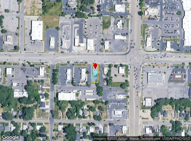
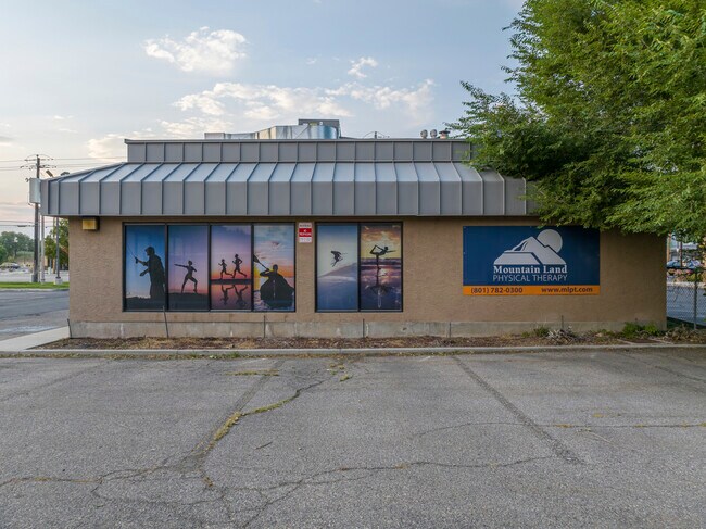
349 12Th St, Ogden, UT 84404

NEARBY LISTINGS FOR SALE OR LEASE
Property Detail
349 12Th St
12-112-0015
PART OF THE NORTHEAST QUARTER OF SECTION 20, TOWNSHIP 6 NORTH RANGE 1 WEST, SALT LAKE MERIDIAN, U.S. SURVEY: BEGINNING AT A
Medicalbuilding
Weber
X
Utah
49057C0426F
0.24 AC
2025
Davis/Weber Counties
2025
Salt Lake City
200400
Ogden, UT
3,564 SF
DEMOGRAPHICS near 349 12Th St
1 Mile
3 Mile
5 Mile
2024 Total Population
13,981
80,201
147,336
2029 Population
15,083
86,137
158,318
Pop Growth 2024-2029
+ 7.88%
+ 7.40%
+ 7.45%
Average Age
35
35
35
2024 Total Households
5,231
29,539
52,788
HH Growth 2024-2029
+ 8.05%
+ 7.63%
+ 7.66%
Median Household Inc
$49,150
$54,067
$61,328
Avg Household Size
2.60
2.60
2.70
2024 Avg HH Vehicles
2.00
2.00
2.00
Median Home Value
$255,363
$291,905
$328,022
Median Year Built
1972
1967
1975
Nearby Places
Map Layers
Map Styles
 Street
 Aerial
- Restaurants
- Banks
- Shops
- Fitness
- Groceries
PUBLIC TRANSPORTATION
COMMUTER RAIL
Ogden (FrontRunner North - Utah Transit Authority (UTA))
DRIVE
WALK
Distance
Ogden (FrontRunner North - Utah Transit Authority (UTA))
5 min
2.0 mi
Roy (FrontRunner North - Utah Transit Authority (UTA))
DRIVE
WALK
Distance
Roy (FrontRunner North - Utah Transit Authority (UTA))
13 min
6.8 mi
AIRPORT
Salt Lake City International
DRIVE
WALK
Distance
Salt Lake City International
52 min
40.9 mi
SALE & LEASE HISTORY
LISTING DATE
SALE/LEASE

Oct 30, 2024
For Sale
Nearby Properties
Address
Land Use
TOTAL SIZE
Lot Size
Zoning
Address
Land Use
TOTAL SIZE
Lot Size
Zoning
841,756 SF
45.79 AC
Address
Land Use
TOTAL SIZE
Lot Size
Zoning
111,832 SF
24.92 AC
Address
Land Use
TOTAL SIZE
Lot Size
Zoning
128,867 SF
3.36 AC
Address
Land Use
TOTAL SIZE
Lot Size
Zoning
97,932 SF
3.07 AC
Address
Land Use
TOTAL SIZE
Lot Size
Zoning
52,200 SF
9.95 AC
Address
Land Use
TOTAL SIZE
Lot Size
Zoning
305,444 SF
1.58 AC
Address
Land Use
TOTAL SIZE
Lot Size
Zoning
152,877 SF
4.96 AC
Address
Land Use
TOTAL SIZE
Lot Size
Zoning
9,464 SF
6.82 AC
Address
Land Use
TOTAL SIZE
Lot Size
Zoning
21,684 SF
8.38 AC
Address
Land Use
TOTAL SIZE
Lot Size
Zoning
48,177 SF
5.54 AC
Address
Land Use
TOTAL SIZE
Lot Size
Zoning
106,752 SF
10.35 AC
Address
Land Use
TOTAL SIZE
Lot Size
Zoning
22,227 SF
10.81 AC
Address
Land Use
TOTAL SIZE
Lot Size
Zoning
66,896 SF
7.50 AC
Address
Land Use
TOTAL SIZE
Lot Size
Zoning
101,191 SF
4.14 AC
Address
Land Use
TOTAL SIZE
Lot Size
Zoning
119,043 SF
2.05 AC
Address
Land Use
TOTAL SIZE
Lot Size
Zoning
95,949 SF
3.29 AC
Address
Land Use
TOTAL SIZE
Lot Size
Zoning
149,400 SF
26.88 AC
Address
Land Use
TOTAL SIZE
Lot Size
Zoning
166,800 SF
0.12 AC
Address
Land Use
TOTAL SIZE
Lot Size
Zoning
19,594 SF
1.12 AC
Address
Land Use
TOTAL SIZE
Lot Size
Zoning
47,750 SF
2.10 AC
Address
Land Use
TOTAL SIZE
Lot Size
Zoning
99,775 SF
6.32 AC
Address
Land Use
TOTAL SIZE
Lot Size
Zoning
7,567 SF
5.12 AC
Address
Land Use
TOTAL SIZE
Lot Size
Zoning
14,520 SF
6.86 AC
The World's #1 Commercial Real Estate Marketplace
Connect with us
© 2026 CoStar Group
The information above has been obtained from sources believed reliable. While we do not doubt its accuracy we have not verified it and make no guarantee, warranty or representation about it. It is your responsibility to independently confirm its accuracy and completeness. Any projections, opinions, assumptions, or estimates used are for example only and do not represent the current or future performance of the property. The value of this transaction to you depends on tax and other factors which should be evaluated by your tax, financial, and legal advisors. You and your advisors should conduct a careful, independent investigation of the property to determine to your satisfaction the suitability of the property for your needs.