Property Record
349 Panther Branch Rd, Alexander, NC 28701

NEARBY LISTINGS FOR SALE OR LEASE
-
-
View all Alexander listings for sale on LoopNet.com
Property Detail
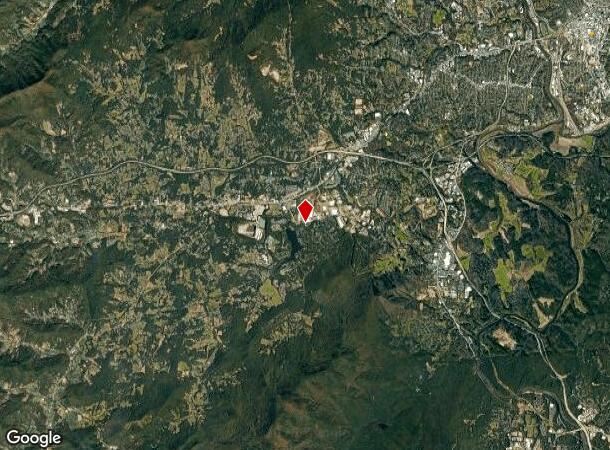
349 Panther Branch Rd
Asheville, NC
Retail Tract
9617-31-8004-00000
SUBDIV: RETAIL TRACT BLOCK: LOT: A1 SECTION: PLAT: 0086-0126
Vacantlandnec
Buncombe
X
North Carolina
3700972400J
a1
0
49.30 AC
2025
Central Asheville
002305
Asheville
DEMOGRAPHICS near 349 Panther Branch Rd
1 Mile
3 Mile
5 Mile
2024 Total Population
10,489
54,846
102,557
2029 Population
11,019
56,889
106,239
Pop Growth 2024-2029
+ 5.05%
+ 3.72%
+ 3.59%
Average Age
42
41
42
2024 Total Households
5,398
25,045
45,795
HH Growth 2024-2029
+ 4.80%
+ 3.31%
+ 3.11%
Median Household Inc
$49,408
$60,444
$63,074
Avg Household Size
1.80
2.00
2.10
2024 Avg HH Vehicles
1.00
2.00
2.00
Median Home Value
$444,576
$389,451
$367,541
Median Year Built
1971
1970
1977
Nearby Places
Map Layers
Map Styles
 Street
 Aerial
- Restaurants
- Banks
- Shops
- Fitness
- Groceries
PUBLIC TRANSPORTATION
AIRPORT
Asheville Regional
DRIVE
WALK
Distance
Asheville Regional
43 min
26.9 mi
Freight Ports
North Charleston Terminal
DRIVE
WALK
Distance
North Charleston Terminal
314 min
270.6 mi
Nearby Properties
Address
Land Use
TOTAL SIZE
Lot Size
Zoning
Address
Land Use
TOTAL SIZE
Lot Size
Zoning
17,052 SF
604.49 AC
OU
Address
Land Use
TOTAL SIZE
Lot Size
Zoning
17,360 SF
17.62 AC
OU
Address
Land Use
TOTAL SIZE
Lot Size
Zoning
846.39 AC
OU
Address
Land Use
TOTAL SIZE
Lot Size
Zoning
13,168 SF
4.04 AC
OU
Address
Land Use
TOTAL SIZE
Lot Size
Zoning
34,390 SF
OU
Address
Land Use
TOTAL SIZE
Lot Size
Zoning
7,228 SF
2.72 AC
OU
Address
Land Use
TOTAL SIZE
Lot Size
Zoning
8,540 SF
58.80 AC
OU
Address
Land Use
TOTAL SIZE
Lot Size
Zoning
6,747 SF
42.59 AC
OU
Address
Land Use
TOTAL SIZE
Lot Size
Zoning
7,798 SF
54 AC
OU
Address
Land Use
TOTAL SIZE
Lot Size
Zoning
10,640 SF
2.25 AC
OU
Address
Land Use
TOTAL SIZE
Lot Size
Zoning
7,582 SF
10.57 AC
OU
Address
Land Use
TOTAL SIZE
Lot Size
Zoning
7,421 SF
15.04 AC
OU
Address
Land Use
TOTAL SIZE
Lot Size
Zoning
7,961 SF
52.45 AC
OU
Address
Land Use
TOTAL SIZE
Lot Size
Zoning
33.54 AC
R-A
Address
Land Use
TOTAL SIZE
Lot Size
Zoning
9,760 SF
3.65 AC
OU
Address
Land Use
TOTAL SIZE
Lot Size
Zoning
9,826 SF
60.98 AC
OU
Address
Land Use
TOTAL SIZE
Lot Size
Zoning
8,418 SF
1.47 AC
OU
Address
Land Use
TOTAL SIZE
Lot Size
Zoning
263.32 AC
OU
Address
Land Use
TOTAL SIZE
Lot Size
Zoning
8,881 SF
9.85 AC
OU
Address
Land Use
TOTAL SIZE
Lot Size
Zoning
9,894 SF
2.41 AC
OU
Address
Land Use
TOTAL SIZE
Lot Size
Zoning
6,142 SF
40.01 AC
OU
Address
Land Use
TOTAL SIZE
Lot Size
Zoning
4,978 SF
10 AC
OU
Address
Land Use
TOTAL SIZE
Lot Size
Zoning
3,633 SF
38.47 AC
OU
Address
Land Use
TOTAL SIZE
Lot Size
Zoning
4,364 SF
26.99 AC
OU
Address
Land Use
TOTAL SIZE
Lot Size
Zoning
7,319 SF
3.56 AC
OU
Address
Land Use
TOTAL SIZE
Lot Size
Zoning
4,972 SF
29.99 AC
OU
Address
Land Use
TOTAL SIZE
Lot Size
Zoning
7,652 SF
15.79 AC
OU
Address
Land Use
TOTAL SIZE
Lot Size
Zoning
4,743 SF
111.76 AC
OU
Address
Land Use
TOTAL SIZE
Lot Size
Zoning
6,653 SF
2.15 AC
OU
Address
Land Use
TOTAL SIZE
Lot Size
Zoning
3,620 SF
17.79 AC
OU
The World's #1 Commercial Real Estate Marketplace
Connect with us
© 2025 CoStar Group
The information above has been obtained from sources believed reliable. While we do not doubt its accuracy we have not verified it and make no guarantee, warranty or representation about it. It is your responsibility to independently confirm its accuracy and completeness. Any projections, opinions, assumptions, or estimates used are for example only and do not represent the current or future performance of the property. The value of this transaction to you depends on tax and other factors which should be evaluated by your tax, financial, and legal advisors. You and your advisors should conduct a careful, independent investigation of the property to determine to your satisfaction the suitability of the property for your needs.