Property Record
349 Spook Rock Rd, Suffern, NY 10901

NEARBY LISTINGS FOR SALE OR LEASE
Property Detail
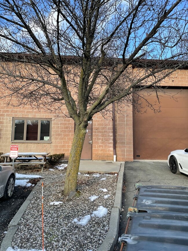
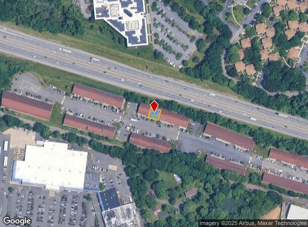
349 Spook Rock Rd
New York-Jersey City-White Plains, NY-NJ
Spook Rock Indl Park Condo 02
392621-055-012-0001-004-000-4070
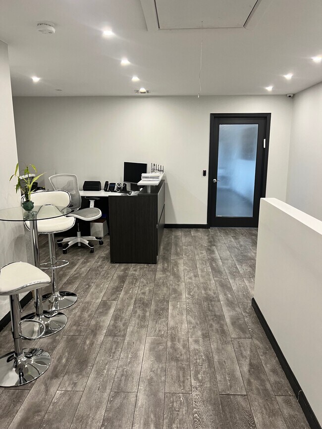
CONDO G BLDG 3600 SQ FT
Warehouse
Rockland
X
New York
34003C0076H
4.0
2023
0.09 AC
2024
Rockland County
011602
Northern New Jersey
3,600 SF
DEMOGRAPHICS near 349 Spook Rock Rd
1 Mile
3 Mile
5 Mile
2024 Total Population
7,585
107,536
210,168
2029 Population
7,625
107,133
209,520
Pop Growth 2024-2029
+ 0.53%
(0.37%)
(0.31%)
Average Age
39
33
35
2024 Total Households
2,306
29,324
60,125
HH Growth 2024-2029
+ 0.52%
(0.31%)
(0.24%)
Median Household Inc
$90,697
$84,968
$95,462
Avg Household Size
3.00
3.40
3.30
2024 Avg HH Vehicles
2.00
2.00
2.00
Median Home Value
$748,824
$630,805
$614,465
Median Year Built
1988
1975
1975
Nearby Places
- Restaurants
- Banks
- Shops
- Fitness
- Groceries
PUBLIC TRANSPORTATION
COMMUTER RAIL
Suffern (Bergen County/Port Jervis Line - NJ Transit Commuter Rail (NJ Transit), Main/Port Jervis Line - NJ Transit Commuter Rail (NJ Transit))
DRIVE
WALK
Distance
Suffern (Bergen County/Port Jervis Line - NJ Transit Commuter Rail (NJ Transit), Main/Port Jervis Line - NJ Transit Commuter Rail (NJ Transit))
8 min
3.5 mi
Mahwah (Bergen County/Port Jervis Line - NJ Transit Commuter Rail (NJ Transit), Main/Port Jervis Line - NJ Transit Commuter Rail (NJ Transit))
DRIVE
WALK
Distance
Mahwah (Bergen County/Port Jervis Line - NJ Transit Commuter Rail (NJ Transit), Main/Port Jervis Line - NJ Transit Commuter Rail (NJ Transit))
10 min
4.7 mi
AIRPORT
Westchester County
DRIVE
WALK
Distance
Westchester County
42 min
28.1 mi
LaGuardia
DRIVE
WALK
Distance
LaGuardia
56 min
37.5 mi
New York Stewart International
DRIVE
WALK
Distance
New York Stewart International
53 min
38.8 mi
Freight Ports
Port Newark Container Terminal
DRIVE
WALK
Distance
Port Newark Container Terminal
55 min
39.8 mi
SALE & LEASE HISTORY
LISTING DATE
SALE/LEASE

Jul 23, 2024
For Lease
Jan 20, 2025
For Sale
Feb 09, 2022
For Lease
Nearby Properties
Address
Land Use
TOTAL SIZE
Lot Size
Zoning
Address
Land Use
TOTAL SIZE
Lot Size
Zoning
1,056 SF
99.35 AC
OP200
Address
Land Use
TOTAL SIZE
Lot Size
Zoning
23.32 AC
Address
Land Use
TOTAL SIZE
Lot Size
Zoning
14.09 AC
B200
Address
Land Use
TOTAL SIZE
Lot Size
Zoning
Address
Land Use
TOTAL SIZE
Lot Size
Zoning
68.78 AC
OP20
Address
Land Use
TOTAL SIZE
Lot Size
Zoning
609,540 SF
174.09 AC
R-50
Address
Land Use
TOTAL SIZE
Lot Size
Zoning
19.60 AC
OP200
Address
Land Use
TOTAL SIZE
Lot Size
Zoning
539,911 SF
38.80 AC
05
Address
Land Use
TOTAL SIZE
Lot Size
Zoning
33.50 AC
GI80
Address
Land Use
TOTAL SIZE
Lot Size
Zoning
219,765 SF
29.88 AC
07
Address
Land Use
TOTAL SIZE
Lot Size
Zoning
5.30 AC
GA200
Address
Land Use
TOTAL SIZE
Lot Size
Zoning
0.44 AC
OP20
Address
Land Use
TOTAL SIZE
Lot Size
Zoning
5.31 AC
GA200
Address
Land Use
TOTAL SIZE
Lot Size
Zoning
3.65 AC
Address
Land Use
TOTAL SIZE
Lot Size
Zoning
4.71 AC
GA200
Address
Land Use
TOTAL SIZE
Lot Size
Zoning
58,473 SF
0.70 AC
HCS
Address
Land Use
TOTAL SIZE
Lot Size
Zoning
7.17 AC
GI80
Address
Land Use
TOTAL SIZE
Lot Size
Zoning
4.97 AC
GI80
Address
Land Use
TOTAL SIZE
Lot Size
Zoning
5.02 AC
B12
Address
Land Use
TOTAL SIZE
Lot Size
Zoning
76,083 SF
0.96 AC
05
Address
Land Use
TOTAL SIZE
Lot Size
Zoning
290,428 SF
35.56 AC
R35
Address
Land Use
TOTAL SIZE
Lot Size
Zoning
5.70 AC
Address
Land Use
TOTAL SIZE
Lot Size
Zoning
2.18 AC
B12
Address
Land Use
TOTAL SIZE
Lot Size
Zoning
859,490 SF
49.12 AC
PI
Address
Land Use
TOTAL SIZE
Lot Size
Zoning
5.56 AC
Address
Land Use
TOTAL SIZE
Lot Size
Zoning
70,527 SF
10.20 AC
RSH
Address
Land Use
TOTAL SIZE
Lot Size
Zoning
335,851 SF
9.96 AC
07
Address
Land Use
TOTAL SIZE
Lot Size
Zoning
2.50 AC
GA200
Address
Land Use
TOTAL SIZE
Lot Size
Zoning
3.03 AC
GI80
Address
Land Use
TOTAL SIZE
Lot Size
Zoning
275,724 SF
40 AC
R1
The World's #1 Commercial Real Estate Marketplace
Connect with us
© 2025 CoStar Group
The information above has been obtained from sources believed reliable. While we do not doubt its accuracy we have not verified it and make no guarantee, warranty or representation about it. It is your responsibility to independently confirm its accuracy and completeness. Any projections, opinions, assumptions, or estimates used are for example only and do not represent the current or future performance of the property. The value of this transaction to you depends on tax and other factors which should be evaluated by your tax, financial, and legal advisors. You and your advisors should conduct a careful, independent investigation of the property to determine to your satisfaction the suitability of the property for your needs.