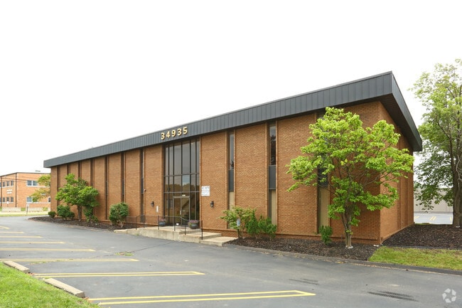
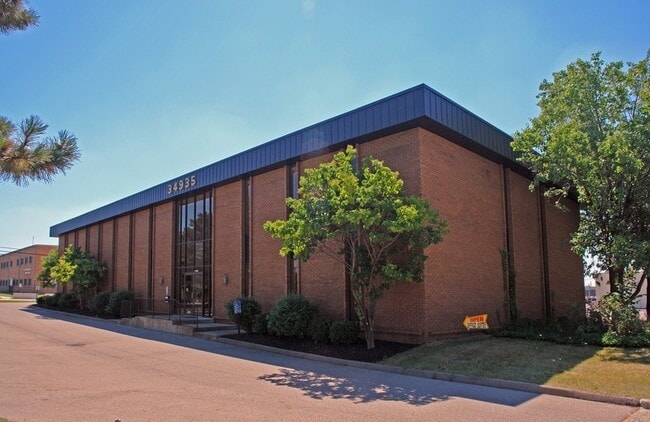
Property Record
34935 Schoolcraft Rd, Livonia, MI 48150

Current Lease Availabilities
NEARBY LISTINGS FOR SALE OR LEASE
Property Detail
34935 Schoolcraft Rd
Detroit-Warren-Dearborn, MI
Lipton Industrial
46-110-01-0016-000
28G16 RICHTER-LIPTON INDUSTRIAL SUB T1SR9E L92 P6 7 WCR LOT 16
Officebuilding
Wayne
X
Michigan
26163C0044E
16
2025
1.37 AC
2025
Southern I-275 Corridor
558301
Detroit
13,000 SF
DEMOGRAPHICS near 34935 Schoolcraft Rd
1 Mile
3 Mile
5 Mile
2024 Total Population
4,353
70,097
215,768
2029 Population
4,191
67,204
207,051
Pop Growth 2024-2029
(3.72%)
(4.13%)
(4.04%)
Average Age
47
44
43
2024 Total Households
1,757
29,654
93,226
HH Growth 2024-2029
(3.81%)
(4.08%)
(4.03%)
Median Household Inc
$94,595
$88,298
$78,027
Avg Household Size
2.30
2.30
2.30
2024 Avg HH Vehicles
2.00
2.00
2.00
Median Home Value
$260,751
$245,063
$219,830
Median Year Built
1968
1965
1966
Nearby Places
Map Layers
Map Styles
 Street
 Aerial
- Restaurants
- Banks
- Shops
- Fitness
- Groceries
PUBLIC TRANSPORTATION
AIRPORT
Detroit Metro Wayne County
DRIVE
WALK
Distance
Detroit Metro Wayne County
31 min
15.5 mi
Windsor International
DRIVE
WALK
Distance
Windsor International
46 min
29.8 mi
Freight Ports
DRIVE
WALK
Distance
77 min
62.6 mi
Nearby Properties
Address
Land Use
TOTAL SIZE
Lot Size
Zoning
Address
Land Use
TOTAL SIZE
Lot Size
Zoning
3,733,882 SF
183.17 AC
M-2
Address
Land Use
TOTAL SIZE
Lot Size
Zoning
1,005,040 SF
Address
Land Use
TOTAL SIZE
Lot Size
Zoning
234,403 SF
74.21 AC
OS
Address
Land Use
TOTAL SIZE
Lot Size
Zoning
250,699 SF
16.89 AC
SH
Address
Land Use
TOTAL SIZE
Lot Size
Zoning
517,265 SF
116.72 AC
Address
Land Use
TOTAL SIZE
Lot Size
Zoning
1,316,911 SF
72.87 AC
M-1
Address
Land Use
TOTAL SIZE
Lot Size
Zoning
192,478 SF
IND
Address
Land Use
TOTAL SIZE
Lot Size
Zoning
352,514 SF
26.40 AC
Address
Land Use
TOTAL SIZE
Lot Size
Zoning
480,910 SF
26.32 AC
Address
Land Use
TOTAL SIZE
Lot Size
Zoning
361,807 SF
18.77 AC
M-2
Address
Land Use
TOTAL SIZE
Lot Size
Zoning
199,485 SF
10.31 AC
R-9
Address
Land Use
TOTAL SIZE
Lot Size
Zoning
730,656 SF
13.73 AC
C-4
Address
Land Use
TOTAL SIZE
Lot Size
Zoning
283,710 SF
IND
Address
Land Use
TOTAL SIZE
Lot Size
Zoning
113,292 SF
15.79 AC
IND
Address
Land Use
TOTAL SIZE
Lot Size
Zoning
249,795 SF
21.17 AC
Address
Land Use
TOTAL SIZE
Lot Size
Zoning
1,013,885 SF
36.48 AC
M-1
Address
Land Use
TOTAL SIZE
Lot Size
Zoning
Address
Land Use
TOTAL SIZE
Lot Size
Zoning
286,188 SF
40.21 AC
Address
Land Use
TOTAL SIZE
Lot Size
Zoning
285,136 SF
15.28 AC
Address
Land Use
TOTAL SIZE
Lot Size
Zoning
172,094 SF
11.84 AC
M-2
Address
Land Use
TOTAL SIZE
Lot Size
Zoning
243,371 SF
16.04 AC
Address
Land Use
TOTAL SIZE
Lot Size
Zoning
121,420 SF
16.01 AC
C-2
Address
Land Use
TOTAL SIZE
Lot Size
Zoning
177,268 SF
17.11 AC
Address
Land Use
TOTAL SIZE
Lot Size
Zoning
127,811 SF
6.95 AC
M-2
Address
Land Use
TOTAL SIZE
Lot Size
Zoning
145,232 SF
7.16 AC
M-2
Address
Land Use
TOTAL SIZE
Lot Size
Zoning
137,490 SF
12.16 AC
C-2
Address
Land Use
TOTAL SIZE
Lot Size
Zoning
1,529,287 SF
76.96 AC
M-1
Address
Land Use
TOTAL SIZE
Lot Size
Zoning
137,400 SF
11.27 AC
Address
Land Use
TOTAL SIZE
Lot Size
Zoning
151,806 SF
15.61 AC
C-2
Address
Land Use
TOTAL SIZE
Lot Size
Zoning
146,160 SF
8.78 AC
The World's #1 Commercial Real Estate Marketplace
Connect with us
© 2026 CoStar Group
The information above has been obtained from sources believed reliable. While we do not doubt its accuracy we have not verified it and make no guarantee, warranty or representation about it. It is your responsibility to independently confirm its accuracy and completeness. Any projections, opinions, assumptions, or estimates used are for example only and do not represent the current or future performance of the property. The value of this transaction to you depends on tax and other factors which should be evaluated by your tax, financial, and legal advisors. You and your advisors should conduct a careful, independent investigation of the property to determine to your satisfaction the suitability of the property for your needs.