Property Record
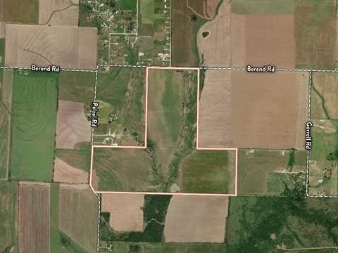
3497 Berend Rd, Pilot Point, TX 76258
Property Detail
3497 Berend Rd
R40811
A0213A J CURBELLO, TR 6,7, 100.0 ACRES, OLD DCAD SHT 1, TR 3
Agriculturalland
DENTON
A Areas with a 1% annual chance of flooding and a 26% chance of flooding over the life of a 30-year mortgage.
Texas
2024
100 AC
2025
Outlying Denton County
020129
Dallas/Ft Worth
1,404 SF
Dallas-Fort Worth-Arlington, TX
NEARBY LISTINGS FOR SALE OR LEASE
DEMOGRAPHICS near 3497 Berend Rd
1 mile
3 mile
5 mile
2024 Total Population
184
426
3,584
2029 Population
233
562
4,735
Pop Growth 2024-2029
+ 26.63%
+ 31.92%
+ 32.11%
Average Age
39
38
40
2024 Total Households
68
148
1,283
HH Growth 2024-2029
+ 26.47%
+ 31.76%
+ 32.27%
Median Household Inc
$67,500
$73,928
$80,820
Avg Household Size
2.80
2.90
2.80
2024 Avg HH Vehicles
2.00
2.00
2.00
Median Home Value
$332,692
$350,000
$321,428
Median Year Built
1993
2003
1998
Nearby Places
Map Layers
Map Styles
 Street
 Aerial
Transit
 Traffic
 Biking
Places
Listings with unknown addresses are not visible on the map
- Restaurants
- Banks
- Shops
- Fitness
- Groceries
Nearby Properties
Address
Land Use
TOTAL SIZE
Lot Size
Zoning
Address
Land Use
TOTAL SIZE
Lot Size
Zoning
118.80 AC
Address
Land Use
TOTAL SIZE
Lot Size
Zoning
8,146 SF
4.75 AC
Address
Land Use
TOTAL SIZE
Lot Size
Zoning
6,400 SF
12.10 AC
Address
Land Use
TOTAL SIZE
Lot Size
Zoning
6,249 SF
11.93 AC
Address
Land Use
TOTAL SIZE
Lot Size
Zoning
5,484 SF
12.61 AC
Address
Land Use
TOTAL SIZE
Lot Size
Zoning
5,810 SF
13.45 AC
Address
Land Use
TOTAL SIZE
Lot Size
Zoning
11,940 SF
4.72 AC
Address
Land Use
TOTAL SIZE
Lot Size
Zoning
3,765 SF
6.53 AC
Address
Land Use
TOTAL SIZE
Lot Size
Zoning
4,428 SF
5.55 AC
Address
Land Use
TOTAL SIZE
Lot Size
Zoning
13.80 AC
Address
Land Use
TOTAL SIZE
Lot Size
Zoning
2,016 SF
6.16 AC
Address
Land Use
TOTAL SIZE
Lot Size
Zoning
6,004 SF
33.72 AC
Address
Land Use
TOTAL SIZE
Lot Size
Zoning
4,223 SF
8.39 AC
Address
Land Use
TOTAL SIZE
Lot Size
Zoning
3,560 SF
15 AC
Address
Land Use
TOTAL SIZE
Lot Size
Zoning
15.26 AC
Address
Land Use
TOTAL SIZE
Lot Size
Zoning
3,456 SF
16.94 AC
Address
Land Use
TOTAL SIZE
Lot Size
Zoning
13.50 AC
Address
Land Use
TOTAL SIZE
Lot Size
Zoning
3,537 SF
16.28 AC
Address
Land Use
TOTAL SIZE
Lot Size
Zoning
3,335 SF
9.20 AC
Address
Land Use
TOTAL SIZE
Lot Size
Zoning
Address
Land Use
TOTAL SIZE
Lot Size
Zoning
4,643 SF
13.11 AC
Address
Land Use
TOTAL SIZE
Lot Size
Zoning
3,199 SF
128.51 AC
Address
Land Use
TOTAL SIZE
Lot Size
Zoning
4,297 SF
2.06 AC
Address
Land Use
TOTAL SIZE
Lot Size
Zoning
5,000 SF
8.04 AC
Address
Land Use
TOTAL SIZE
Lot Size
Zoning
2,769 SF
19.70 AC
Address
Land Use
TOTAL SIZE
Lot Size
Zoning
2,672 SF
95 AC
Address
Land Use
TOTAL SIZE
Lot Size
Zoning
3,780 SF
24.07 AC
Address
Land Use
TOTAL SIZE
Lot Size
Zoning
4,174 SF
90 AC
Address
Land Use
TOTAL SIZE
Lot Size
Zoning
3,059 SF
30.04 AC
The World's #1 Commercial Real Estate Marketplace
Connect with us
© 2026 CoStar Group
The information above has been obtained from sources believed reliable. While we do not doubt its accuracy we have not verified it and make no guarantee, warranty or representation about it. It is your responsibility to independently confirm its accuracy and completeness. Any projections, opinions, assumptions, or estimates used are for example only and do not represent the current or future performance of the property. The value of this transaction to you depends on tax and other factors which should be evaluated by your tax, financial, and legal advisors. You and your advisors should conduct a careful, independent investigation of the property to determine to your satisfaction the suitability of the property for your needs.