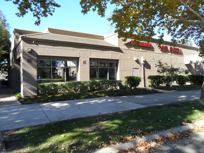
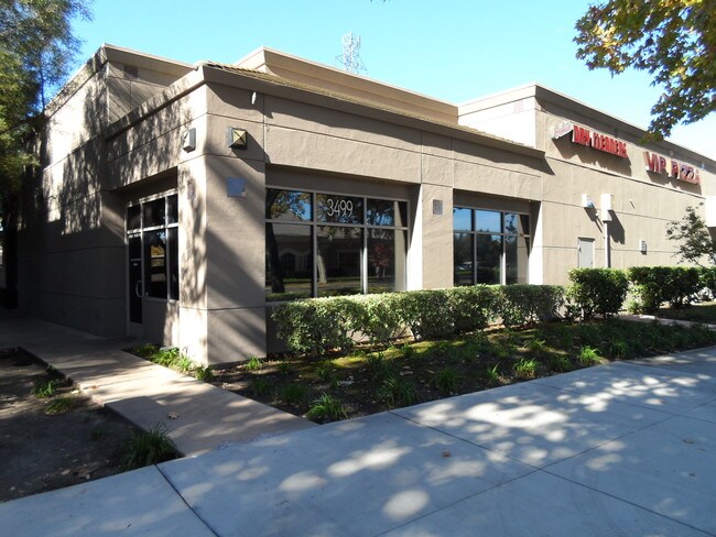
Property Record
3499 Brookside Rd, Stockton, CA 95219


Property Detail
3499 Brookside Rd
Stockton-Lodi, CA
PARCEL MAPS 20 PG 120 LOT 85-6D
116-280-11
San Joaquin
Storesoffices
California
2025
85-6d
2025
1.03 AC
003119
Stockton
11,443 SF
Stockton/Modesto
NEARBY LISTINGS FOR SALE OR LEASE
DEMOGRAPHICS near 3499 Brookside Rd
1 mile
3 mile
5 mile
2025 Total Population
13,741
100,550
263,205
2030 Population
14,244
104,412
273,955
Pop Growth 2025-2030
+ 3.66%
+ 3.84%
+ 4.08%
Average Age
42
38
38
2025 Total Households
5,180
37,025
86,617
HH Growth 2025-2030
+ 3.71%
+ 4.04%
+ 4.29%
Median Household Inc
$119,415
$80,754
$77,875
Avg Household Size
2.70
2.60
2.90
2025 Avg HH Vehicles
2.00
2.00
2.00
Median Home Value
$641,472
$444,788
$434,754
Median Year Built
1991
1972
1976
Nearby Places
Map Layers
Map Styles
 Street
 Aerial
Layers
 Traffic
 Biking
Places
Listings with unknown addresses are not visible on the map
- Restaurants
- Banks
- Shops
- Fitness
- Groceries
PUBLIC TRANSPORTATION
COMMUTER RAIL
Drive
Walk
Distance
11 min
5.8 mi
Drive
Walk
Distance
11 min
6.3 mi
AIRPORT
Stockton Metro
Drive
Walk
Distance
Stockton Metro
18 min
11.2 mi
Freight Ports
Port of Stockton
Drive
Walk
Distance
Port of Stockton
8 min
3.6 mi
SALE & LEASE HISTORY
LISTING DATE
SALE/LEASE

Dec 12, 2018
For Lease
Nearby Properties
Address
Land Use
TOTAL SIZE
Lot Size
Zoning
Address
Land Use
TOTAL SIZE
Lot Size
Zoning
30,080 SF
82.44 AC
Address
Land Use
TOTAL SIZE
Lot Size
Zoning
60,137 SF
7.22 AC
Address
Land Use
TOTAL SIZE
Lot Size
Zoning
10,208 SF
47.57 AC
Address
Land Use
TOTAL SIZE
Lot Size
Zoning
22.89 AC
Address
Land Use
TOTAL SIZE
Lot Size
Zoning
161,229 SF
10.16 AC
Address
Land Use
TOTAL SIZE
Lot Size
Zoning
23,112 SF
9.20 AC
Address
Land Use
TOTAL SIZE
Lot Size
Zoning
151,271 SF
8.97 AC
Address
Land Use
TOTAL SIZE
Lot Size
Zoning
82,512 SF
4.14 AC
Address
Land Use
TOTAL SIZE
Lot Size
Zoning
14,212 SF
26.11 AC
Address
Land Use
TOTAL SIZE
Lot Size
Zoning
18.66 AC
Address
Land Use
TOTAL SIZE
Lot Size
Zoning
97,276 SF
5.46 AC
RHD
Address
Land Use
TOTAL SIZE
Lot Size
Zoning
190,923 SF
3.96 AC
Address
Land Use
TOTAL SIZE
Lot Size
Zoning
17,573 SF
3.17 AC
Address
Land Use
TOTAL SIZE
Lot Size
Zoning
14,035 SF
10.02 AC
Address
Land Use
TOTAL SIZE
Lot Size
Zoning
77,568 SF
2.58 AC
Address
Land Use
TOTAL SIZE
Lot Size
Zoning
81,482 SF
5 AC
RM
Address
Land Use
TOTAL SIZE
Lot Size
Zoning
5,888 SF
3.64 AC
Address
Land Use
TOTAL SIZE
Lot Size
Zoning
119,341 SF
7.98 AC
Address
Land Use
TOTAL SIZE
Lot Size
Zoning
176,492 SF
10.55 AC
Address
Land Use
TOTAL SIZE
Lot Size
Zoning
146,660 SF
8.35 AC
Address
Land Use
TOTAL SIZE
Lot Size
Zoning
2,880 SF
36.83 AC
Address
Land Use
TOTAL SIZE
Lot Size
Zoning
5.70 AC
RL
Address
Land Use
TOTAL SIZE
Lot Size
Zoning
44,752 SF
2.31 AC
Address
Land Use
TOTAL SIZE
Lot Size
Zoning
11,720 SF
4.28 AC
Address
Land Use
TOTAL SIZE
Lot Size
Zoning
95,592 SF
3.20 AC
O
Address
Land Use
TOTAL SIZE
Lot Size
Zoning
64,656 SF
3.55 AC
Address
Land Use
TOTAL SIZE
Lot Size
Zoning
55,228 SF
4.04 AC
Address
Land Use
TOTAL SIZE
Lot Size
Zoning
46,982 SF
2.26 AC
Address
Land Use
TOTAL SIZE
Lot Size
Zoning
8,000 SF
7.34 AC
The World's #1 Commercial Real Estate Marketplace
Connect with us
© 2026 CoStar Group
The information above has been obtained from sources believed reliable. While we do not doubt its accuracy we have not verified it and make no guarantee, warranty or representation about it. It is your responsibility to independently confirm its accuracy and completeness. Any projections, opinions, assumptions, or estimates used are for example only and do not represent the current or future performance of the property. The value of this transaction to you depends on tax and other factors which should be evaluated by your tax, financial, and legal advisors. You and your advisors should conduct a careful, independent investigation of the property to determine to your satisfaction the suitability of the property for your needs.