Property Record
3499 N Patterson Ave, Winston Salem, NC 27105
NEARBY LISTINGS FOR SALE OR LEASE
Property Detail
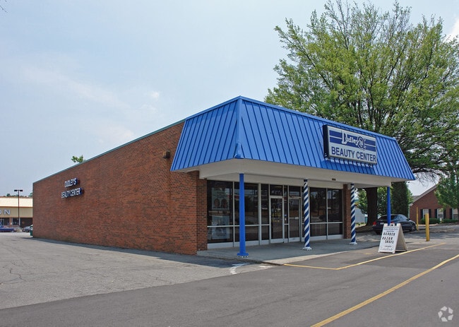
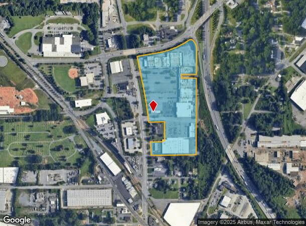
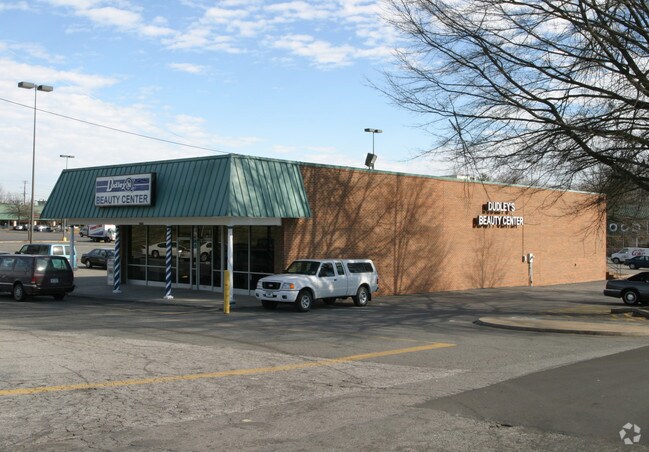
3499 N Patterson Ave
Winston-Salem, NC
Northside Shopping Center
6837-30-4492
NORTHSIDE SHOPPING CENTER LO:351 BL:2431 BU:1
Regionalshoppingcenterormallwithanchorstore
Forsyth
X
North Carolina
3710683700J
351
2024
18.37 AC
2025
NE Forsyth County
001500
Greensboro/Winston-Salem
1,088 SF
DEMOGRAPHICS near 3499 N Patterson Ave
1 Mile
3 Mile
5 Mile
2024 Total Population
5,301
64,314
139,432
2029 Population
5,587
67,505
145,743
Pop Growth 2024-2029
+ 5.40%
+ 4.96%
+ 4.53%
Average Age
35
37
38
2024 Total Households
1,864
25,896
56,731
HH Growth 2024-2029
+ 5.47%
+ 5.29%
+ 4.68%
Median Household Inc
$29,761
$39,708
$47,360
Avg Household Size
2.70
2.20
2.20
2024 Avg HH Vehicles
1.00
1.00
2.00
Median Home Value
$99,016
$151,182
$191,336
Median Year Built
1966
1971
1972
Nearby Places
Map Layers
Map Styles
 Street
 Aerial
- Restaurants
- Banks
- Shops
- Fitness
- Groceries
PUBLIC TRANSPORTATION
AIRPORT
Piedmont Triad International
DRIVE
WALK
Distance
Piedmont Triad International
38 min
26.1 mi
Nearby Properties
Address
Land Use
TOTAL SIZE
Lot Size
Zoning
Address
Land Use
TOTAL SIZE
Lot Size
Zoning
100 SF
213.71 AC
C
Address
Land Use
TOTAL SIZE
Lot Size
Zoning
368,715 SF
4.11 AC
CI
Address
Land Use
TOTAL SIZE
Lot Size
Zoning
205,729 SF
2.35 AC
CI
Address
Land Use
TOTAL SIZE
Lot Size
Zoning
244,516 SF
4.42 AC
CI
Address
Land Use
TOTAL SIZE
Lot Size
Zoning
297,475 SF
3.06 AC
CI-S
Address
Land Use
TOTAL SIZE
Lot Size
Zoning
315,590 SF
2 AC
CB
Address
Land Use
TOTAL SIZE
Lot Size
Zoning
156,507 SF
NULL
Address
Land Use
TOTAL SIZE
Lot Size
Zoning
121,886 SF
3.92 AC
PB-S
Address
Land Use
TOTAL SIZE
Lot Size
Zoning
436,579 SF
72.65 AC
RM8-S
Address
Land Use
TOTAL SIZE
Lot Size
Zoning
202,752 SF
3.43 AC
PB-L
Address
Land Use
TOTAL SIZE
Lot Size
Zoning
329,963 SF
58.84 AC
RM18-S
Address
Land Use
TOTAL SIZE
Lot Size
Zoning
352,549 SF
2.30 AC
CB WO
Address
Land Use
TOTAL SIZE
Lot Size
Zoning
140,472 SF
1.33 AC
CB WO
Address
Land Use
TOTAL SIZE
Lot Size
Zoning
283,831 SF
559.85 AC
GI,RS9
Address
Land Use
TOTAL SIZE
Lot Size
Zoning
122,900 SF
49.54 AC
GB
Address
Land Use
TOTAL SIZE
Lot Size
Zoning
153,315 SF
2.07 AC
CI
Address
Land Use
TOTAL SIZE
Lot Size
Zoning
195,551 SF
2.07 AC
CI
Address
Land Use
TOTAL SIZE
Lot Size
Zoning
154,655 SF
0.76 AC
CI
Address
Land Use
TOTAL SIZE
Lot Size
Zoning
153,937 SF
34.63 AC
RM12-S
Address
Land Use
TOTAL SIZE
Lot Size
Zoning
264,904 SF
21.63 AC
GB
Address
Land Use
TOTAL SIZE
Lot Size
Zoning
169,443 SF
33.02 AC
GB
Address
Land Use
TOTAL SIZE
Lot Size
Zoning
112,000 SF
15.57 AC
IP
Address
Land Use
TOTAL SIZE
Lot Size
Zoning
449,945 SF
20.96 AC
LI
Address
Land Use
TOTAL SIZE
Lot Size
Zoning
205,979 SF
1.73 AC
CB WO
Address
Land Use
TOTAL SIZE
Lot Size
Zoning
207,203 SF
4.26 AC
PB
Address
Land Use
TOTAL SIZE
Lot Size
Zoning
188,135 SF
8.65 AC
GO-S
Address
Land Use
TOTAL SIZE
Lot Size
Zoning
152,968 SF
32.40 AC
RM18
Address
Land Use
TOTAL SIZE
Lot Size
Zoning
106,204 SF
1.13 AC
CI
Address
Land Use
TOTAL SIZE
Lot Size
Zoning
124,134 SF
2.14 AC
CB WO
Address
Land Use
TOTAL SIZE
Lot Size
Zoning
121,925 SF
1.49 AC
GO
The World's #1 Commercial Real Estate Marketplace
Connect with us
© 2026 CoStar Group
The information above has been obtained from sources believed reliable. While we do not doubt its accuracy we have not verified it and make no guarantee, warranty or representation about it. It is your responsibility to independently confirm its accuracy and completeness. Any projections, opinions, assumptions, or estimates used are for example only and do not represent the current or future performance of the property. The value of this transaction to you depends on tax and other factors which should be evaluated by your tax, financial, and legal advisors. You and your advisors should conduct a careful, independent investigation of the property to determine to your satisfaction the suitability of the property for your needs.