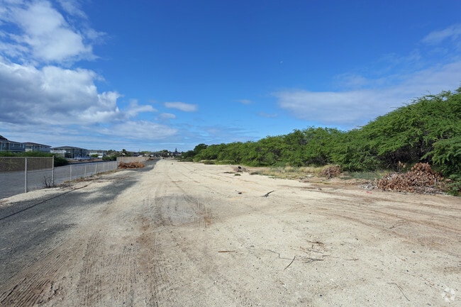
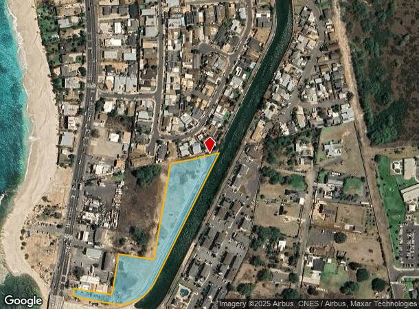
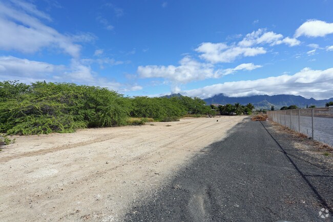
Property Record
35-B Farrington Hwy, Waianae, HI 96792
NEARBY LISTINGS FOR SALE OR LEASE
Property Detail
35-B Farrington Hwy
Urban Honolulu, HI
Lualualei Homesteads 02 Serie
1-8-7-023-059-0000
POR LOT 35-B, POR LOT 13 LUALUALEI HMSTDS 2ND SERIES 147,008 SF
Commercialnec
Honolulu
AE
Hawaii
15003C0192J
35-b
2024
3.38 AC
2025
Waianae
009705
Hawaii
DEMOGRAPHICS near 35-B Farrington Hwy
1 Mile
3 Mile
5 Mile
2024 Total Population
7,642
28,037
41,193
2029 Population
7,106
26,358
38,923
Pop Growth 2024-2029
(7.01%)
(5.99%)
(5.51%)
Average Age
35
36
36
2024 Total Households
1,805
6,507
9,727
HH Growth 2024-2029
(8.25%)
(7.16%)
(6.44%)
Median Household Inc
$109,648
$84,154
$78,444
Avg Household Size
3.80
3.80
3.70
2024 Avg HH Vehicles
2.00
2.00
2.00
Median Home Value
$530,153
$534,697
$503,807
Median Year Built
1987
1978
1978
Nearby Places
Map Layers
Map Styles
 Street
 Aerial
- Restaurants
- Banks
- Shops
- Fitness
- Groceries
PUBLIC TRANSPORTATION
AIRPORT
Daniel K Inouye International
DRIVE
WALK
Distance
Daniel K Inouye International
41 min
25.9 mi
Freight Ports
Honolulu Harbor, Oahu
DRIVE
WALK
Distance
Honolulu Harbor, Oahu
49 min
30.0 mi
SALE & LEASE HISTORY
LISTING DATE
SALE/LEASE

Sep 24, 2016
For Sale
Oct 12, 2017
For Sale
Oct 05, 2017
For Sale
Nearby Properties
Address
Land Use
TOTAL SIZE
Lot Size
Zoning
Address
Land Use
TOTAL SIZE
Lot Size
Zoning
89,685 SF
14.35 AC
B-2
Address
Land Use
TOTAL SIZE
Lot Size
Zoning
177,221 SF
11 AC
B-2
Address
Land Use
TOTAL SIZE
Lot Size
Zoning
63,315 SF
3.06 AC
B-2
Address
Land Use
TOTAL SIZE
Lot Size
Zoning
672.13 AC
F-1
Address
Land Use
TOTAL SIZE
Lot Size
Zoning
18.04 AC
I-2
Address
Land Use
TOTAL SIZE
Lot Size
Zoning
18,877 SF
1.72 AC
B-2
Address
Land Use
TOTAL SIZE
Lot Size
Zoning
38,236 SF
2.52 AC
R-5
Address
Land Use
TOTAL SIZE
Lot Size
Zoning
38,282 SF
25 AC
I-2
Address
Land Use
TOTAL SIZE
Lot Size
Zoning
26,311 SF
4.26 AC
R-5
Address
Land Use
TOTAL SIZE
Lot Size
Zoning
81,920 SF
1.93 AC
B-2
Address
Land Use
TOTAL SIZE
Lot Size
Zoning
24,958 SF
0.57 AC
R-5
Address
Land Use
TOTAL SIZE
Lot Size
Zoning
76,085 SF
5.66 AC
B-2
Address
Land Use
TOTAL SIZE
Lot Size
Zoning
18,846 SF
0.39 AC
B-2
Address
Land Use
TOTAL SIZE
Lot Size
Zoning
37,465 SF
12.38 AC
AG-1
Address
Land Use
TOTAL SIZE
Lot Size
Zoning
179.11 AC
AG-2
Address
Land Use
TOTAL SIZE
Lot Size
Zoning
6,349 SF
2.69 AC
B-2
Address
Land Use
TOTAL SIZE
Lot Size
Zoning
15,210 SF
1.44 AC
B-2
Address
Land Use
TOTAL SIZE
Lot Size
Zoning
18,198 SF
1.69 AC
R-5
Address
Land Use
TOTAL SIZE
Lot Size
Zoning
12,417 SF
0.49 AC
R-5
Address
Land Use
TOTAL SIZE
Lot Size
Zoning
61,200 SF
1.26 AC
B-2
Address
Land Use
TOTAL SIZE
Lot Size
Zoning
4,168 SF
113.07 AC
AG-2
Address
Land Use
TOTAL SIZE
Lot Size
Zoning
18,204 SF
1.27 AC
B-2
Address
Land Use
TOTAL SIZE
Lot Size
Zoning
7.69 AC
I-2
Address
Land Use
TOTAL SIZE
Lot Size
Zoning
12,788 SF
1.03 AC
B-2
Address
Land Use
TOTAL SIZE
Lot Size
Zoning
31,514 SF
1.03 AC
B-2
Address
Land Use
TOTAL SIZE
Lot Size
Zoning
18,416 SF
1.06 AC
B-2
Address
Land Use
TOTAL SIZE
Lot Size
Zoning
9,084 SF
0.97 AC
B-2
Address
Land Use
TOTAL SIZE
Lot Size
Zoning
1,728 SF
23.96 AC
P-1
Address
Land Use
TOTAL SIZE
Lot Size
Zoning
236.15 AC
P-2
Address
Land Use
TOTAL SIZE
Lot Size
Zoning
10,000 SF
18.90 AC
P-2
The World's #1 Commercial Real Estate Marketplace
Connect with us
© 2025 CoStar Group
The information above has been obtained from sources believed reliable. While we do not doubt its accuracy we have not verified it and make no guarantee, warranty or representation about it. It is your responsibility to independently confirm its accuracy and completeness. Any projections, opinions, assumptions, or estimates used are for example only and do not represent the current or future performance of the property. The value of this transaction to you depends on tax and other factors which should be evaluated by your tax, financial, and legal advisors. You and your advisors should conduct a careful, independent investigation of the property to determine to your satisfaction the suitability of the property for your needs.