Property Record
35 Evanston, Battle Creek, MI 49014

NEARBY LISTINGS FOR SALE OR LEASE
-
-
View all Battle Creek listings for sale on LoopNet.com
Property Detail
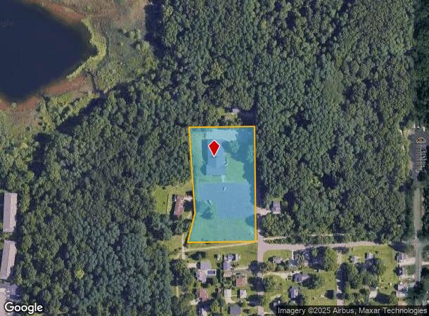
35 Evanston
Battle Creek, MI
Eastdale
10-009-016-01
EMMETT TWP/T2S R7W, SEC 9: PART SE1/4 NE1/4 COM 66 FT N OF NW COR LOT 1 EASTDALE N9DEG 05'30"E 135.55 FT N04DEG 09'30"W
Charitableorganization
Calhoun
X
Michigan
26025C0205C
1
0
2.84 AC
2025
Battle Crk/W Calhoun Cnty
002000
West Michigan
9,160 SF
DEMOGRAPHICS near 35 Evanston
1 Mile
3 Mile
5 Mile
2024 Total Population
3,460
24,714
55,343
2029 Population
3,428
24,506
54,831
Pop Growth 2024-2029
(0.92%)
(0.84%)
(0.93%)
Average Age
40
39
40
2024 Total Households
1,564
9,902
22,208
HH Growth 2024-2029
(1.02%)
(0.87%)
(0.96%)
Median Household Inc
$56,992
$50,790
$51,475
Avg Household Size
2.10
2.40
2.40
2024 Avg HH Vehicles
2.00
2.00
2.00
Median Home Value
$121,605
$106,904
$119,406
Median Year Built
1984
1952
1955
Nearby Places
Map Layers
Map Styles
 Street
 Aerial
- Restaurants
- Banks
- Shops
- Fitness
- Groceries
PUBLIC TRANSPORTATION
COMMUTER RAIL
Battle Creek (Blue Water - Amtrak, Wolverine - Amtrak)
DRIVE
WALK
Distance
Battle Creek (Blue Water - Amtrak, Wolverine - Amtrak)
6 min
3.7 mi
AIRPORT
Kalamazoo/Battle Creek International
DRIVE
WALK
Distance
Kalamazoo/Battle Creek International
39 min
27.7 mi
Freight Ports
Port of Toledo
DRIVE
WALK
Distance
Port of Toledo
147 min
119.6 mi
Nearby Properties
Address
Land Use
TOTAL SIZE
Lot Size
Zoning
Address
Land Use
TOTAL SIZE
Lot Size
Zoning
1,513,110 SF
108.07 AC
I2
Address
Land Use
TOTAL SIZE
Lot Size
Zoning
1,131,895 SF
26.46 AC
I1
Address
Land Use
TOTAL SIZE
Lot Size
Zoning
324,731 SF
69.91 AC
MF
Address
Land Use
TOTAL SIZE
Lot Size
Zoning
177,292 SF
50.14 AC
IP
Address
Land Use
TOTAL SIZE
Lot Size
Zoning
158,786 SF
22.52 AC
HDR
Address
Land Use
TOTAL SIZE
Lot Size
Zoning
134,482 SF
17.15 AC
MFR
Address
Land Use
TOTAL SIZE
Lot Size
Zoning
34,452 SF
1.12 AC
T4
Address
Land Use
TOTAL SIZE
Lot Size
Zoning
126,060 SF
15.89 AC
MF
Address
Land Use
TOTAL SIZE
Lot Size
Zoning
55,620 SF
3.70 AC
GC
Address
Land Use
TOTAL SIZE
Lot Size
Zoning
52,109 SF
6.46 AC
MFR
Address
Land Use
TOTAL SIZE
Lot Size
Zoning
149,939 SF
28.09 AC
I1
Address
Land Use
TOTAL SIZE
Lot Size
Zoning
394,832 SF
48.36 AC
I1
Address
Land Use
TOTAL SIZE
Lot Size
Zoning
263,389 SF
13.23 AC
I1
Address
Land Use
TOTAL SIZE
Lot Size
Zoning
9,069 SF
6.64 AC
RC
Address
Land Use
TOTAL SIZE
Lot Size
Zoning
38,485 SF
10.86 AC
RC
Address
Land Use
TOTAL SIZE
Lot Size
Zoning
141,239 SF
6.90 AC
I1
Address
Land Use
TOTAL SIZE
Lot Size
Zoning
44.96 AC
Address
Land Use
TOTAL SIZE
Lot Size
Zoning
13,958 SF
4.71 AC
GC
Address
Land Use
TOTAL SIZE
Lot Size
Zoning
25,200 SF
1.39 AC
MFR
Address
Land Use
TOTAL SIZE
Lot Size
Zoning
14,550 SF
1.10 AC
T3
Address
Land Use
TOTAL SIZE
Lot Size
Zoning
24,036 SF
1.22 AC
T4
Address
Land Use
TOTAL SIZE
Lot Size
Zoning
52,441 SF
5.21 AC
GC
Address
Land Use
TOTAL SIZE
Lot Size
Zoning
7,110 SF
2.28 AC
GC
Address
Land Use
TOTAL SIZE
Lot Size
Zoning
5,566 SF
14.47 AC
MF
Address
Land Use
TOTAL SIZE
Lot Size
Zoning
40,918 SF
97.87 AC
LI
Address
Land Use
TOTAL SIZE
Lot Size
Zoning
20,008 SF
0.17 AC
T5
Address
Land Use
TOTAL SIZE
Lot Size
Zoning
142.15 AC
IP
Address
Land Use
TOTAL SIZE
Lot Size
Zoning
817 SF
14.15 AC
LI
Address
Land Use
TOTAL SIZE
Lot Size
Zoning
5,784 SF
1.86 AC
GC
Address
Land Use
TOTAL SIZE
Lot Size
Zoning
87.42 AC
RC
The World's #1 Commercial Real Estate Marketplace
Connect with us
© 2025 CoStar Group
The information above has been obtained from sources believed reliable. While we do not doubt its accuracy we have not verified it and make no guarantee, warranty or representation about it. It is your responsibility to independently confirm its accuracy and completeness. Any projections, opinions, assumptions, or estimates used are for example only and do not represent the current or future performance of the property. The value of this transaction to you depends on tax and other factors which should be evaluated by your tax, financial, and legal advisors. You and your advisors should conduct a careful, independent investigation of the property to determine to your satisfaction the suitability of the property for your needs.