Property Record
35 Hurricane Ln, Williston, VT 05495
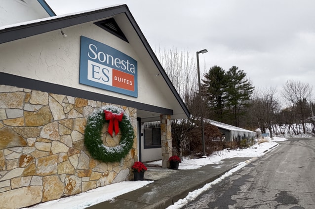


This Property Is For Sale
Property Detail
35 Hurricane Ln
(241) 13086002000
6.21A-LOT 1 W/BLDGS (RESIDENCE INN)
Commercialnec
CHITTENDEN
B and X Area of moderate flood hazard, usually the area between the limits of the 100-year and 500-year floods.
Vermont
2020
6.21 AC
2024
Vermont North Area
003102
Other Market Areas
8,632 SF
Burlington-South Burlington, VT
NEARBY LISTINGS FOR SALE OR LEASE
-
-
View all Williston listings for sale on LoopNet.com
DEMOGRAPHICS near 35 Hurricane Ln
1 mile
3 mile
5 mile
2025 Total Population
1,235
15,494
63,326
2030 Population
1,274
15,740
64,184
Pop Growth 2025-2030
+ 3.16%
+ 1.59%
+ 1.35%
Average Age
43
43
40
2025 Total Households
602
6,685
24,991
HH Growth 2025-2030
+ 3.65%
+ 1.82%
+ 1.53%
Median Household Inc
$99,578
$117,590
$108,072
Avg Household Size
2.00
2.30
2.20
2025 Avg HH Vehicles
2.00
2.00
2.00
Median Home Value
$462,036
$474,888
$447,504
Median Year Built
2004
1990
1986
Nearby Places
Map Layers
Map Styles
 Street
 Aerial
Layers
 Traffic
 Biking
Places
Listings with unknown addresses are not visible on the map
- Restaurants
- Banks
- Shops
- Fitness
- Groceries
PUBLIC TRANSPORTATION
COMMUTER RAIL
Essex Junction-Burlington Amtrak Station (Vermonter - Amtrak)
Drive
Walk
Distance
Essex Junction-Burlington Amtrak Station (Vermonter - Amtrak)
8 min
4.1 mi
Burlington (Ethan Allen Express - Amtrak)
Drive
Walk
Distance
Burlington (Ethan Allen Express - Amtrak)
13 min
7.3 mi
AIRPORT
Patrick Leahy Burlington International
Drive
Walk
Distance
Patrick Leahy Burlington International
16 min
5.3 mi
Plattsburgh International
Drive
Walk
Distance
Plattsburgh International
71 min
38.6 mi
Freight Ports
Montreal
Drive
Walk
Distance
Montreal
130 min
102.0 mi
Nearby Properties
Address
Land Use
TOTAL SIZE
Lot Size
Zoning
Address
Land Use
TOTAL SIZE
Lot Size
Zoning
227.57 AC
Address
Land Use
TOTAL SIZE
Lot Size
Zoning
Address
Land Use
TOTAL SIZE
Lot Size
Zoning
Address
Land Use
TOTAL SIZE
Lot Size
Zoning
736.20 AC
Address
Land Use
TOTAL SIZE
Lot Size
Zoning
Address
Land Use
TOTAL SIZE
Lot Size
Zoning
52,824 SF
14.43 AC
Address
Land Use
TOTAL SIZE
Lot Size
Zoning
54,000 SF
3.98 AC
Address
Land Use
TOTAL SIZE
Lot Size
Zoning
Address
Land Use
TOTAL SIZE
Lot Size
Zoning
54,000 SF
5 AC
Address
Land Use
TOTAL SIZE
Lot Size
Zoning
69,120 SF
11.20 AC
Address
Land Use
TOTAL SIZE
Lot Size
Zoning
35,064 SF
3.71 AC
Address
Land Use
TOTAL SIZE
Lot Size
Zoning
78.78 AC
Address
Land Use
TOTAL SIZE
Lot Size
Zoning
Address
Land Use
TOTAL SIZE
Lot Size
Zoning
Address
Land Use
TOTAL SIZE
Lot Size
Zoning
30,000 SF
4.52 AC
Address
Land Use
TOTAL SIZE
Lot Size
Zoning
30,600 SF
2.94 AC
Address
Land Use
TOTAL SIZE
Lot Size
Zoning
Address
Land Use
TOTAL SIZE
Lot Size
Zoning
54,446 SF
6.43 AC
Address
Land Use
TOTAL SIZE
Lot Size
Zoning
29,150 SF
3.90 AC
Address
Land Use
TOTAL SIZE
Lot Size
Zoning
Address
Land Use
TOTAL SIZE
Lot Size
Zoning
Address
Land Use
TOTAL SIZE
Lot Size
Zoning
Address
Land Use
TOTAL SIZE
Lot Size
Zoning
28,000 SF
3.36 AC
Address
Land Use
TOTAL SIZE
Lot Size
Zoning
55,312 SF
25 AC
Address
Land Use
TOTAL SIZE
Lot Size
Zoning
40,319 SF
3.64 AC
Address
Land Use
TOTAL SIZE
Lot Size
Zoning
19,440 SF
3.50 AC
Address
Land Use
TOTAL SIZE
Lot Size
Zoning
30,000 SF
7.86 AC
Address
Land Use
TOTAL SIZE
Lot Size
Zoning
34,628 SF
3.56 AC
Address
Land Use
TOTAL SIZE
Lot Size
Zoning
57,599 SF
Address
Land Use
TOTAL SIZE
Lot Size
Zoning
28,122 SF
4.80 AC
The World's #1 Commercial Real Estate Marketplace
Connect with us
© 2026 CoStar Group
The information above has been obtained from sources believed reliable. While we do not doubt its accuracy we have not verified it and make no guarantee, warranty or representation about it. It is your responsibility to independently confirm its accuracy and completeness. Any projections, opinions, assumptions, or estimates used are for example only and do not represent the current or future performance of the property. The value of this transaction to you depends on tax and other factors which should be evaluated by your tax, financial, and legal advisors. You and your advisors should conduct a careful, independent investigation of the property to determine to your satisfaction the suitability of the property for your needs.