Property Record
35 Industrial Rd, Cumberland, RI 02864


Property Detail
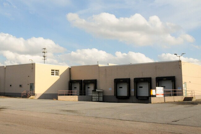
35 Industrial Rd
Industrialgeneral
Providence
60
Rhode Island
B and X Area of moderate flood hazard, usually the area between the limits of the 100-year and 500-year floods.
5.36 AC
2025
Lincoln
2025
Providence
011404
Providence-Warwick, RI-MA
111,434 SF
CUMB-000021-000755-000000
NEARBY LISTINGS FOR SALE OR LEASE
DEMOGRAPHICS near 35 Industrial Rd
1 mile
3 mile
5 mile
2025 Total Population
5,864
36,366
143,129
2030 Population
6,122
37,588
146,698
Pop Growth 2025-2030
+ 4.40%
+ 3.36%
+ 2.49%
Average Age
43
42
41
2025 Total Households
2,230
13,870
56,001
HH Growth 2025-2030
+ 4.44%
+ 3.35%
+ 2.52%
Median Household Inc
$123,482
$125,101
$89,998
Avg Household Size
2.60
2.60
2.50
2025 Avg HH Vehicles
2.00
2.00
2.00
Median Home Value
$468,749
$474,462
$438,218
Median Year Built
1978
1973
1965
Nearby Places
Map Layers
Map Styles
 Street
 Aerial
Layers
 Traffic
 Biking
Places
Listings with unknown addresses are not visible on the map
- Restaurants
- Banks
- Shops
- Fitness
- Groceries
PUBLIC TRANSPORTATION
COMMUTER RAIL
Drive
Walk
Distance
11 min
6.0 mi
South Attleboro (Providence/Stoughton Line - Massachusetts Bay Transportation Authority Commuter Rail (Purple Line))
Drive
Walk
Distance
South Attleboro (Providence/Stoughton Line - Massachusetts Bay Transportation Authority Commuter Rail (Purple Line))
13 min
7.2 mi
AIRPORT
Rhode Island Tf Green International
Drive
Walk
Distance
Rhode Island Tf Green International
34 min
18.8 mi
Worcester Regional
Drive
Walk
Distance
Worcester Regional
54 min
39.3 mi
General Edward Lawrence Logan International
Drive
Walk
Distance
General Edward Lawrence Logan International
63 min
46.0 mi
SALE & LEASE HISTORY
LISTING DATE
SALE/LEASE

Sep 25, 2016
For Lease
Oct 11, 2016
For Lease
Apr 06, 2018
For Lease
Nearby Properties
Address
Land Use
TOTAL SIZE
Lot Size
Zoning
Address
Land Use
TOTAL SIZE
Lot Size
Zoning
741,896 SF
27.75 AC
GU
Address
Land Use
TOTAL SIZE
Lot Size
Zoning
41.01 AC
30
Address
Land Use
TOTAL SIZE
Lot Size
Zoning
64.31 AC
C60
Address
Land Use
TOTAL SIZE
Lot Size
Zoning
26.54 AC
90
Address
Land Use
TOTAL SIZE
Lot Size
Zoning
54.49 AC
RS20
Address
Land Use
TOTAL SIZE
Lot Size
Zoning
4.60 AC
60
Address
Land Use
TOTAL SIZE
Lot Size
Zoning
14,841 SF
15.70 AC
PHB
Address
Land Use
TOTAL SIZE
Lot Size
Zoning
10,920 SF
11.03 AC
Address
Land Use
TOTAL SIZE
Lot Size
Zoning
190,458 SF
16.30 AC
C60
Address
Land Use
TOTAL SIZE
Lot Size
Zoning
341,251 SF
16.22 AC
60
Address
Land Use
TOTAL SIZE
Lot Size
Zoning
115,258 SF
10.08 AC
100
Address
Land Use
TOTAL SIZE
Lot Size
Zoning
105,878 SF
12.05 AC
C60
Address
Land Use
TOTAL SIZE
Lot Size
Zoning
126,073 SF
22.90 AC
C60
Address
Land Use
TOTAL SIZE
Lot Size
Zoning
27,264 SF
6.20 AC
Address
Land Use
TOTAL SIZE
Lot Size
Zoning
97,027 SF
12.02 AC
C60
Address
Land Use
TOTAL SIZE
Lot Size
Zoning
6 AC
120
Address
Land Use
TOTAL SIZE
Lot Size
Zoning
89,242 SF
14.65 AC
C60
Address
Land Use
TOTAL SIZE
Lot Size
Zoning
100,019 SF
10.37 AC
120
Address
Land Use
TOTAL SIZE
Lot Size
Zoning
11.87 AC
C60
Address
Land Use
TOTAL SIZE
Lot Size
Zoning
105,384 SF
17.07 AC
120
Address
Land Use
TOTAL SIZE
Lot Size
Zoning
116,540 SF
9.70 AC
PHB
Address
Land Use
TOTAL SIZE
Lot Size
Zoning
101 AC
90
Address
Land Use
TOTAL SIZE
Lot Size
Zoning
53,375 SF
10.14 AC
IC30
Address
Land Use
TOTAL SIZE
Lot Size
Zoning
33.95 AC
50
Address
Land Use
TOTAL SIZE
Lot Size
Zoning
132,005 SF
17.07 AC
ML05
Address
Land Use
TOTAL SIZE
Lot Size
Zoning
85,921 SF
34.74 AC
90
Address
Land Use
TOTAL SIZE
Lot Size
Zoning
182,578 SF
8.09 AC
GU
Address
Land Use
TOTAL SIZE
Lot Size
Zoning
52,282 SF
14.67 AC
C60
Address
Land Use
TOTAL SIZE
Lot Size
Zoning
48,400 SF
5.32 AC
60
Address
Land Use
TOTAL SIZE
Lot Size
Zoning
83,819 SF
3.37 AC
90
The World's #1 Commercial Real Estate Marketplace
Connect with us
© 2026 CoStar Group
The information above has been obtained from sources believed reliable. While we do not doubt its accuracy we have not verified it and make no guarantee, warranty or representation about it. It is your responsibility to independently confirm its accuracy and completeness. Any projections, opinions, assumptions, or estimates used are for example only and do not represent the current or future performance of the property. The value of this transaction to you depends on tax and other factors which should be evaluated by your tax, financial, and legal advisors. You and your advisors should conduct a careful, independent investigation of the property to determine to your satisfaction the suitability of the property for your needs.