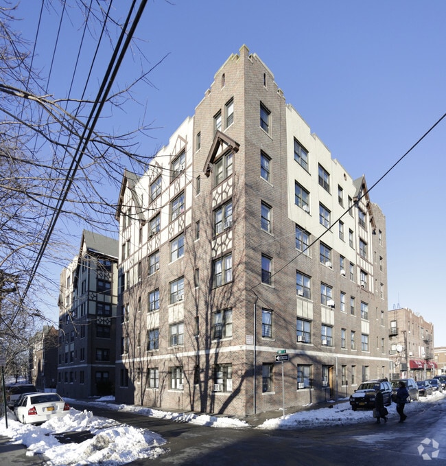
Property Record
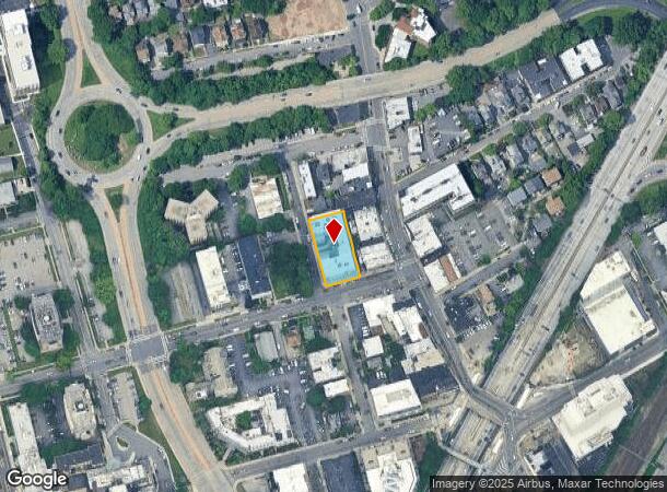
35 May St, New Rochelle, NY 10801
NEARBY LISTINGS FOR SALE OR LEASE
Property Detail
35 May St
New York-Jersey City-White Plains, NY-NJ
Property Belonging To Loretta P Hendrick
1000-000-004-01210-000-0005
Westchester
Apartment
New York
X
0.005
36119C0341F
0.40 AC
2025
Downtown New Rochelle
2024
Westchester/So Connecticut
006302
DEMOGRAPHICS near 35 May St
1 Mile
3 Mile
5 Mile
2024 Total Population
48,349
176,227
495,596
2029 Population
47,977
172,291
468,944
Pop Growth 2024-2029
(0.77%)
(2.23%)
(5.38%)
Average Age
39
41
41
2024 Total Households
17,179
64,866
185,154
HH Growth 2024-2029
(0.44%)
(2.19%)
(5.55%)
Median Household Inc
$79,144
$95,455
$84,839
Avg Household Size
2.60
2.60
2.60
2024 Avg HH Vehicles
1.00
1.00
1.00
Median Home Value
$554,903
$666,512
$594,124
Median Year Built
1951
1948
1953
Nearby Places
- Restaurants
- Banks
- Shops
- Fitness
- Groceries
PUBLIC TRANSPORTATION
COMMUTER RAIL
New Rochelle Station (New Haven Line - Metro-North Commuter Railroad Company (Metro-North))
DRIVE
WALK
Distance
New Rochelle Station (New Haven Line - Metro-North Commuter Railroad Company (Metro-North))
1 min
7 min
0.4 mi
Pelham Station (New Haven Line - Metro-North Commuter Railroad Company (Metro-North))
DRIVE
WALK
Distance
Pelham Station (New Haven Line - Metro-North Commuter Railroad Company (Metro-North))
4 min
1.9 mi
AIRPORT
LaGuardia
DRIVE
WALK
Distance
LaGuardia
27 min
15.3 mi
Westchester County
DRIVE
WALK
Distance
Westchester County
24 min
15.7 mi
John F Kennedy International
DRIVE
WALK
Distance
John F Kennedy International
33 min
22.8 mi
Freight Ports
NY - Red Hook Container Terminal
DRIVE
WALK
Distance
NY - Red Hook Container Terminal
41 min
25.8 mi
Nearby Properties
Address
Land Use
TOTAL SIZE
Lot Size
Zoning
Address
Land Use
TOTAL SIZE
Lot Size
Zoning
18,000 SF
13.85 AC
A
Address
Land Use
TOTAL SIZE
Lot Size
Zoning
301,156 SF
13.94 AC
A
Address
Land Use
TOTAL SIZE
Lot Size
Zoning
413,946 SF
20.27 AC
Address
Land Use
TOTAL SIZE
Lot Size
Zoning
Address
Land Use
TOTAL SIZE
Lot Size
Zoning
4,000 SF
19.83 AC
BUS
Address
Land Use
TOTAL SIZE
Lot Size
Zoning
Address
Land Use
TOTAL SIZE
Lot Size
Zoning
Address
Land Use
TOTAL SIZE
Lot Size
Zoning
Address
Land Use
TOTAL SIZE
Lot Size
Zoning
64,165 SF
3.24 AC
B
Address
Land Use
TOTAL SIZE
Lot Size
Zoning
165,529 SF
7.05 AC
RA3
Address
Land Use
TOTAL SIZE
Lot Size
Zoning
118,723 SF
3.45 AC
Address
Land Use
TOTAL SIZE
Lot Size
Zoning
5,170 SF
9.08 AC
B
Address
Land Use
TOTAL SIZE
Lot Size
Zoning
132,505 SF
5.53 AC
R6
Address
Land Use
TOTAL SIZE
Lot Size
Zoning
Address
Land Use
TOTAL SIZE
Lot Size
Zoning
99,502 SF
11.97 AC
Address
Land Use
TOTAL SIZE
Lot Size
Zoning
74,147 SF
2.76 AC
Address
Land Use
TOTAL SIZE
Lot Size
Zoning
48,240 SF
3.89 AC
Address
Land Use
TOTAL SIZE
Lot Size
Zoning
Address
Land Use
TOTAL SIZE
Lot Size
Zoning
76,258 SF
4.22 AC
R7.5
Address
Land Use
TOTAL SIZE
Lot Size
Zoning
92,960 SF
11.39 AC
Address
Land Use
TOTAL SIZE
Lot Size
Zoning
7,855 SF
1.10 AC
C
Address
Land Use
TOTAL SIZE
Lot Size
Zoning
62,664 SF
3.50 AC
Address
Land Use
TOTAL SIZE
Lot Size
Zoning
52,138 SF
3.24 AC
R6
Address
Land Use
TOTAL SIZE
Lot Size
Zoning
24,668 SF
11.17 AC
Address
Land Use
TOTAL SIZE
Lot Size
Zoning
91,463 SF
0.69 AC
Address
Land Use
TOTAL SIZE
Lot Size
Zoning
Address
Land Use
TOTAL SIZE
Lot Size
Zoning
42,053 SF
4.11 AC
MUL
Address
Land Use
TOTAL SIZE
Lot Size
Zoning
38,080 SF
3.62 AC
Address
Land Use
TOTAL SIZE
Lot Size
Zoning
36,923 SF
0.25 AC
Address
Land Use
TOTAL SIZE
Lot Size
Zoning
38,667 SF
14.46 AC
The World's #1 Commercial Real Estate Marketplace
Connect with us
© 2025 CoStar Group
The information above has been obtained from sources believed reliable. While we do not doubt its accuracy we have not verified it and make no guarantee, warranty or representation about it. It is your responsibility to independently confirm its accuracy and completeness. Any projections, opinions, assumptions, or estimates used are for example only and do not represent the current or future performance of the property. The value of this transaction to you depends on tax and other factors which should be evaluated by your tax, financial, and legal advisors. You and your advisors should conduct a careful, independent investigation of the property to determine to your satisfaction the suitability of the property for your needs.