Property Record
35 Summerlin Ln N, Saint Augustine, FL 32095

Property Detail
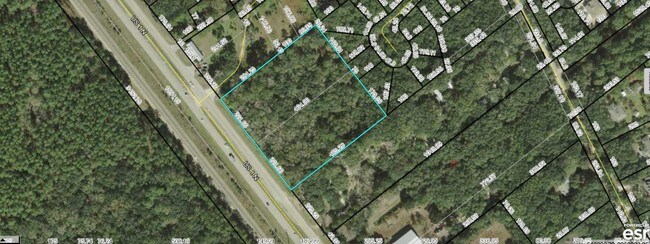
35 Summerlin Ln N
074670-0000
29 30 PT OF SABATE GRANT 450.45FT ON E SIDE OF US 1 LYING N OF MARCHIOLI (EX .25AC IN R/W RD US 1)(EX ELY PT IN OR2215/469) (EX R/W TO SJC IN OR2463/796) (EX PT IN OR4421/963 OR5541/1620
Regionalshoppingcenterormallwithanchorstore
ST. JOHNS
CI
Florida
B and X Area of moderate flood hazard, usually the area between the limits of the 100-year and 500-year floods.
29&30
2025
4.73 AC
2026
St Johns County
020606
Jacksonville (Florida)
7,200 SF
Jacksonville, FL
NEARBY LISTINGS FOR SALE OR LEASE
DEMOGRAPHICS near 35 Summerlin Ln N
1 mile
3 mile
5 mile
2025 Total Population
1,681
9,532
35,031
2030 Population
1,984
11,201
40,731
Pop Growth 2025-2030
+ 18.02%
+ 17.51%
+ 16.27%
Average Age
44
45
45
2025 Total Households
669
3,677
14,288
HH Growth 2025-2030
+ 18.39%
+ 17.98%
+ 16.69%
Median Household Inc
$115,717
$118,044
$99,010
Avg Household Size
2.40
2.40
2.40
2025 Avg HH Vehicles
2.00
2.00
2.00
Median Home Value
$336,764
$484,644
$501,420
Median Year Built
2004
2005
2006
Nearby Places
Map Layers
Map Styles
 Street
 Aerial
Layers
 Traffic
 Biking
Places
Listings with unknown addresses are not visible on the map
- Restaurants
- Banks
- Shops
- Fitness
- Groceries
SALE & LEASE HISTORY
LISTING DATE
SALE/LEASE

Sep 24, 2016
For Sale
May 01, 2019
For Sale
Nearby Properties
Address
Land Use
TOTAL SIZE
Lot Size
Zoning
Address
Land Use
TOTAL SIZE
Lot Size
Zoning
198,608 SF
54.13 AC
AD
Address
Land Use
TOTAL SIZE
Lot Size
Zoning
325,487 SF
19.20 AC
PS
Address
Land Use
TOTAL SIZE
Lot Size
Zoning
132,489 SF
74.83 AC
AD
Address
Land Use
TOTAL SIZE
Lot Size
Zoning
116,861 SF
18.08 AC
PS
Address
Land Use
TOTAL SIZE
Lot Size
Zoning
69,600 SF
24 AC
AD
Address
Land Use
TOTAL SIZE
Lot Size
Zoning
268.05 AC
Address
Land Use
TOTAL SIZE
Lot Size
Zoning
24,167 SF
12.90 AC
IW/OR
Address
Land Use
TOTAL SIZE
Lot Size
Zoning
Address
Land Use
TOTAL SIZE
Lot Size
Zoning
360.62 AC
AD
Address
Land Use
TOTAL SIZE
Lot Size
Zoning
29,519 SF
9.13 AC
PS
Address
Land Use
TOTAL SIZE
Lot Size
Zoning
17,956 SF
4.50 AC
PUD
Address
Land Use
TOTAL SIZE
Lot Size
Zoning
48,573 SF
94.83 AC
OR
Address
Land Use
TOTAL SIZE
Lot Size
Zoning
44,150 SF
2.75 AC
Address
Land Use
TOTAL SIZE
Lot Size
Zoning
8,018 SF
5.26 AC
IW
Address
Land Use
TOTAL SIZE
Lot Size
Zoning
19,450 SF
6 AC
IW
Address
Land Use
TOTAL SIZE
Lot Size
Zoning
35,408 SF
4.64 AC
CI
Address
Land Use
TOTAL SIZE
Lot Size
Zoning
1,680 SF
2.20 AC
CG
Address
Land Use
TOTAL SIZE
Lot Size
Zoning
11,139 SF
2.75 AC
CI
Address
Land Use
TOTAL SIZE
Lot Size
Zoning
14,810 SF
9.78 AC
AD
Address
Land Use
TOTAL SIZE
Lot Size
Zoning
Address
Land Use
TOTAL SIZE
Lot Size
Zoning
9,350 SF
4.92 AC
IW
Address
Land Use
TOTAL SIZE
Lot Size
Zoning
33,170 SF
9.39 AC
AD
Address
Land Use
TOTAL SIZE
Lot Size
Zoning
12,868 SF
1.58 AC
DRI
Address
Land Use
TOTAL SIZE
Lot Size
Zoning
23,720 SF
3.05 AC
PSD
Address
Land Use
TOTAL SIZE
Lot Size
Zoning
33.46 AC
OR
Address
Land Use
TOTAL SIZE
Lot Size
Zoning
9,706 SF
0.69 AC
PUD
Address
Land Use
TOTAL SIZE
Lot Size
Zoning
123.97 AC
AD
Address
Land Use
TOTAL SIZE
Lot Size
Zoning
13,440 SF
0.47 AC
AD
Address
Land Use
TOTAL SIZE
Lot Size
Zoning
9,012 SF
1.84 AC
The World's #1 Commercial Real Estate Marketplace
Connect with us
© 2026 CoStar Group
The information above has been obtained from sources believed reliable. While we do not doubt its accuracy we have not verified it and make no guarantee, warranty or representation about it. It is your responsibility to independently confirm its accuracy and completeness. Any projections, opinions, assumptions, or estimates used are for example only and do not represent the current or future performance of the property. The value of this transaction to you depends on tax and other factors which should be evaluated by your tax, financial, and legal advisors. You and your advisors should conduct a careful, independent investigation of the property to determine to your satisfaction the suitability of the property for your needs.