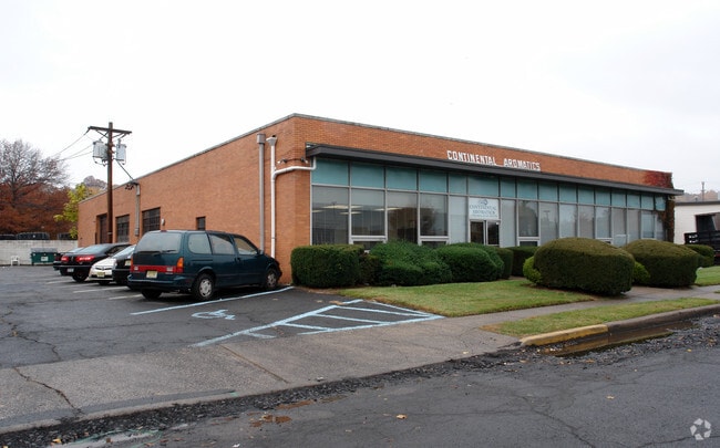
Property Record
35 Thomas Rd, Hawthorne, NJ 07506

Save to a Folder
{{folder.Name}}
{{folder.ListingIds.length}} Properties
{{folder.ListingIds.length}} Property
Create a New Folder
Property Detail
35 Thomas Rd
New York-Jersey City-White Plains, NY-NJ
PASSAIC
04-00047-0000-00021
New Jersey
Vacantlandnec
21
B and X Area of moderate flood hazard, usually the area between the limits of the 100-year and 500-year floods.
0.60 AC
2025
Northwest Bergen
2026
Northern New Jersey
143301
NEARBY LISTINGS FOR SALE OR LEASE
DEMOGRAPHICS near 35 Thomas Rd
1 mile
3 mile
5 mile
2025 Total Population
33,137
245,904
471,811
2030 Population
32,712
248,709
479,066
Pop Growth 2025-2030
(1.28%)
+ 1.14%
+ 1.54%
Average Age
37
39
40
2025 Total Households
10,697
80,759
159,380
HH Growth 2025-2030
(1.40%)
+ 1.24%
+ 1.58%
Median Household Inc
$59,480
$75,570
$93,788
Avg Household Size
3.00
2.90
2.90
2025 Avg HH Vehicles
1.00
1.00
2.00
Median Home Value
$433,825
$490,406
$569,000
Median Year Built
1948
1954
1955
Nearby Places
Map Layers
Map Styles
 Street
 Aerial
Layers
 Traffic
 Biking
Places
Listings with unknown addresses are not visible on the map
- Restaurants
- Banks
- Shops
- Fitness
- Groceries
PUBLIC TRANSPORTATION
TRANSIT/SUBWAY
Hawthorne (Main/Port Jervis Line - NJ Transit Commuter Rail (NJ Transit))
Drive
Walk
Distance
Hawthorne (Main/Port Jervis Line - NJ Transit Commuter Rail (NJ Transit))
2 min
13 min
0.7 mi
COMMUTER RAIL
Hawthorne (Main/Port Jervis Line - NJ Transit Commuter Rail (NJ Transit))
Drive
Walk
Distance
Hawthorne (Main/Port Jervis Line - NJ Transit Commuter Rail (NJ Transit))
2 min
13 min
0.7 mi
Paterson (Main/Port Jervis Line - NJ Transit Commuter Rail (NJ Transit))
Drive
Walk
Distance
Paterson (Main/Port Jervis Line - NJ Transit Commuter Rail (NJ Transit))
5 min
2.1 mi
AIRPORT
Newark Liberty International
Drive
Walk
Distance
Newark Liberty International
31 min
23.0 mi
LaGuardia
Drive
Walk
Distance
LaGuardia
39 min
24.3 mi
Westchester County
Drive
Walk
Distance
Westchester County
59 min
42.5 mi
Freight Ports
Maher Terminal
Drive
Walk
Distance
Maher Terminal
37 min
23.6 mi
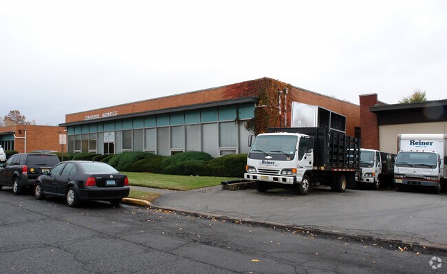
Nearby Properties
Address
Land Use
TOTAL SIZE
Lot Size
Zoning
Address
Land Use
TOTAL SIZE
Lot Size
Zoning
8.75 AC
Address
Land Use
TOTAL SIZE
Lot Size
Zoning
12,506 SF
130 AC
B-2
Address
Land Use
TOTAL SIZE
Lot Size
Zoning
79,310 SF
2 AC
B-2
Address
Land Use
TOTAL SIZE
Lot Size
Zoning
152,050 SF
1.96 AC
B-1
Address
Land Use
TOTAL SIZE
Lot Size
Zoning
7.83 AC
Address
Land Use
TOTAL SIZE
Lot Size
Zoning
1.80 AC
Address
Land Use
TOTAL SIZE
Lot Size
Zoning
0.69 AC
I-1
Address
Land Use
TOTAL SIZE
Lot Size
Zoning
45,000 SF
124.04 AC
R-A
Address
Land Use
TOTAL SIZE
Lot Size
Zoning
61.98 AC
Address
Land Use
TOTAL SIZE
Lot Size
Zoning
764,364 SF
16.60 AC
I-2
Address
Land Use
TOTAL SIZE
Lot Size
Zoning
0.12 AC
Address
Land Use
TOTAL SIZE
Lot Size
Zoning
183,072 SF
5.50 AC
Address
Land Use
TOTAL SIZE
Lot Size
Zoning
192,252 SF
5 AC
Address
Land Use
TOTAL SIZE
Lot Size
Zoning
140,626 SF
3.28 AC
B-2
Address
Land Use
TOTAL SIZE
Lot Size
Zoning
269,236 SF
10 AC
Address
Land Use
TOTAL SIZE
Lot Size
Zoning
Address
Land Use
TOTAL SIZE
Lot Size
Zoning
9.96 AC
MU
Address
Land Use
TOTAL SIZE
Lot Size
Zoning
Address
Land Use
TOTAL SIZE
Lot Size
Zoning
7.03 AC
MU
Address
Land Use
TOTAL SIZE
Lot Size
Zoning
1.07 AC
Address
Land Use
TOTAL SIZE
Lot Size
Zoning
57,680 SF
20.01 AC
CR
Address
Land Use
TOTAL SIZE
Lot Size
Zoning
3.73 AC
B-2
Address
Land Use
TOTAL SIZE
Lot Size
Zoning
84.08 AC
Address
Land Use
TOTAL SIZE
Lot Size
Zoning
1.20 AC
B-2
Address
Land Use
TOTAL SIZE
Lot Size
Zoning
82,976 SF
0.89 AC
Address
Land Use
TOTAL SIZE
Lot Size
Zoning
48,265 SF
3 AC
R-4
Address
Land Use
TOTAL SIZE
Lot Size
Zoning
1.30 AC
B-2
Address
Land Use
TOTAL SIZE
Lot Size
Zoning
84,845 SF
2.30 AC
B-2
Address
Land Use
TOTAL SIZE
Lot Size
Zoning
63,600 SF
2.46 AC
Address
Land Use
TOTAL SIZE
Lot Size
Zoning
73,052 SF
1.27 AC
B-2
The World's #1 Commercial Real Estate Marketplace
Connect with us
© 2026 CoStar Group
The information above has been obtained from sources believed reliable. While we do not doubt its accuracy we have not verified it and make no guarantee, warranty or representation about it. It is your responsibility to independently confirm its accuracy and completeness. Any projections, opinions, assumptions, or estimates used are for example only and do not represent the current or future performance of the property. The value of this transaction to you depends on tax and other factors which should be evaluated by your tax, financial, and legal advisors. You and your advisors should conduct a careful, independent investigation of the property to determine to your satisfaction the suitability of the property for your needs.