Property Record
350 Bedford St, Lakeville, MA 02347


NEARBY LISTINGS FOR SALE OR LEASE
-
-
View all Lakeville listings for sale on LoopNet.com
Property Detail
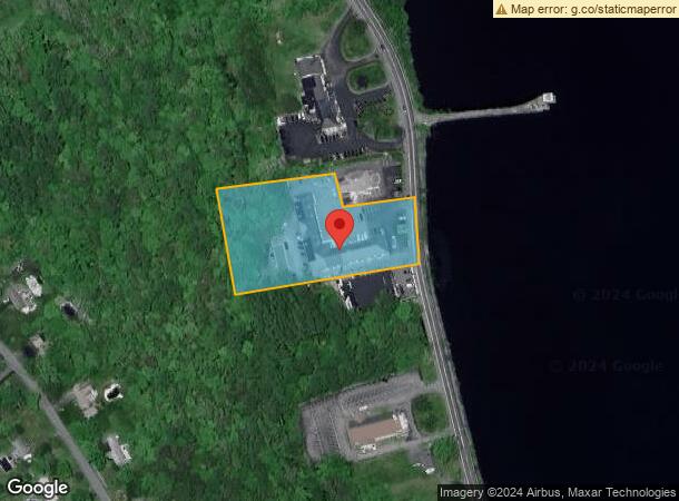
350 Bedford St
LAKE-000057-000001-000003
Plymouth
Regionalshoppingcenterormallwithanchorstore
Massachusetts
AE
3
25023C0429K
2.80 AC
2025
Route 3 South
2025
Boston
540103
Boston-Cambridge-Newton, MA-NH
22,171 SF
DEMOGRAPHICS near 350 Bedford St
1 Mile
3 Mile
5 Mile
2024 Total Population
783
10,837
33,905
2029 Population
793
11,035
34,021
Pop Growth 2024-2029
+ 1.28%
+ 1.83%
+ 0.34%
Average Age
43
43
41
2024 Total Households
273
4,051
12,706
HH Growth 2024-2029
+ 1.47%
+ 1.83%
+ 0.28%
Median Household Inc
$124,073
$101,833
$94,782
Avg Household Size
2.80
2.70
2.60
2024 Avg HH Vehicles
3.00
2.00
2.00
Median Home Value
$551,095
$487,317
$434,134
Median Year Built
1984
1979
1976
Nearby Places
Map Layers
Map Styles
 Street
 Aerial
- Restaurants
- Banks
- Shops
- Fitness
- Groceries
PUBLIC TRANSPORTATION
COMMUTER RAIL
Middleborough/Lakeville (Middleborough/Lakeville Line - Massachusetts Bay Transportation Authority Commuter Rail (Purple Line))
DRIVE
WALK
Distance
Middleborough/Lakeville (Middleborough/Lakeville Line - Massachusetts Bay Transportation Authority Commuter Rail (Purple Line))
7 min
3.6 mi
AIRPORT
Rhode Island Tf Green International
DRIVE
WALK
Distance
Rhode Island Tf Green International
62 min
35.8 mi
Freight Ports
Port of New Bedford Harbor
DRIVE
WALK
Distance
Port of New Bedford Harbor
25 min
16.7 mi
Nearby Properties
Address
Land Use
TOTAL SIZE
Lot Size
Zoning
Address
Land Use
TOTAL SIZE
Lot Size
Zoning
77,642 SF
14.30 AC
Address
Land Use
TOTAL SIZE
Lot Size
Zoning
575,572 SF
119.44 AC
Address
Land Use
TOTAL SIZE
Lot Size
Zoning
Address
Land Use
TOTAL SIZE
Lot Size
Zoning
48.30 AC
Address
Land Use
TOTAL SIZE
Lot Size
Zoning
7.50 AC
Address
Land Use
TOTAL SIZE
Lot Size
Zoning
128,922 SF
12.50 AC
Address
Land Use
TOTAL SIZE
Lot Size
Zoning
5,792 SF
22.04 AC
Address
Land Use
TOTAL SIZE
Lot Size
Zoning
35,805 SF
4.18 AC
Address
Land Use
TOTAL SIZE
Lot Size
Zoning
67,224 SF
4.04 AC
Address
Land Use
TOTAL SIZE
Lot Size
Zoning
19,794 SF
144.57 AC
Address
Land Use
TOTAL SIZE
Lot Size
Zoning
72,045 SF
3.12 AC
Address
Land Use
TOTAL SIZE
Lot Size
Zoning
52,308 SF
1.67 AC
Address
Land Use
TOTAL SIZE
Lot Size
Zoning
34,090 SF
3.93 AC
Address
Land Use
TOTAL SIZE
Lot Size
Zoning
12.08 AC
Address
Land Use
TOTAL SIZE
Lot Size
Zoning
43,344 SF
2.77 AC
Address
Land Use
TOTAL SIZE
Lot Size
Zoning
30,420 SF
2.99 AC
Address
Land Use
TOTAL SIZE
Lot Size
Zoning
14,981 SF
0.88 AC
Address
Land Use
TOTAL SIZE
Lot Size
Zoning
6.27 AC
Address
Land Use
TOTAL SIZE
Lot Size
Zoning
12,848 SF
3.31 AC
Address
Land Use
TOTAL SIZE
Lot Size
Zoning
13,449 SF
4.70 AC
Address
Land Use
TOTAL SIZE
Lot Size
Zoning
7.71 AC
Address
Land Use
TOTAL SIZE
Lot Size
Zoning
Address
Land Use
TOTAL SIZE
Lot Size
Zoning
22,936 SF
2.28 AC
Address
Land Use
TOTAL SIZE
Lot Size
Zoning
3.23 AC
Address
Land Use
TOTAL SIZE
Lot Size
Zoning
29,670 SF
1.74 AC
Address
Land Use
TOTAL SIZE
Lot Size
Zoning
22,705 SF
2.58 AC
Address
Land Use
TOTAL SIZE
Lot Size
Zoning
27,277 SF
1.87 AC
Address
Land Use
TOTAL SIZE
Lot Size
Zoning
12,925 SF
0.99 AC
Address
Land Use
TOTAL SIZE
Lot Size
Zoning
30,000 SF
4.76 AC
The World's #1 Commercial Real Estate Marketplace
Connect with us
© 2026 CoStar Group
The information above has been obtained from sources believed reliable. While we do not doubt its accuracy we have not verified it and make no guarantee, warranty or representation about it. It is your responsibility to independently confirm its accuracy and completeness. Any projections, opinions, assumptions, or estimates used are for example only and do not represent the current or future performance of the property. The value of this transaction to you depends on tax and other factors which should be evaluated by your tax, financial, and legal advisors. You and your advisors should conduct a careful, independent investigation of the property to determine to your satisfaction the suitability of the property for your needs.