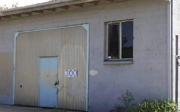
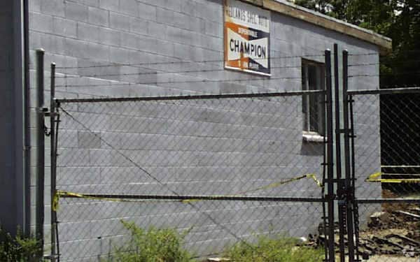
Property Record
350 New York St, Redlands, CA 92373


NEARBY LISTINGS FOR SALE OR LEASE
Property Detail
350 New York St
0171-171-34
PARCEL MAP 18165 PARCEL 6 BOOK 233 PAGE 54 TOGETHER WITH THAT PORTION OF NEW YORK ST VACATED ADJACENT ON THE WEST.
Officebuilding
San Bernardino
AO
California
06065C0090G
5.56 AC
2024
Redlands/Loma Linda
2025
Inland Empire (California)
008302
Riverside-San Bernardino-Ontario, CA
81,275 SF
DEMOGRAPHICS near 350 New York St
1 Mile
3 Mile
5 Mile
2024 Total Population
13,847
82,051
159,825
2029 Population
14,122
84,026
163,140
Pop Growth 2024-2029
+ 1.99%
+ 2.41%
+ 2.07%
Average Age
37
39
38
2024 Total Households
5,808
29,604
54,837
HH Growth 2024-2029
+ 1.91%
+ 2.46%
+ 2.15%
Median Household Inc
$76,111
$88,557
$83,084
Avg Household Size
2.30
2.60
2.80
2024 Avg HH Vehicles
2.00
2.00
2.00
Median Home Value
$455,172
$513,140
$478,993
Median Year Built
1974
1978
1979
Nearby Places
Map Layers
Map Styles
 Street
 Aerial
- Restaurants
- Banks
- Shops
- Fitness
- Groceries
PUBLIC TRANSPORTATION
COMMUTER RAIL
Redlands - Esri Metrolink Station (Metrolink San Bernardino Line - Metrolink Trains)
DRIVE
WALK
Distance
Redlands - Esri Metrolink Station (Metrolink San Bernardino Line - Metrolink Trains)
1 min
13 min
0.3 mi
Redlands - Downtown Metrolink Station (Metrolink San Bernardino Line - Metrolink Trains)
DRIVE
WALK
Distance
Redlands - Downtown Metrolink Station (Metrolink San Bernardino Line - Metrolink Trains)
3 min
17 min
0.9 mi
AIRPORT
Ontario International
DRIVE
WALK
Distance
Ontario International
32 min
24.6 mi
Freight Ports
Port of Long Beach
DRIVE
WALK
Distance
Port of Long Beach
90 min
70.0 mi
Nearby Properties
Address
Land Use
TOTAL SIZE
Lot Size
Zoning
Address
Land Use
TOTAL SIZE
Lot Size
Zoning
1,079,236 SF
54.70 AC
EVIR
Address
Land Use
TOTAL SIZE
Lot Size
Zoning
393,088 SF
25.98 AC
Address
Land Use
TOTAL SIZE
Lot Size
Zoning
345,158 SF
36.95 AC
Address
Land Use
TOTAL SIZE
Lot Size
Zoning
445,160 SF
24.11 AC
Address
Land Use
TOTAL SIZE
Lot Size
Zoning
460,038 SF
22.70 AC
Address
Land Use
TOTAL SIZE
Lot Size
Zoning
589,602 SF
36.89 AC
Address
Land Use
TOTAL SIZE
Lot Size
Zoning
1,313,470 SF
60.31 AC
Address
Land Use
TOTAL SIZE
Lot Size
Zoning
1,012,980 SF
50.48 AC
Address
Land Use
TOTAL SIZE
Lot Size
Zoning
105,803 SF
10.86 AC
Address
Land Use
TOTAL SIZE
Lot Size
Zoning
417,188 SF
21.54 AC
Address
Land Use
TOTAL SIZE
Lot Size
Zoning
329,075 SF
10.93 AC
Address
Land Use
TOTAL SIZE
Lot Size
Zoning
614,292 SF
27.84 AC
Address
Land Use
TOTAL SIZE
Lot Size
Zoning
771,907 SF
35.59 AC
Address
Land Use
TOTAL SIZE
Lot Size
Zoning
69,495 SF
3.04 AC
RM
Address
Land Use
TOTAL SIZE
Lot Size
Zoning
784,280 SF
34.62 AC
EVSDCOM
Address
Land Use
TOTAL SIZE
Lot Size
Zoning
983,986 SF
47.60 AC
Address
Land Use
TOTAL SIZE
Lot Size
Zoning
606,450 SF
27.91 AC
EVSDCOM
Address
Land Use
TOTAL SIZE
Lot Size
Zoning
56.83 AC
Address
Land Use
TOTAL SIZE
Lot Size
Zoning
809,679 SF
37.19 AC
Address
Land Use
TOTAL SIZE
Lot Size
Zoning
777,580 SF
23.13 AC
Address
Land Use
TOTAL SIZE
Lot Size
Zoning
801,126 SF
36.03 AC
Address
Land Use
TOTAL SIZE
Lot Size
Zoning
683,406 SF
31.38 AC
Address
Land Use
TOTAL SIZE
Lot Size
Zoning
703,479 SF
33.53 AC
Address
Land Use
TOTAL SIZE
Lot Size
Zoning
291,560 SF
7.19 AC
Address
Land Use
TOTAL SIZE
Lot Size
Zoning
593,615 SF
27.54 AC
EVCG
Address
Land Use
TOTAL SIZE
Lot Size
Zoning
542,519 SF
27.07 AC
Address
Land Use
TOTAL SIZE
Lot Size
Zoning
121,035 SF
36.62 AC
Address
Land Use
TOTAL SIZE
Lot Size
Zoning
601,335 SF
27.60 AC
Address
Land Use
TOTAL SIZE
Lot Size
Zoning
205,555 SF
6.39 AC
Address
Land Use
TOTAL SIZE
Lot Size
Zoning
425,285 SF
24.41 AC
The World's #1 Commercial Real Estate Marketplace
Connect with us
© 2025 CoStar Group
The information above has been obtained from sources believed reliable. While we do not doubt its accuracy we have not verified it and make no guarantee, warranty or representation about it. It is your responsibility to independently confirm its accuracy and completeness. Any projections, opinions, assumptions, or estimates used are for example only and do not represent the current or future performance of the property. The value of this transaction to you depends on tax and other factors which should be evaluated by your tax, financial, and legal advisors. You and your advisors should conduct a careful, independent investigation of the property to determine to your satisfaction the suitability of the property for your needs.