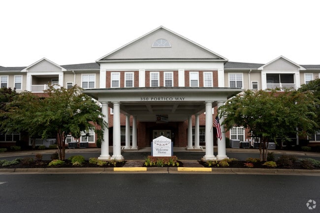
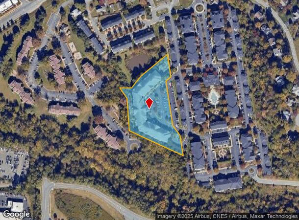
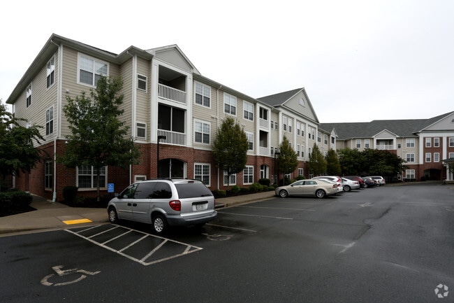
Property Record
350 Portico Way, Charlottesville, VA 22911

NEARBY LISTINGS FOR SALE OR LEASE
Property Detail
350 Portico Way
078B0-04-00-00100
ACREAGE PARCEL 3
Highriseapartments
Albemarle
X
Virginia
51003C0287D
2.94 AC
2025
Charlottesville
2025
Other Market Areas
010502
Charlottesville, VA
101,938 SF
DEMOGRAPHICS near 350 Portico Way
1 Mile
3 Mile
5 Mile
2024 Total Population
6,952
45,634
100,357
2029 Population
7,127
45,429
101,424
Pop Growth 2024-2029
+ 2.52%
(0.45%)
+ 1.06%
Average Age
44
39
37
2024 Total Households
3,377
20,273
40,804
HH Growth 2024-2029
+ 2.87%
(0.25%)
+ 1.20%
Median Household Inc
$94,800
$76,173
$74,977
Avg Household Size
2.00
2.20
2.20
2024 Avg HH Vehicles
2.00
2.00
2.00
Median Home Value
$435,885
$422,813
$405,884
Median Year Built
1998
1983
1984
Nearby Places
Map Layers
Map Styles
 Street
 Aerial
- Restaurants
- Banks
- Shops
- Fitness
- Groceries
PUBLIC TRANSPORTATION
COMMUTER RAIL
Charlottesville (Cardinal - Amtrak, Crescent - Amtrak, Northeast Regional - Amtrak)
DRIVE
WALK
Distance
Charlottesville (Cardinal - Amtrak, Crescent - Amtrak, Northeast Regional - Amtrak)
9 min
3.3 mi
AIRPORT
Charlottesville-Albemarle
DRIVE
WALK
Distance
Charlottesville-Albemarle
23 min
11.0 mi
Freight Ports
Virginia Port Authority - Richmond
DRIVE
WALK
Distance
Virginia Port Authority - Richmond
92 min
75.3 mi
Nearby Properties
Address
Land Use
TOTAL SIZE
Lot Size
Zoning
Address
Land Use
TOTAL SIZE
Lot Size
Zoning
872,960 SF
20.90 AC
CM
Address
Land Use
TOTAL SIZE
Lot Size
Zoning
429,500 SF
38.49 AC
PDMC
Address
Land Use
TOTAL SIZE
Lot Size
Zoning
15 AC
RURAL AREA
Address
Land Use
TOTAL SIZE
Lot Size
Zoning
167,708 SF
1.05 AC
CM
Address
Land Use
TOTAL SIZE
Lot Size
Zoning
3,465 SF
145.17 AC
CV
Address
Land Use
TOTAL SIZE
Lot Size
Zoning
101,778 SF
11.11 AC
CM
Address
Land Use
TOTAL SIZE
Lot Size
Zoning
3,803 SF
266.70 AC
CV
Address
Land Use
TOTAL SIZE
Lot Size
Zoning
578,208 SF
2.06 AC
CX-8
Address
Land Use
TOTAL SIZE
Lot Size
Zoning
43,616 SF
2.24 AC
CX-8
Address
Land Use
TOTAL SIZE
Lot Size
Zoning
10,270 SF
3.59 AC
RX-5
Address
Land Use
TOTAL SIZE
Lot Size
Zoning
393,960 SF
16.14 AC
NMD
Address
Land Use
TOTAL SIZE
Lot Size
Zoning
30,896 SF
0.97 AC
DX
Address
Land Use
TOTAL SIZE
Lot Size
Zoning
240,936 SF
1.26 AC
NX-10
Address
Land Use
TOTAL SIZE
Lot Size
Zoning
14,000 SF
6.45 AC
CX-5
Address
Land Use
TOTAL SIZE
Lot Size
Zoning
336,000 SF
20.20 AC
R15 RESIDE
Address
Land Use
TOTAL SIZE
Lot Size
Zoning
20.41 AC
Address
Land Use
TOTAL SIZE
Lot Size
Zoning
218,660 SF
1.27 AC
CX-8
Address
Land Use
TOTAL SIZE
Lot Size
Zoning
1.38 AC
CX-3
Address
Land Use
TOTAL SIZE
Lot Size
Zoning
222,253 SF
0.73 AC
NX-10
Address
Land Use
TOTAL SIZE
Lot Size
Zoning
110,969 SF
2.06 AC
CM
Address
Land Use
TOTAL SIZE
Lot Size
Zoning
5,136 SF
4.27 AC
RX-5
Address
Land Use
TOTAL SIZE
Lot Size
Zoning
82,308 SF
97.43 AC
R1 RESIDEN
Address
Land Use
TOTAL SIZE
Lot Size
Zoning
249,740 SF
42.40 AC
CM
Address
Land Use
TOTAL SIZE
Lot Size
Zoning
42,336 SF
0.90 AC
CV
Address
Land Use
TOTAL SIZE
Lot Size
Zoning
12,495 SF
4.50 AC
NX-10
Address
Land Use
TOTAL SIZE
Lot Size
Zoning
67,354 SF
18.86 AC
CM
Address
Land Use
TOTAL SIZE
Lot Size
Zoning
223,492 SF
35 AC
COMMERCIAL
Address
Land Use
TOTAL SIZE
Lot Size
Zoning
73,068 SF
13.39 AC
PLANNED DE
Address
Land Use
TOTAL SIZE
Lot Size
Zoning
100 SF
51.71 AC
LIGHT INDU
Address
Land Use
TOTAL SIZE
Lot Size
Zoning
100 SF
19 AC
RURAL AREA
The World's #1 Commercial Real Estate Marketplace
Connect with us
© 2026 CoStar Group
The information above has been obtained from sources believed reliable. While we do not doubt its accuracy we have not verified it and make no guarantee, warranty or representation about it. It is your responsibility to independently confirm its accuracy and completeness. Any projections, opinions, assumptions, or estimates used are for example only and do not represent the current or future performance of the property. The value of this transaction to you depends on tax and other factors which should be evaluated by your tax, financial, and legal advisors. You and your advisors should conduct a careful, independent investigation of the property to determine to your satisfaction the suitability of the property for your needs.